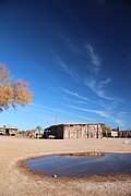
Independencia Department | |
---|---|
Coordinates: 31°S69°W / 31°S 69°W Coordinates: 31°S69°W / 31°S 69°W | |
Country | Argentina |
Province | La Rioja Province |
Area | |
• Total | 7,120 km2 (2,750 sq mi) |
Population (2001) | |
• Total | 2,405 |
• Density | 0.34/km2 (0.87/sq mi) |
[1] | |
Demonym | Independense |
Time zone | UTC-3 (ART) |
Area code | 03732 |
Independencia is a department of La Rioja Province (Argentina). [2] [3]
The department was created by Law 108 of 28 September 1864 . This law also established Patquía as the head town.
The department has 7,120 km² and borders to the north with the departments of Capital, Chilecito and Coronel Felipe Varela, to the east with the department of Angel Vicente Peñaloza, to the west with the province of San Juan and to the south with the department of Facundo Quiroga.
Misiones is one of the 23 provinces of Argentina, located in the northeastern corner of the country in the Mesopotamia region. It is surrounded by Paraguay to the northwest, Brazil to the north, east and south, and Corrientes Province of Argentina to the southwest.
Argentina is subdivided into twenty-three federated states called provinces and one called the autonomous city of Buenos Aires, which is the federal capital of the republic as decided by the Argentine Congress. The provinces and the capital have their own constitutions, and exist under a federal system.
Formosa Province is a province in northeastern Argentina, part of the Gran Chaco Region. Formosa's northeast end touches Asunción, Paraguay, and the province borders the provinces of Chaco and Salta to its south and west, respectively. The capital is Formosa.
Río Negro is a province of Argentina, located in northern Patagonia. Neighboring provinces are from the south clockwise Chubut, Neuquén, Mendoza, La Pampa and Buenos Aires. To the east lies the Atlantic Ocean.
The territory of the United States and its overseas possessions has evolved over time, from the colonial era to the present day. It includes formally organized territories, proposed and failed states, unrecognized breakaway states, international and interstate purchases, cessions, and land grants, and historical military departments and administrative districts. The last section lists informal regions from American vernacular geography known by popular nicknames and linked by geographical, cultural, or economic similarities, some of which are still in use today.
Entre Ríos is a central province of Argentina, located in the Mesopotamia region. It borders the provinces of Buenos Aires (south), Corrientes (north) and Santa Fe (west), and Uruguay in the east.
Corrientes, officially the Province of Corrientes is a province in northeast Argentina, in the Mesopotamia region. It is surrounded by : Paraguay, the province of Misiones, Brazil, Uruguay, and the provinces of Entre Rios, Santa Fe and Chaco.
Jujuy[xuˈxuj] is a province of Argentina, located in the extreme northwest of the country, at the borders with Chile and Bolivia. The only neighboring Argentine province is Salta to the east and south.
Neuquén is a province of Argentina, located in the west of the country, at the northern end of Patagonia. It borders Mendoza Province to the north, Rio Negro Province to the southeast, and Chile to the west. It also meets La Pampa Province at its northeast corner.
La Pampa is a sparsely populated province of Argentina, located in the Pampas in the center of the country. Neighboring provinces are from the north clockwise San Luis, Córdoba, Buenos Aires, Río Negro, Neuquén and Mendoza.
La Rioja is a province of Argentina located in the west of the country. The landscape of the province consist of a series of arid to semi-arid mountain ranges and agricultural valleys in between. It is in one of these valleys that the capital of the province, the city of la La Rioja, lies. Neighboring provinces are from the north clockwise Catamarca, Córdoba, San Luis and San Juan. The dinosaur Riojasaurus is named after the province.
The Iguazú National Park is a national park of Argentina, located in the Iguazú Department, in the north of the province of Misiones, Argentine Mesopotamia. It has an area of 677 km2 (261 sq mi).
San Martín de los Andes is a city in the south-west of the province of Neuquén, Argentina, serving as the administration centre of the Lácar Department. Lying at the foot of the Andes, on the Lácar lake, it is considered one of the main tourism destinations in the province. The National Route 40 runs to the city, connecting it with important touristic points in the south of the province, such as Lanín and Nahuel Huapí national parks.
The Calchaquí Valley is an area in the northwestern region of Argentina which crosses the provinces of Catamarca, Tucumán, Jujuy and Salta. It is best known for its contrast of colors and its unique geography that ranges from the mountain desert to the subtropical forest.
Suipacha Partido is a partido of Buenos Aires Province in Argentina.
The North Argentine Railway was a State-owned railway company which built a 1,000 mmmetre gauge railway network in the Argentine provinces of Catamarca and Córdoba which was later merged with the state-owned Ferrocarril Central Norte in 1909.
Carmen de Areco is a town in Buenos Aires Province, Argentina. It is the administrative centre for Carmen de Areco Partido.
Tafí del Valle is a city in Tucumán, Argentina. It is located in the department of the same name, of which it is the main settlement, in the west of the Argentine province of Tucumán, 126 km from the provincial capital, San Miguel de Tucumán.
Purmamarca is a town in the Tumbaya Department of the Jujuy Province in Argentina.
Los Llanos Formation is a geological formation in the in La Rioja Province, northwestern Argentina whose strata date back to the Campanian stage of the Late Cretaceous.