History
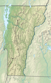
The reservoir was created to address the increasing demand for water in Chittenden County. A series of droughts in the early 20th century led the village of Essex Junction to procure land for water conservation. On June 29, 1955, Essex Junction purchased 501 acres of land from various owners. [1] In 1957, the village hired Knight Consulting Engineers, Inc. to build a dam across Indian Brook and flood the valley. The resulting impounded water formed a 58 acre reservoir and became the main source of water for the village. The land surrounding it was established as a water conservation area known as the Indian Brook Town Conservation Area. [2]
In the early 1970s, the growth of the village was again restricted by inadequate water supply, so in 1973 the village officially connected to the Champlain Water District and discontinued use of the reservoir. The taxes on the land, and the need to repay the new water infrastructure debt and future costs, led to a push to sell and/or rezone the land. [3] In August 1977, after a public bidding process, the village trustees sold the Indian Brook property for $167,000 to several private developers.
In November 1986, the town of Essex made a decision to purchase the land from private developers. On December 31, 1986, the land was purchased for $435,000. The Nature Conservancy provided a donation of $16,000. Following the purchase, the land was rezoned for open recreation. [2]
In 1988, water was lowered in the reservoir to facilitate minor repairs on the dam. Parking lots and roads were also upgraded, a boat launch and picnic sites were established, the remains of the old water treatment plant were razed, and park signs and trail markers were added. [2]

Essex is a town in Chittenden County, Vermont, United States. Vermont Route 289 crosses the town from east to west. The city of Essex Junction, with a population as of 2020 of 10,590, was located within the town as an incorporated village until 2022.

Essex Junction is a city in Chittenden County, Vermont, United States. As of the 2020 U.S. census, the population was 10,590. It was incorporated as a village on November 15, 1892. Essex Junction became Vermont’s 10th city on July 1, 2022.

South Burlington is a city in Chittenden County, Vermont, United States. Along with neighboring Burlington, it is a principal city of the Burlington metropolitan area. As of the 2020 U.S. census, the population was 20,292. It is home to the headquarters of Ben & Jerry's and the state of Vermont's largest mall, the University Mall.

The Connecticut River is the longest river in the New England region of the United States, flowing roughly southward for 406 miles (653 km) through four states. It rises 300 yards south of the U.S. border with Quebec, Canada, and discharges at Long Island Sound. Its watershed encompasses 11,260 square miles (29,200 km2), covering parts of five U.S. states and one Canadian province, via 148 tributaries, 38 of which are major rivers. It produces 70% of Long Island Sound's fresh water, discharging at 18,400 cubic feet (520 m3) per second.

Burlington is a town in Middlesex County, Massachusetts, United States. The population was 26,377 at the 2020 census.
The Department of Conservation and Recreation (DCR) is a state agency of the Commonwealth of Massachusetts, United States, situated in the Executive Office of Energy and Environmental Affairs. It is best known for its parks and parkways. The DCR's mission is "To protect, promote and enhance our common wealth of natural, cultural and recreational resources for the well-being of all." The agency is the largest landowner in Massachusetts.

The Winooski River is a tributary of Lake Champlain, approximately 90 miles (145 km) long, in the northern half of Vermont. Although not Vermont's longest river, it is one of the state's most significant, forming a major valley way from Lake Champlain through the Green Mountains towards the Connecticut River valley.

The West Canada Creek is a 76-mile-long (122 km) river in upstate New York, United States. West Canada Creek is an important water way in Hamilton, Oneida, and Herkimer counties, draining the south part of the Adirondack Mountains before emptying into the Mohawk River near the Village of Herkimer. The name "Canada" is derived from an Iroquoian word for "village" (Kanata).

Vermont Route 15 (VT 15) is a 68.957-mile-long (110.976 km) east–west state highway in northern Vermont, United States. Its western terminus is at U.S. Route 2 (US 2) and US 7 in Winooski and its eastern terminus is at US 2 in Danville. It is known as the Grand Army of the Republic Highway, a designation shared nationally with U.S. Route 6.

Fishkill Creek is a tributary of the Hudson River in Dutchess County, New York, United States. At 33.5 miles (53.9 km) it is the second longest stream in the county, after Wappinger Creek. It rises in the town of Union Vale and flows generally southwest to a small estuary on the Hudson just south of Beacon. Part of its 193-square-mile (500 km2) watershed is in Putnam County to the south. Sprout Creek, the county's third-longest creek, is its most significant tributary. Whaley and Sylvan lakes and Beacon Reservoir, its largest, deepest and highest lakes, are among the bodies of water within the watershed.
Vermont Route 114 (VT 114) is a 53.094-mile-long (85.447 km) north–south state highway in northeastern Vermont in the United States. It runs northward from U.S. Route 5 (US 5) in Lyndon until nearing the Canada–United States border in the town of Norton; thereafter, the road continues east to the New Hampshire state line in Canaan. The vast majority of VT 114 is situated within Essex County; however, the route also passes through small, isolated portions of Caledonia and Orleans Counties.

The Ware River is a 35.4-mile-long (57.0 km) river in central Massachusetts. It has two forks, its West Branch, which begins in Hubbardston, Massachusetts, and its East Branch, which begins in Westminster, Massachusetts. The Ware River flows southwest through the middle of the state, joins the Quaboag River at Three Rivers, Massachusetts, to form the Chicopee River on its way to the Connecticut River.
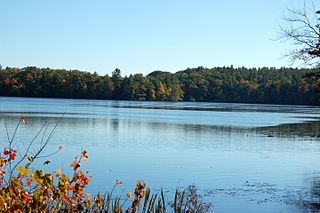
The Quinapoxet River is part of the Nashua River watershed in northern Massachusetts in the United States. It is part of the Massachusetts Water Resources Authority water system supplying drinking water to the greater Boston area.
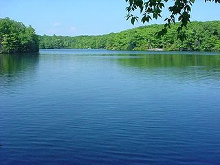
Millers Pond State Park is a public recreation area lying adjacent to Cockaponset State Forest in the towns of Durham and Haddam, Connecticut. The park's central feature is 33-acre (13 ha) Millers Pond, whose principal source of water is large springs that create a body of unpolluted water excellent for trout and smallmouth bass. The park offers fishing, hiking, mountain biking, and hunting.
The Clyde River is a tributary of Lake Memphremagog, over 33.5 miles (54 km) long, in northern Vermont in the United States. It is the easternmost of the four major rivers in Orleans County. It is the most powerful of the four within Orleans County, powering several turbines at damsites. It is part of the Northern Forest Canoe Trail.
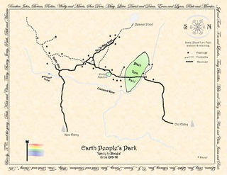
Earth Peoples Park (1970–1994) was a 592-acre (2.40 km2) parcel of swamp and forested land located in the small Canada–US border village of Norton, Vermont. The park property is now known as Black Turn Brook State Forest, owned by the State of Vermont.

Townshend Dam is a dam in Townshend, Windham County, Vermont.

Antelope Dam or Antelope Valley Dam is a dam in Plumas County, California, part of the California State Water Project.

Trout Brook Valley State Park Reserve is a 300-acre (120 ha) parcel owned by the state of Connecticut that is part of the larger Trout Brook Valley Preserve, located in Easton, Connecticut. The full conservation area covers 1,009 acres (408 ha) and comprises several contiguous parcels in the towns of Easton and Weston, bordering the southeast corner of the Saugatuck Reservoir. It is managed by the Aspetuck Land Trust. The state park portion of the preserve offers opportunities for hiking and hunting.


