Related Research Articles

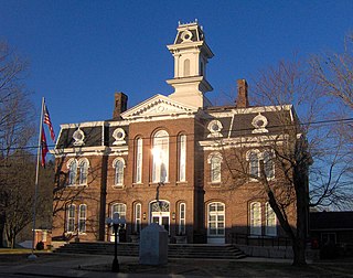
Putnam County is a county located in the U.S. state of Tennessee. As of the 2020 census, the population was 79,854. Its county seat is Cookeville. Putnam County is part of the Cookeville, TN Micropolitan Statistical Area.
Smith County is a county in the U.S. state of Tennessee. As of the 2020 census, the population was 19,904. Smith County is located in the region of the state known as Middle Tennessee. Its county seat is Carthage. The county was organized in 1799 and is named for Daniel Smith, a Revolutionary War veteran who made the first map of Tennessee and served as a United States senator.
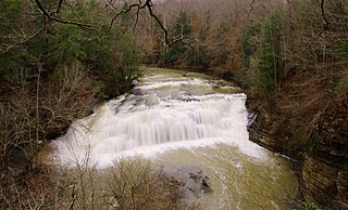
Indian Creek may refer to the following:
The Barren Fork is a 23.4-mile-long (37.7 km) tributary of the Collins River in the U.S. state of Tennessee. Via the Collins River, the Caney Fork, and the Cumberland and Ohio rivers, it is part of the Mississippi River watershed.

The Calfkiller River is a 42.4-mile-long (68.2 km) stream in the east-central portion of Middle Tennessee in the United States. It is a tributary of the Caney Fork, and is part of the Cumberland, Ohio, and Mississippi watersheds. The river is believed to be named for a Cherokee chief who once lived in the area.

The Little Pigeon River is a river located entirely within Sevier County, Tennessee. It rises from a series of streams which flow together on the dividing ridge between the states of Tennessee and North Carolina, with most of the flow from inside the boundary of the Great Smoky Mountains National Park. The river has three main forks or prongs, East, Middle, and West.

The Collins River is a 67-mile-long (108 km) stream in the east-central portion of Middle Tennessee in the United States. It is a tributary of the Caney Fork, and is part of the Cumberland, Ohio and Mississippi watersheds. The river drains the scenic Savage Gulf area, located just below the river's source, and empties into Great Falls Lake at Rock Island State Park.

The Rocky River is a 31.0-mile-long (49.9 km) stream in the east-central portion of Middle Tennessee in the United States. It is a tributary of the Caney Fork River, and is part of the Cumberland, Ohio and Mississippi watersheds. The lower portion of the river is part of the reservoir created by Great Falls Dam, which is located near the river's confluence with the Caney Fork.
The Falling Water River is a 46.8-mile-long (75.3 km) stream in the east-central portion of Middle Tennessee in the United States. It rises just west of Monterey at the edge of the Cumberland Plateau, and traverses the Eastern Highland Rim before dropping off to the Nashville Basin and emptying into Center Hill Lake along the Caney Fork. The river is noted for the 136-foot (41 m) Burgess Falls, which it spills over near the end of its course.

The Big South Fork of the Cumberland River is a 76-mile-long (122 km) river in the U.S. states of Tennessee and Kentucky. It is a major drainage feature of the Cumberland Plateau, a major tributary of the Cumberland River system, and the major feature of the Big South Fork National River and Recreation Area.

The Caney Fork River is a river that flows through central Tennessee in the United States, draining a substantial portion of the southwestern Cumberland Plateau and southeastern Highland Rim regions. It is a major tributary of the Cumberland River, and is part of the Cumberland, Ohio and Mississippi basins. The river is 143 miles (230 km) long, and its watershed covers 1,771 square miles (4,590 km2) in eleven counties. Monterey, Baxter, Sparta, Smithville, McMinnville, Altamont, Spencer and Gordonsville are among the towns that are at least partially drained by the river.

Rock Island State Park is a state park in Warren County and White County, Tennessee, located in the Southeastern United States. The park is named after the community of Rock Island, Tennessee, which in turn received its name from an island on the Caney Fork upstream from the Collins River confluence and Great Falls Dam. Rock Island State Park is centered on a peninsula created by the confluence of these two rivers and extends downstream to the headwaters of Center Hill Lake.

Scott's Gulf is a canyon situated along the Caney Fork River in White County, Tennessee, in the southeastern United States. The canyon stretches for approximately 18 miles (29 km) as the Caney Fork drops from the top of the Cumberland Plateau down to the eastern Highland Rim. This remote section of the river is home to a wilderness area consisting of a largely undisturbed deciduous forest, numerous waterfalls, caves and other geological formations, and Class IV and Class V whitewater rapids.
Buffalo Valley is an unincorporated town in far western Putnam County, Tennessee, United States. The zipcode is: 38548. The town could be described as a ghost town.
Temperance Hall is an unincorporated community in northern DeKalb County, Tennessee, United States. It is located approximately 4 miles (6.4 km) west-southwest of Center Hill Dam. It was established in 1798 by Stephen Robinson Sr., one of the first four settlers of DeKalb County.

Hammersley Fork is a tributary of Kettle Creek in Potter County and Clinton County, Pennsylvania, in the United States. It is approximately 10.0 miles (16.1 km) long and flows through Warton Township in Potter County and Leidy Township in Clinton County. The watershed of the stream has an area of 32.7 square miles (85 km2). The main rock formation in the watershed is the Pottsville Formation. A number of bridges cross the stream.
The Smith Fork Creek is a large stream that flows through Middle Tennessee in the United States, draining much of the southwestern Upper Cumberland region. It is a major tributary of the Caney Fork River, and is part of the Cumberland, Ohio and Mississippi basins. The creek is approximately 39 to 40 miles long, and its watershed covers parts of four counties as a subset of the Caney Fork watershed. The small towns and communities of Statesville, Auburntown, Gassaway, Liberty, Dowelltown, Temperance Hall, and Lancaster are drained by the creek, which empties into the Caney Fork 4.1 miles (6.6 km) southeast of Gordonsville.
Short Mountain is a mountain-sized monadnock that is the highest point in Cannon County, Tennessee and the Nashville metropolitan area. It is surrounded by the Highland Rim to the north, east and south but is an outlier of the Cumberland Plateau, evidenced by its sandstone caprock reaching over 2,000 feet in elevation; this makes it the westernmost part of Tennessee with an elevation over 2,000 feet. Nearby Little Short Mountain to the east and Sugar Tree Knob to the west also stand well over 1,400 feet above sea level, and Little Short Mountain is even still high enough above nearby river valleys in the Nashville Basin to qualify as a Class 6 mountain, but they don't have sandstone caprock nor reach the height Short Mountain does.
References
- 1 2 "Indian Creek Topo Map in Putnam County, Tennessee". www.anyplaceamerica.com.
- ↑ "Indian Creek". Geographic Names Information System . United States Geological Survey, United States Department of the Interior . Retrieved June 6, 2020.
- 1 2 "Indian Creek (in Putnam County, TN)".
- ↑ "Google Maps". Google Maps.
- ↑ "Indian Creek (dry), Putnam County, Tennessee". January 15, 2017 – via Flickr.
- ↑ "Google Maps". Google Maps.
- ↑ "Google Maps". Google Maps.
- ↑ "Google Maps". Google Maps.
- ↑ "Gentry". Gentry.
- ↑ "Google Maps". Google Maps.
- ↑ "Little Indian Creek (in Putnam County, TN)".