The Erie Canal is a historic canal in upstate New York that runs east–west between the Hudson River and Lake Erie. Completed in 1825, the canal was the first navigable waterway connecting the Atlantic Ocean to the Great Lakes, vastly reducing the costs of transporting people and goods across the Appalachians. The Erie Canal accelerated the settlement of the Great Lakes region, the westward expansion of the United States, and the economic ascendancy of New York state. It has been called "The Nation's First Superhighway".

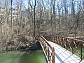
A towpath is a road or trail on the bank of a river, canal, or other inland waterway. The purpose of a towpath is to allow a land vehicle, beasts of burden, or a team of human pullers to tow a boat, often a barge. This mode of transport was common where sailing was impractical because of tunnels and bridges, unfavorable winds, or the narrowness of the channel.

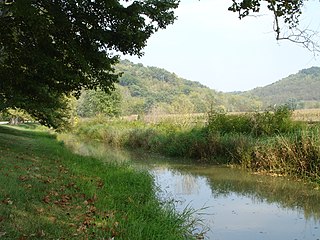
The Maumee River is a river running in the United States Midwest from northeastern Indiana into northwestern Ohio and Lake Erie. It is formed at the confluence of the St. Joseph and St. Marys rivers, where Fort Wayne, Indiana has developed, and meanders northeastwardly for 137 miles (220 km) through an agricultural region of glacial moraines before flowing into the Maumee Bay of Lake Erie. The city of Toledo is located at the mouth of the Maumee. The Maumee was designated an Ohio State Scenic River on July 18, 1974. The Maumee watershed is Ohio's breadbasket; it is two-thirds farmland, mostly corn and soybeans. It is the largest watershed of any of the rivers feeding the Great Lakes, and supplies five percent of Lake Erie's water.

The Wabash River is a 503-mile-long (810 km) river that drains most of the state of Indiana, and a significant part of Illinois, in the United States. It flows from the headwaters in Ohio, near the Indiana border, then southwest across northern Indiana turning south near the Illinois border, where the southern portion forms the Indiana-Illinois border before flowing into the Ohio River.

The Wabash and Erie Canal was a shipping canal that linked the Great Lakes to the Ohio River via an artificial waterway. The canal provided traders with access from the Great Lakes all the way to the Gulf of Mexico. Over 460 miles long, it was the longest canal ever built in North America.

The Ohio Rhineland is a German cultural region of Ohio. It was named by Rhinelanders and other Germans who settled the area in the mid-19th century. They named the canal "the Rhine" in reference to the river Rhine in Germany, and the newly settled area north of the canal as "Over the Rhine".

White River State Park is an urban park in downtown Indianapolis, Indiana. Situated along the eastern and western banks of its namesake White River, the park covers 267 acres (108 ha). The park is home to numerous attractions, including the Eiteljorg Museum of American Indians and Western Art, the Indiana State Museum, the Indianapolis Zoo, the NCAA Hall of Champions, Victory Field, Everwise Amphitheater, and White River Gardens.

The Ohio and Erie Canal was a canal constructed during the 1820s and early 1830s in Ohio. It connected Akron with the Cuyahoga River near its outlet on Lake Erie in Cleveland, and a few years later, with the Ohio River near Portsmouth. It also had connections to other canal systems in Pennsylvania.

The Monon Trail is a rail trail located entirely within the U.S. state of Indiana. It runs along the main line of the Monon Railroad, a popular railroad line connecting the cities of Chicago and Indianapolis with stops at major locations. After the decline of railroad travel and the sale of the company in 1987, the portion of the line between Indianapolis and Delphi, Indiana, was abandoned.
The Whitewater Valley Railroad is a heritage railroad in southeastern Indiana between Connersville and Metamora.

The Delaware and Hudson Canal was the first venture of the Delaware and Hudson Canal Company, which would later build the Delaware and Hudson Railway. Between 1828 and 1899, the canal's barges carried anthracite coal from the mines of northeastern Pennsylvania to the Hudson River and thence to market in New York City.
Summit Metro Parks is a Metroparks system serving the citizens of Summit County, Ohio by managing 14,000 acres (5,700 ha) in 16 developed parks, six conservation areas and more than 150 miles (240 km) of trails, with 22.4 miles (36.0 km) of the Ohio & Erie Canal Towpath Trail.

The Delaware Division of the Pennsylvania Canal, more commonly called the Delaware Canal, runs for 60 miles (97 km) parallel to the right bank of the Delaware River from the entry locks near the mouth of the Lehigh River and terminal end of the Lehigh Canal at Easton south to Bristol. At Easton, which today is the home of The National Canal Museum, the Delaware Canal also connected with the Morris Canal built to carry anthracite coal to energy-starved New Jersey industries.
Seven neighborhoods in Indianapolis, Indiana, are designated as official Cultural Districts. These are Broad Ripple Village, Canal and White River State Park, Fountain Square, Indiana Avenue, Market East, Mass Ave, and the Wholesale District.
The Whitewater Canal, which was built between 1836 and 1847, spanned a distance of 76 miles (122 km) and stretched from Lawrenceburg, Indiana on the Ohio River to Hagerstown, Indiana near the West Fork of the White River.

Interstate 65 (I-65) in the US state of Indiana traverses from the south-southeastern Falls City area bordering Louisville, Kentucky, through the centrally located capital city of Indianapolis, to the northwestern Calumet Region of the Hoosier State which is part of the Chicago metropolitan area. The Indiana portion of I-65 begins in Jeffersonville after crossing the Ohio River and travels mainly north, passing just west of Columbus prior to reaching the Indianapolis metro area. Upon reaching Indianapolis, the route alignment of I-65 begins to run more to the northwest and subsequently passes Lafayette on that city's east and north sides. Northwest of there, in west-central Jasper County, the route again curves more northward as it approaches the Calumet Region. Shortly after passing a major junction with I-80 and I-94, I-65 reaches its northern national terminus in Gary at US Highway 12/US Highway 20 after an interchange on I-90. I-65 covers 261.27 miles (420.47 km) in the state of Indiana. This is one of the principal Interstate Highways that cross the state, and, more specifically, intersect at the city of Indianapolis, that has given the state the nickname of "Crossroads of America".

Interstate 70 (I-70) in the US state of Indiana travels east–west across the central portion of the state, passing through the capital of Indianapolis. I-70 crosses from Illinois into Indiana near Terre Haute and departs into Ohio at Richmond. It covers 156.6 miles (252.0 km) in Indiana, paralleling U.S. Highway 40 (US 40), the old National Road.
Pogue's Run is an urban creek that starts near the intersection of Elizabeth Street and Lennington Drive on the east side of Indianapolis, Indiana, and empties into the White River south of the Kentucky Avenue bridge over that river. At the stream's intersection with New York Street just east of downtown Indianapolis it enters a double-box culvert conduit through which it flows underneath downtown Indianapolis. It is named for George Pogue, who, along with John Wesley McCormick, were among the first settlers in what would become the city of Indianapolis. Construction of the Pogue's Run Trail along the creek's eastern section has been started.

The Mohawk Towpath Scenic Byway is a National Scenic Byway in the Capital District region of New York in the United States. It extends from Schenectady to Waterford by way of a series of local, county, and state highways along the Mohawk River and the Erie Canal. The byway is intended to showcase the history of the waterway, from Native American times through the creation of the Erie Canal and the role the waterside communities played in the Industrial Revolution and the westward expansion of the United States. At its east end, the byway connects to the Lakes to Locks Passage, an All-American Road.
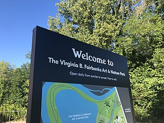
The Virginia B. Fairbanks Art & Nature Park: 100 Acres, also referred to as the 100 Acres or Fairbanks Park, is a public interactive art park located on the Newfields campus in Indianapolis, Indiana, United States.