
Putnam County is a county located in the U.S. state of Indiana. As of the 2010 United States Census, the population was 37,963. The county seat is Greencastle. The county was named for Israel Putnam, a hero in the French and Indian War and a general in the American Revolutionary War. The county was created in 1821 and organized in April 1822.
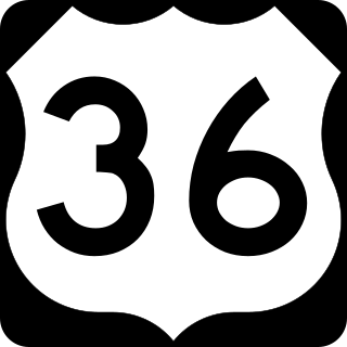
U.S. Route 36 (US 36) is an east–west United States highway that travels approximately 1,414 miles (2,276 km) from Rocky Mountain National Park, Colorado to Uhrichsville, Ohio. The highway's western terminus is at Deer Ridge Junction, an intersection in Rocky Mountain National Park, Colorado, where it meets US 34. Its eastern terminus is at US 250 in Uhrichsville, Ohio.

U.S. Route 136 is an east-west U.S. highway that is a spur route of U.S. Route 36. It runs from Edison, Nebraska, at U.S. Route 6 and U.S. Route 34 to the Interstate 74/Interstate 465 interchange in Speedway, Indiana. This is a distance of 804 miles (1,294 km). US 136 never meets its parent, US 36; however, it does come within two miles of it at its interchange with I-465/I-74 at its eastern terminus.

State Road 1 (SR 1) is a north–south state highway in eastern Indiana, consisting of two segments. Its southern segment begins at U.S. Highway 50 and Interstate 275 in east-central Dearborn County, just east of Lawrenceburg, and ends at Interstate 469 south of Fort Wayne. Its northern segment begins at Interstate 69 on Fort Wayne's north side, and ends at U.S. Route 20 in east-central Steuben County, approximately 6 miles (9.7 km) east of Angola.

State Road 2 (SR 2) in the U.S. State of Indiana is an east–west route running from the Illinois border at Illinois Route 17 east to the outskirts of South Bend, Indiana, at the U.S. Route 20/U.S. Route 31 freeway, also known as the St. Joseph Valley Parkway. This is a distance of 80.98 miles (130.32 km).

State Road 32 (SR 32) in the U.S. state of Indiana is an east–west state highway in central Indiana that crosses the entire state, covering a distance of about 157 miles (253 km). The western terminus of SR 32 is at the Illinois state line, southeast of Danville, Illinois, where the state highway becomes a county road. The eastern terminus is at Union City, Indiana, and Union City, Ohio, at the Ohio state border where the highway becomes Ohio State Route 47.

State Road 51 in the U.S. state of Indiana is a north–south route on the state highway system in northwest Indiana. It consists of a route 9.56 miles (15.39 km) long from a point on U.S. Route 30 4 miles (6.4 km) east of Merrillville and 8 miles (13 km) west of Valparaiso, north to U.S. Route 20 in Gary. Immediately north of US 30, the highway is signed as the Adam Benjamin Highway.

State Road 62 (SR 62) in the U.S. state of Indiana is an east–west route that travels 204 miles (328 km) from the Illinois state line in the southwest corner of Indiana to the Louisville, Kentucky area, then northeast toward the Cincinnati, Ohio area.
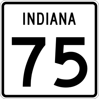
State Road 75, the highest two-digit route in the U.S. state of Indiana consists of two discontinuous north–south segments.

State Road 158 is a short connector route in Lawrence County in the southwest portion of the U.S. State of Indiana.
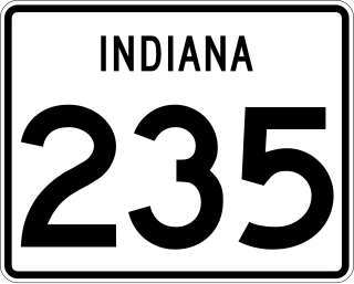
State Road 235 in the U.S. state of Indiana is a short route in southwest Jackson County.

State Road 14 is an east–west highway route which traverses the northern portion of the U.S. State of Indiana. Its western terminus is at U.S. Route 41 in Enos, and since 1995 its eastern terminus is at Interstate 69 in Fort Wayne.

State Road 28 is an east–west road in central Indiana in the United States that crosses the entire state from east to west, covering a distance of about 153 miles (246 km) and passing about 20 miles (32 km) to the north of the state capitol of Indianapolis.

State Road 520 is a four-lane connector about 1,000 feet (300 m) in length. It exists solely to connect U.S. Route 12 and U.S. Route 20 in Pines, about 3 miles (4.8 km) west of Michigan City. U.S. 12 and U.S. 20 do not cross with each other — they parallel each other for another 22 miles (35 km) westbound and overlap in Gary; U.S. 20 is generally considered the faster of the two, while U.S. 12 is the scenic Dunes Highway. Eastbound, U.S. 12 travels through Michigan City and northeast into Michigan where it forks east from the Red Arrow Highway. U.S. 20 stays in Indiana and runs around Michigan City as a bypass to the south.

Interstate 65 (I-65) in the US state of Indiana traverses from the south-southeastern Falls City area bordering Louisville, Kentucky, through the centrally located capital city of Indianapolis, to the northwestern Calumet Region of the Hoosier State which is part of the Chicago metropolitan area. The Indiana portion of I-65 begins in Jeffersonville after crossing the Ohio River and travels mainly north, passing just west of Columbus prior to reaching the Indianapolis metro area. Upon reaching Indianapolis, the route alignment of I-65 begins to run more to the northwest and subsequently passes Lafayette on that city's east and north sides. Northwest of there, in west-central Jasper County, the route again curves more northward as it approaches the Calumet Region. Shortly after passing a major junction with I-80 and I-94, I-65 reaches its northern national terminus in Gary at I-90 which is carried on the Indiana East–West Toll Road. I-65 covers 261.27 miles (420.47 km) in the state of Indiana. This is one of the principal Interstate Highways that cross the state, and, more specifically, intersect at the city of Indianapolis, that has given the state the nickname of "Crossroads of America".

Interstate 70 (I-70) in the US state of Indiana travels east–west across the state passing through the capital of Indianapolis. I-70 crosses from Illinois into Indiana near Terre Haute and departs into Ohio at Richmond. It covers 156.6 miles (252.0 km) in Indiana, paralleling U.S. Highway 40 (US 40), the old National Road.
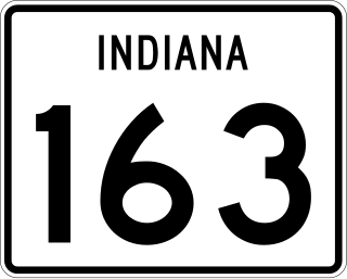
State Road 163 in the U.S. State of Indiana is a short 9-mile (14 km) route in Vermillion and Parke counties. Though it is an odd-numbered route, it is an east–west route.
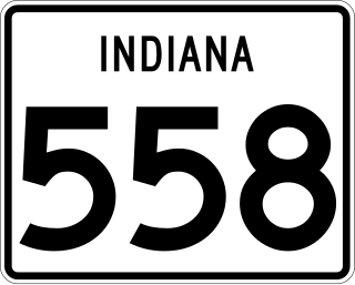
State Road 558 is a State Road in the southwestern section of the U.S. state of Indiana. Running for about 1.1 miles (1.8 km) in a general east–west direction, connecting the Naval Surface Warfare Center Crane Division with U.S. Route 231, passing through the town of Crane. SR 558 was originally introduced in the 1950s to connect the Crane Naval Depot, now Naval Surface Warfare Center Crane Division with SR 45, now US 231.

U.S. Route 31 (US 31) is a part of the United States Numbered Highway System that runs from Spanish Fort, Alabama, to Mackinaw City, Michigan. It enters the U.S. state of Indiana via the George Rogers Clark Memorial Bridge between Louisville, Kentucky, and Clarksville, Indiana. The 266.02 miles (428.12 km) of US 31 that lie within Indiana serve as a major conduit. Some of the highway is listed on the National Highway System. Various sections are rural two-lane highway and urbanized four- or six-lane divided expressway. The northernmost community along the highway is South Bend near the Michigan state line.

U.S. Route 231 is the longest numbered highway in Indiana, covering over 284 miles (457 km). It is a main north–south highway in the western part of the state. The southern terminus of US 231 is at the Kentucky state line and the northern terminus is at US 41 just south of St. John. The highway is a mixture of expressway and two-lane roadway. The expressway portions exist mainly in southern Indiana and around the Lafayette area, with the rest mainly being two lanes.

