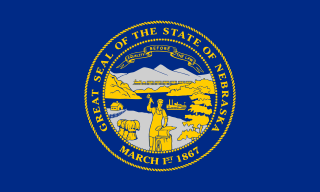
Nebraska is a state in the Midwestern region of the United States. It is bordered by South Dakota to the north; Iowa to the east and Missouri to the southeast, both across the Missouri River; Kansas to the south; Colorado to the southwest; and Wyoming to the west. It is the only triply landlocked U.S. state.

Omaha is the largest city in the U.S. state of Nebraska and the county seat of Douglas County. Omaha is in the Midwestern United States on the Missouri River, about 10 miles (15 km) north of the mouth of the Platte River. The nation's 39th-largest city, Omaha's 2020 census population was 486,051. It is the second-largest city in the Great Plains states, the second-largest city along the Missouri River, and the seventh-largest city in the Midwest.

The United States Department of Agriculture (USDA) is the federal executive department responsible for developing and executing federal laws related to farming, forestry, rural economic development, and food. It aims to meet the needs of commercial farming and livestock food production, promotes agricultural trade and production, works to assure food safety, protects natural resources, fosters rural communities and works to end hunger in the United States and internationally. It is headed by the Secretary of Agriculture, who reports directly to the President of the United States and is a member of the president's Cabinet. The current secretary is Tom Vilsack, who has served since February 24, 2021.

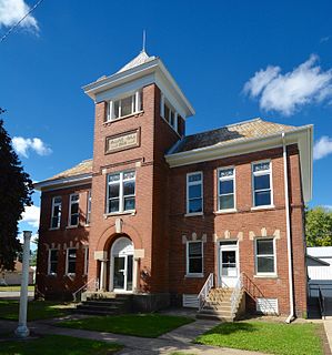
Dawson County is a county in the U.S. state of Nebraska. As of the 2010 United States Census, the population was 24,326. Its county seat is Lexington.

The Midwestern United States, also referred to as the Midwest or the American Midwest, is one of four census regions of the United States Census Bureau. It occupies the northern central part of the United States. It was officially named the North Central Region by the Census Bureau until 1984. It is between the Northeastern United States and the Western United States, with Canada to its north and the Southern United States to its south.

Sheffield is a village in Bureau County, Illinois, United States. The population was 926 at the 2010 census. It is part of the Ottawa Micropolitan Statistical Area. Sheffield was founded by Joseph E. Sheffield and Henry Farnam in 1852. Sheffield and Farnam constructed the Chicago and Rock Island Railroad, and the town site was intended as a coaling station for trains. According to Farnam, he and Sheffield flipped a coin to see for whom the town would be named. A monument to Joseph E. Sheffield, and the Rock Island Railroad stands today in Sheffield's town square.

Shullsburg is a city in Lafayette County, Wisconsin, United States. The population was 1,226 at the 2010 census. The city is adjacent to the Town of Shullsburg. Founded in 1827 it is one of the oldest settlements in Wisconsin. There are 34 buildings listed on the National Register of Historic Places on its historic Water Street Commercial District. It is located within the Midwestern Driftless Area and is known for its history of lead mining and its cheese industry.
The U.S. state of Kansas, located on the eastern edge of the Great Plains, was the home of nomadic Native American tribes who hunted the vast herds of bison. In around 1450 AD, the Wichita People founded the great city of Etzanoa. The city of Etzanoa was abandoned in around 1700 AD. The region was explored by Spanish conquistadores in the 16th century. It was later explored by French fur trappers who traded with the Native Americans. Most of Kansas became permanently part of the United States in the Louisiana Purchase of 1803. When the area was opened to settlement by the Kansas–Nebraska Act of 1854 it became a battlefield that helped cause the American Civil War. Settlers from North and South came in order to vote slavery down or up. The free state element prevailed.

The Corn Belt is a region of the Midwestern United States that, since the 1850s, has dominated corn production in the United States. In the United States, "corn" is the common word for "maize". More generally, the concept of the "Corn Belt" connotes the area of the Midwest dominated by farming and agriculture.

The Dundee–Happy Hollow Historic District is located west of Midtown Omaha, Nebraska. It covers the area between Harney Street on the south, Hamilton Street on the north, Happy Hollow Boulevard on the west, and 46th Street on the east. The "heart" of Dundee is located at 50th and Underwood Avenue in Omaha, Nebraska, United States. It was founded in 1880 and annexed into the city in 1915. Dundee is home to Warren Buffett and nationally syndicated editorial cartoonist Jeff Koterba and was the hometown of filmmaker Alexander Payne. Actor Henry Fonda additionally lived in the Dundee neighborhood.
Native Americans in the United States resided in what is now Iowa for thousands of years. The written history of Iowa begins with the proto-historic accounts of Native Americans by explorers such as Marquette and Joliet in the 1680s. Until the early 19th century Iowa was occupied exclusively by Native Americans and a few European traders, with loose political control by France and Spain.
The history of Idaho is an examination of the human history and social activity within the state of Idaho, one of the United States of America located in the Pacific Northwest area near the west coast of the United States and Canada. Other associated areas include southern Alaska, all of British Columbia, Washington, Oregon, western Montana and northern California and Nevada.

Mercur is a historical hard rock mining ghost town in Tooele County, Utah, United States. In 1891, it became the site of the first successful use of the cyanide process of gold extraction in the United States, the dominant metallurgy today. Its elevation above sea level is approximately 2,042 m. The nearby Mercur Gold Mine was re-opened by Barrick Gold in 1985, with mining operations again coming to an end in 1997. The reclamation and restoration project was set to continue up to 2010.

The history of Omaha, Nebraska, began before the settlement of the city, with speculators from neighboring Council Bluffs, Iowa staking land across the Missouri River illegally as early as the 1840s. When it was legal to claim land in Indian Country, William D. Brown was operating the Lone Tree Ferry to bring settlers from Council Bluffs to Omaha. A treaty with the Omaha Tribe allowed the creation of the Nebraska Territory, and Omaha City was founded on July 4, 1854. With early settlement came claim jumpers and squatters, and the formation of a vigilante law group called the Omaha Claim Club, which was one of many claim clubs across the Midwest. During this period many of the city's founding fathers received lots in Scriptown, which was made possible by the actions of the Omaha Claim Club. The club's violent actions led to the U.S. Supreme Court trial, Baker v. Morton, which led to the end of the organization.

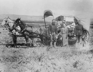
The history of the U.S. state of Nebraska dates back to its formation as a territory by the Kansas–Nebraska Act, passed by the United States Congress on May 30, 1854. The Nebraska Territory was settled extensively under the Homestead Act of 1862 during the 1860s, and in 1867 was admitted to the Union as the 37th U.S. state. The Plains Indians were descendants of succeeding cultures of indigenous peoples who have occupied the area for thousands of years.

Jobbers Canyon Historic District was a large industrial and warehouse area comprising 24 buildings located in downtown Omaha, Nebraska, US. It was roughly bound by Farnam Street on the north, South Eighth Street on the east, Jackson Street on the south, and South Tenth Street on the west. In 1989, all 24 buildings in Jobbers Canyon were demolished, representing the largest National Register historic district loss to date.
Mexicans in Omaha are people living in Omaha, Nebraska, United States who have citizenship or ancestral connections to the country Mexico. They have contributed to the economic, social and cultural well-being of Omaha for more than a century. Mexicans, or Latino people identified incorrectly as being from Mexico, have been accounted for in the history of Omaha, Nebraska since 1900. The entire Latino population of Omaha increased ninety percent between 1990 and 1997.

DeWitty, later renamed Audacious, was a village in Cherry County, Nebraska, United States. The settlement, which was founded in 1907 and disincorporated in 1936, was located 10 miles (20 km) north and west of Brownlee. DeWitty was Nebraska's "largest and most permanent colony" of African American homesteaders.

The Lincoln Highway in Omaha, Nebraska, runs east–west from near North 183rd Street and West Dodge Road in Omaha, Nebraska, towards North 192nd Street outside of Elkhorn. This section of the Lincoln Highway, one of only 20 miles (32 km) that were paved with brick in Nebraska, is one of the most well-preserved in the country. The roadway was listed on the National Register of Historic Places in 1984. The Lincoln Highway was the first road across the United States, traversing coast-to-coast from Times Square in New York City to Lincoln Park in San Francisco, California.

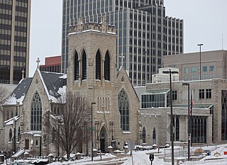
Trinity Cathedral is located in Downtown Omaha, Nebraska. Nebraska's first Episcopal parish, Trinity was established in 1856, and became the state's first Episcopal cathedral in 1872. Designed by noted English architect Henry G. Harrison in 1880, the cathedral was consecrated on November 15, 1883. It was added to the National Register of Historic Places in 1974. Today Trinity Cathedral is considered one of the most beautiful churches in Omaha.


