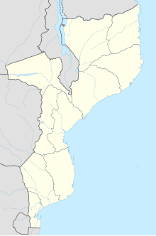
Inhambane is a province of Mozambique located on the coast in the southern part of the country. It has an area of 68,615 km2 and a population of 1,488,676. The provincial capital is also called Inhambane.

Jay Prakash Narayan Airport is an domestic airport serving Patna, the capital of Bihar, India. It is named after the independence activist and political leader, Jayprakash Narayan. It is the 15th busiest airport in India. To meet demand, the Airports Authority of India (AAI) is working to expand and modernise airport infrastructure. The airport is currently undergoing an ambitious expansion project that includes a new two-level passenger terminal, which will be completed by April 2025.

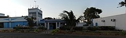
Inhambane, also known as Terra de Boa Gente, is a city located in southern Mozambique, lying on Inhambane Bay, 470 km northeast of Maputo. It is the capital of the Inhambane Province and, according to the 2017 census, has a population of 79,724, growing from 54,157 in the 1997 census.

Gaya International Airport is an international airport serving Gaya, Bihar, India. It is located 12 km (7.5 mi) south-west of Gaya and 5 km (3.1 mi) from Bodh Gaya, from where Gautama Buddha attained enlightenment.
Dimapur Airport is a domestic airport serving Chümoukedima–Dimapur and its neighbouring areas. It is located between the districts of Chümoukedima and Dimapur, from where National Highway 29 passes just beside the airport. It is the only airport in the state of Nagaland. The terminal building can handle 500 departing and 300 arriving passengers, and was built during World War II.
Tezpur Airport, also known as Salonibari Air Force Station, is a domestic airport and an Indian Air Force Station serving Tezpur, Assam, India. It is located in Salonibari, situated 8.5 km (5.3 mi) from the city centre.
Uray Airport is an airport in Khanty-Mansi Autonomous Okrug, Russia located 4 km southeast of Uray. It services up to medium-sized airliners.

Elista International Airport is an international airport located near the city of Elista in the Republic of Kalmykia of Russia. The airport was closed from 24 February 2022 until May 2024 due to the Russian invasion of Ukraine. The airport reopened on 3 May 2024, and the first flight since 2022 took place on 28 May. The airport later reported that 214 flights had been made to and from the airport over summer 2024, transporting 13,846 passengers.

Khajuraho Airport is a domestic airport that serves the cities of Khajuraho and Chhatarpur in Madhya Pradesh, India. The airport is 3 km south of Khajuraho, 4 km from Khajuraho railway station and 40 km from Chhatarpur. It covers an area of 590 acres.

Kushok Bakula Rimpochee Airport is a military airfield of the Indian Air Force as well as domestic airport serving Leh, the capital of Ladakh, India. Situated at 3,256 m (10,682 ft) above mean sea level, it is the highest commercial airport in India and one of the highest in the world. The airport is named after 19th Kushok Bakula Rinpoche, a Buddhist monk whose Spituk Monastery is in vicinity to the airfield. Due to its location in between the Himalayas, the approach to Leh Airport is one of the most challenging and scenic.

Sultan Muhammad Salahuddin Airport, also known as Bima Airport, is a public airport located approximately 10 kilometres (6.2 mi) to the south of the city of Bima, on the island of Sumbawa, West Nusa Tenggara, Indonesia.

Jaisalmer Airport is a domestic airport serving Jaisalmer, Rajasthan, India. It is located 12.6 kilometres (7.8 mi) from the city centre. The airport operates as a civil enclave on an Indian Air Force base.

Bareilly Airport is a domestic airport serving Bareilly, Uttar Pradesh, India at Indian Air Force's Trishul Air Base in Izzatnagar, located 6 kilometres (3.7 mi) north from the city centre.