
Pudding Lane is a small street in London, widely known as the location of Thomas Farriner's bakery, where the Great Fire of London started in 1666. It runs between Eastcheap and Thames Street in the historic City of London, and intersects Monument Street, the site of Christopher Wren's Monument to the Great Fire.
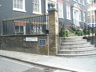
St Thomas the Apostle was a parish church in St Thomas Apostle Street in the City of London. In existence by the late twelfth century, it was destroyed in the Great Fire of London in 1666 and not rebuilt.

Fenchurch Street is a street in London, England, linking Aldgate at its eastern end with Lombard Street and Gracechurch Street in the west. It is a well-known thoroughfare in the City of London financial district and is the site of many corporate offices and headquarters. The name "Fenchurch" means "church in the fenny or marshy ground" and presumably refers to St Gabriel Fenchurch, which stood at the junction of Fenchurch Street and Cullum Street until it was destroyed by the Great Fire.

St George Botolph Lane was a church off Eastcheap, in the ward of Billingsgate in the City of London. The rear of the church overlooked Pudding Lane, where the fire of London started. It was first recorded in the twelfth century, and destroyed in the Great Fire of 1666. It was one of the 51 churches rebuilt by the office of Sir Christopher Wren. The church was demolished in 1904.

St. Matthew Friday Street was a church in the City of London located on Friday Street, off Cheapside. Recorded since the 13th century, the church was destroyed in the Great Fire of 1666, then rebuilt by the office of Sir Christopher Wren. The rebuilt church was demolished in 1885.

St Mary Bothaw was a parish church in the Walbrook ward of the City of London. It was destroyed in the Great Fire of London in 1666 and not rebuilt. However, some of its materials were used in the rebuilding of St Swithin, London Stone, with which parish it was merged.

St Mildred, Poultry, was a parish church in the Cheap ward of the City of London dedicated to Anglo-Saxon Saint Mildred. It was rebuilt after the Great Fire of London, and demolished in 1872. St Mildred in the Poultry was the burial place of the writer Thomas Tusser. Some description of the church and its monuments is given in John Stow's Survey of London.

St Nicholas Acons was a parish church in the City of London. In existence by the late 11th century, it was destroyed during the Great Fire of London of 1666 and not rebuilt.

All Hallows, Honey Lane was a parish church in the City of London, England. Of medieval origin, it was destroyed in the Great Fire of London in 1666 and not rebuilt; the site became part of Honey Lane Market, which was in turn partially cleared to make way for the City of London School in the 19th century. Much of the area was destroyed during the bombing in World War II and has been redeveloped. The name Honey Lane is retained in a nearby walkway.

Foster Lane is a short street within Cheap ward, in the City of London, England. It is situated northeast of St Paul's Cathedral and runs southbound Gresham Street to Cheapside.

St Mary Colechurch was a parish church in the City of London destroyed in the Great Fire of London in 1666 and not rebuilt.

St Gabriel Fenchurch was a parish church in the Langbourn Ward of the City of London, destroyed in the Great Fire of London and not rebuilt.

Wood Street is a street in the City of London, the historic centre and primary financial district of London. It originates in the south at a junction with Cheapside; heading north it crosses Gresham Street and London Wall. The northernmost end runs alongside The Postern, part of the Barbican estate, stopping at Andrewes House. Today Wood Street lies within the wards of Bassishaw and Cheap.

St Mary Magdalen, Milk Street, was a parish church in the City of London, England, dedicated to Jesus' companion Mary Magdalene. Originally constructed in the 12th century, it was destroyed in the Great Fire of London in 1666 and not rebuilt. The location was converted into a market, then from 1835 to 1879 was the site of the City of London School.

St Michael-le-Querne, also called St Michael ad Bladum, was a parish church in the Farringdon Within Ward in the City of London. It was destroyed in the Great Fire of London of 1666 and not rebuilt. The name is apparently a reference to a quern-stone as there was a corn market in the churchyard.

St Pancras, Soper Lane, was a parish church in the City of London, in England. Of medieval origin, it was destroyed in the Great Fire of London in 1666 and not rebuilt.

St Martin Pomeroy was a parish church in the Cheap ward of the City of London. It was also known as St Martin Ironmonger Lane.

St Mary Woolchurch Haw was a parish church in the City of London, destroyed in the Great Fire of London of 1666 and not rebuilt. It came within the ward of Walbrook.
Poultry is a short street in the City of London, which is the historic nucleus and modern financial centre of London. It is an eastern continuation of Cheapside, between Old Jewry and Mansion House Street, towards Bank Junction.

Trump Street is a street in the City of London that was originally known as Trumpadere Street, probably after the trumpet or horn makers who once worked there or in the adjacent Trump Alley. It was built after the Great Fire of London (1666) but completely destroyed by bombing during the Second World War and has since been entirely rebuilt.
