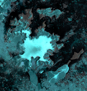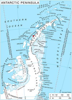
Ineson Glacier is a glacier flowing northwest into Gin Cove, James Ross Island, Antarctica. Following geological work by the British Antarctic Survey (BAS), 1981–83, it was named by the UK Antarctic Place-Names Committee after Jonathan R. Ineson, a BAS geologist in the area.

Lawrie Glacier is a glacier flowing between Mount Genecand and Mezzo Buttress, and entering the head of Barilari Bay between Cherkovna Point and Prestoy Point on the west coast of Graham Land, Antarctica. It was charted by the British Graham Land Expedition under Rymill, 1934–37, and was named by the UK Antarctic Place-Names Committee in 1959 for Robert Lawrie, an English alpine and polar equipment specialist.

Posadowsky Glacier is a glacier about 9 nautical miles long, flowing north to Posadowsky Bay immediately east of Gaussberg. Posadowsky Bay is an open embayment, located just east of the West Ice Shelf and fronting on the Davis Sea in Kaiser Wilhelm II Land. Kaiser Wilhelm II Land is the part of East Antarctica lying between Cape Penck, at 87°43'E, and Cape Filchner, at 91°54'E, and is claimed by Australia as part of the Australian Antarctic Territory. Other notable geographic features in this area include Drygalski Island, located 45 mi NNE of Cape Filchner in the Davis Sea, and Mirny Station, a Russian scientific research station.
Willey Glacier is a heavily crevassed glacier north of Creswick Peaks in Palmer Land, flowing west from Creswick Gap into George VI Sound. Named by United Kingdom Antarctic Place-Names Committee (UK-APC) for Lawrence E. Willey, British Antarctic Survey (BAS) geologist at Fossil Bluff and Stonington Island stations, 1966–69 and 1973, and awarded the Polar Medal for services to Antarctic Survey in 1976.
Wotkyns Glacier is a glacier flowing north from Michigan Plateau along the west side of Caloplaca Hills to enter the Reedy Glacier. Mapped by United States Geological Survey (USGS) from surveys and U.S. Navy air photos, 1960-64. Named by Advisory Committee on Antarctic Names (US-ACAN) for Grosvenor S. Wotkyns, hospital corpsman at Byrd Station in 1962.

Barnes Glacier is a glacier on the west side of Hemimont Plateau flowing west into Blind Bay on the west coast of Graham Land. It was named by the UK Antarctic Place-Names Committee in 1958 for Howard T. Barnes, Canadian physicist and pioneer of ice engineering.
Norman Glacier is a glacier, 5 nautical miles (9 km) long, flowing southwest from Palmer Land to enter George VI Sound just north of Bushell Bluff, in Antarctica. It was named, by the United Kingdom Antarctic Place-Names Committee (UK-APC), for Shaun M. Norman, the base commander with the British Antarctic Survey (BAS) at Stonington Island from 1966 to 1968.
Whitten Peak is a pyramidal peak, 445 m, forming the northeast end of Blade Ridge at the west side of the head of Hope Bay, on the northeast end of Antarctic Peninsula. Discovered by the Swedish Antarctic Expedition, 1901–04, under Nordenskjold. Named by the Falkland Islands Dependencies Survey (FIDS) for R. Whitten, first mate of the ship Eagle, which participated in FIDS operations in 1944-45.
DeMaster Point is a point at the foot of Marshall Valley, Denton Hills, on the Scott Coast of Victoria Land. It was named by the Advisory Committee on Antarctic Names (1994) after Douglas P. DeMaster, a biologist at the University of Minnesota. He conducted seal studies at McMurdo Sound (1976–77), the South Shetland Islands (1977–78), and the Palmer Archipelago (1978–79).
The Dorsey Mountains are a mountain range just east of Somigliana Glacier in the northern part of the Arrowsmith Peninsula in Graham Land. They were mapped by the Falkland Islands Dependencies Survey from surveys and air photos in 1956 to 1959 and named by the UK Antarctic Place-Names Committee for Noah Ernest Dorsey, an American physicist.

Edholm Point is the northwestern point of Krogh Island in the Biscoe Islands, Antarctica forming the west side of the entrance to Transmarisca Bay.

The Fish Islands are a group of small islands lying in the northern part of the entrance to Holtedahl Bay, off the west coast of Graham Land, Antarctica. They were discovered and named by the British Graham Land Expedition, 1934–37, under John Rymill.
Flint Glacier is a glacier which flows south into Whirlwind Inlet between Demorest Glacier and Cape Northrop, on the east coast of Graham Land, Antarctica. It was discovered by Sir Hubert Wilkins on his flight of December 20, 1928, and photographed from the air by the United States Antarctic Service in 1940. It was charted in 1947 by the Falkland Islands Dependencies Survey, who named it for glaciologist Richard F. Flint, professor of geology at Yale University.

Flogeken Glacier is a deeply entrenched glacier, flowing northwest between Mount Grytoyr and Langfloget Cliff, in the Mühlig-Hofmann Mountains of Queen Maud Land, Antarctica. it was mapped by Norwegian cartographers from surveys and air photos by the Sixth Norwegian Antarctic Expedition (1956–60) and named Flogeken.
Hardy Point is the western point of Bellingshausen Island in the South Sandwich Islands. It was charted in 1930 by Discovery Investigations personnel on the Discovery II, who named it for Alister C. Hardy, a member of the zoological staff of the Discovery Committee, 1924–28, and professor of zoology at University College Hull.

Litz Glacier is a glacier flowing northeast from the vicinity of Smith Peak and Litz Bluff in north-central Thurston Island, Antarctica. The glacier enters the west part of Peale Inlet north of the Guy Peaks. It was named by the Advisory Committee on Antarctic Names after A.K. Litz, Chief Photographer's Mate in the Eastern Group of Operation Highjump, which obtained aerial photographs of this glacier and adjacent coastal areas, 1946–47.

Hoek Glacier is a glacier flowing into Dimitrov Cove northeast of Veshka Point on the northwest coast of Velingrad Peninsula on Graham Coast in Graham Land, Antarctica, southward of the Llanquihue Islands. It was charted by the British Graham Land Expedition under John Rymill, 1934–37, and was named by the UK Antarctic Place-Names Committee in 1959 for Henry W. Hoek (1878–1951), a pioneer Swiss ski-mountaineer and author of one of the earliest skiing manuals.
McClary Glacier is a glacier 10 nautical miles (19 km) long and 2 nautical miles (4 km) wide on the west coast of Graham Land, Antarctica. It flows southwest along the north side of Butson Ridge into Marguerite Bay between Cape Calmette and the Debenham Islands. The glacier was first roughly surveyed by the British Graham Land Expedition, 1936–37, and resurveyed by the Falkland Islands Dependencies Survey, 1946–50. It was named by the UK Antarctic Place-Names Committee for George B. McClary, father of Nelson McClary, mate on the Port of Beaumont during the Ronne Antarctic Research Expedition, 1947–48.

Stenhouse Glacier is a small glacier flowing into the head of Visca Anchorage immediately west of Stenhouse Bluff, on King George Island in the South Shetland Islands. Charted but not named by the French Antarctic Expedition, 1908–10, under Charcot. The name West Stenhouse Glacier arose locally for this feature in 1958 from association with Stenhouse Bluff, but the shortened form recommended by United Kingdom Antarctic Place-Names Committee (UK-APC) in 1960 has been adopted.

Sölch Glacier is a glacier on the Pernik Peninsula of the Loubet Coast in Graham Land, flowing west to Salmon Cove just north of Kanchov Peak on the east side of Lallemand Fjord. It was mapped from air photos taken by the Falkland Islands and Dependencies Aerial Survey Expedition, 1956–57, and named by United Kingdom Antarctic Place-Names Committee for Johann Sölch (1883–1951), an Austrian glacial geologist and glaciologist.


