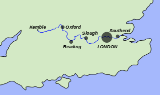
The River Thames, known alternatively in parts as the River Isis, is a river that flows through southern England including London. At 215 miles (346 km), it is the longest river entirely in England and the second-longest in the United Kingdom, after the River Severn.

The Oxford Canal is a 78-mile (126 km) narrow canal in central England linking Oxford with Bedworth via Banbury and Rugby. Completed in 1790, it connects to the River Thames at Oxford and is integrated with the Grand Union Canal—combined for 5 miles (8 km) close to the villages of Braunston and Napton-on-the-Hill, a canal which soon after construction superseded much of its traffic.

Teddington Lock is a complex of three locks and a weir on the River Thames between Ham and Teddington in the London Borough of Richmond upon Thames, England. It was first built in 1810.

The Cotswold Line is an 86 1⁄2-mile (139.2 km) railway line between Oxford and Hereford in England.

The Thames Path is a National Trail following the River Thames from its source near Kemble in Gloucestershire to the Thames Barrier at Charlton, south east London. It is about 184 miles (296 km) long. A path was first proposed in 1948 but it only opened in 1996.

Osney or Osney Island is a riverside community in the west of the city of Oxford, England. In modern times the name is applied to a community also known as Osney Town astride Botley Road, just west of the city's main railway station, on an island surrounded by the River Thames, Osney Ditch and another backwater connecting the Thames to Osney Ditch.

The River Wey Navigation and Godalming Navigation together provide a 20-mile (32 km) continuous navigable route from the River Thames near Weybridge via Guildford to Godalming. Both waterways are in Surrey and are owned by the National Trust. The River Wey Navigation connects to the Basingstoke Canal at West Byfleet, and the Godalming Navigation to the Wey and Arun Canal near Shalford. The Navigations consist of both man-made canal cuts and adapted parts of the River Wey.

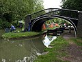
Culham Lock is a lock on the River Thames in England close to Culham, Oxfordshire. It is on a lock cut to the north of the main stream, which approaches the large village of Sutton Courtenay. The lock was built of stone by the Thames Navigation Commission in 1809.

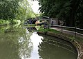
Osney Lock is a lock on the River Thames in Oxford, England, where the village or island of Osney is next to the river.

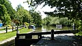
Godstow Lock is a lock on the River Thames in Oxfordshire, England. It is between the villages of Wolvercote and Wytham on the outskirts of Oxford. The first lock was built of stone by Daniel Harris for the Thames Navigation Commission in 1790. It is the lock furthest upstream on the river which has mechanical (electro-hydraulic) operation - every lock upstream of Godstow utilises manual beam operation instead.

The Lea Valley Walk is a 50-mile (80 km) long-distance path located between Leagrave, the source of the River Lea near Luton, and the Thames, at Limehouse Basin, Limehouse, east London. From its source much of the walk is rural. At Hertford the path follows the towpath of the River Lee Navigation, and it becomes increasingly urbanised as it approaches London. The walk was opened in 1993 and is waymarked throughout using a swan logo.
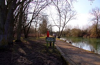
Fiddler's Island is an island in the River Thames at Oxford in England. It is situated south of Port Meadow on the reach above Osney Lock.

Castle Mill Stream is a backwater of the River Thames in the west of Oxford, England. It is 5.5 km long.

Medley Footbridge is a pedestrian bridge across the River Thames near the village of Binsey in Oxford, England. It is also known as Rainbow Bridge, although there is another bridge of that name in the University Parks in Oxford.
Daniel Harris was an English builder, prison governor, civil engineer, and architect prominent in Oxford.
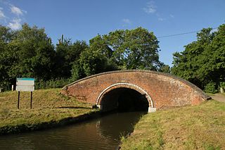
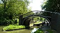
Duke's Cut is a short waterway in Oxfordshire, England, which connects the Oxford Canal with the River Thames via the Wolvercote Mill Stream. It is named after George Spencer, 4th Duke of Marlborough, across whose land the waterway was cut. It is seen as a branch of the Oxford Canal.

The River Sow Navigation was a short river navigation in Staffordshire, England, which connected the Staffordshire and Worcestershire Canal to the centre of Stafford. There was a coal wharf in Stafford, and a single lock to connect it to the canal. It opened in 1816, and closed in the 1920s. There are proposals to restore the navigation as the Stafford Riverway Link.

Sheepwash Channel connects the River Thames to the west and the Castle Mill Stream next to the Oxford Canal to the east, in west Oxford, England. To the north are Cripley Meadow and Fiddler's Island. To the south are Osney Island and the Botley Road.
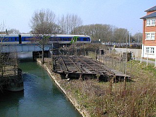
Rewley Road Swing Bridge is a disused railway swing bridge over Sheepwash Channel in west Oxford, England. To the north are Cripley Meadow and Fiddler's Island and to the south are Osney Island and the Botley Road.
Sheepwash Channel Railway Bridge is a railway bridge over Sheepwash Channel in west Oxford, England, just north of Oxford railway station. To the north are Cripley Meadow and Fiddler's Island. To the south are Osney Island and the Botley Road.