Isla Blanca (Santa)

Last updated
Blanca Island
Isla Blanca  (Spanish)
Isla Blanca (Chimbote).jpg
Blanca Island
Peru location map.svg
Red pog.svg
Blanca Island
Geography
Location Pacific Ocean
Coordinates 9°6′18.0″S78°37′18.0″W / 9.105000°S 78.621667°W / -9.105000; -78.621667 Coordinates: 9°6′18.0″S78°37′18.0″W / 9.105000°S 78.621667°W / -9.105000; -78.621667
Administration
Flag of Peru.svg  Peru
Region Ancash
Province Santa
Additional information
Time zone

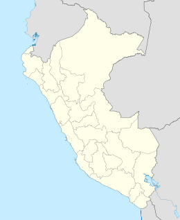
Isla Blanca [1] or Blanca Island [2] is a volcanic island located at the mouth of Chimbote Bay, near Chimbote, Peru. Administratively it is in Chimbote District, Santa Province, Ancash Region. The island is approximately 3200 m long and 920 m wide. It rises to an altitude of 204 m. Its relief is very rough and rocky. The contours are very steep, especially on the west side of the island. The island is white in appearance due to the deposition of guano by seabirds.
Reserve

This island is an ecological and tourist reserve formed by mountains largely devoid of vegetation. It is the largest of the islands in El Ferrol Bay (Chimbote Bay) and is located northwest of the city of Chimbote, about 5 km from the coast. It preserves a guano island, the lítico forest, the fauna of the island, coves, and defiles.

The island has no human population. It serves as a refuge to some guaneras birds such as pelicans and gulls. When taking refuge these guaneras birds in this place the birds carry ticks. There are also small lizards on the island that feed on the ticks. Sea lions can be found in the surroundings of the island. The island's beaches are home to different types of shells and small animals, such as seashells, clams, mussels, crabs and snails. [3]

Related Research Articles

Baker Island Uninhabited Pacific atoll

Baker Island is an uninhabited atoll located just north of the equator in the central Pacific Ocean about 3,090 km (1,920 mi) southwest of Honolulu. The island lies almost halfway between Hawaii and Australia. Its nearest neighbor is Howland Island, 42 mi (68 km) to the north-northwest; both have been claimed as territories of the United States since 1857, though the United Kingdom considered them part of the British Empire between 1897 and 1936.

Howland Island United States Minor Outlying Islands

Howland Island is an uninhabited coral island located just north of the equator in the central Pacific Ocean, about 1,700 nautical miles (3,100 km) southwest of Honolulu. The island lies almost halfway between Hawaii and Australia and is an unincorporated, unorganized territory of the United States. Together with Baker Island it forms part of the Phoenix Islands. For statistical purposes, Howland is grouped as one of the United States Minor Outlying Islands. The island has an elongated banana-shape on a north–south axis, 1.40 by 0.55 nautical miles, and covers 2.6 square kilometres.

Jarvis Island Coral island located in the South Pacific Ocean

Jarvis Island is an uninhabited 1 34-square-mile (4.5 km2) coral island located in the South Pacific Ocean, about halfway between Hawaii and the Cook Islands. It is an unincorporated, unorganized territory of the United States, administered by the United States Fish and Wildlife Service of the United States Department of the Interior as part of the National Wildlife Refuge system. Unlike most coral atolls, the lagoon on Jarvis is wholly dry.

Navassa Island Island in the Caribbean

Navassa Island is a small uninhabited island in the Caribbean Sea. Located northeast of Jamaica, south of Cuba, 40 nautical miles west of Jérémie on the south west peninsula of Haiti, the island is subject to an ongoing territorial dispute between Haiti and the United States, which administers the island through the U.S. Fish and Wildlife Service. The U.S. has claimed the island since 1857, based on the Guano Islands Act of 1856. Haiti's claim over Navassa goes back to the Treaty of Ryswick in 1697 that established French possessions in mainland Hispaniola, that were transferred from Spain by the treaty. As well as the western half of the main island and certain other specifically named nearby islands, Haiti's 1801 constitution also claimed "other adjacent islands", though Navassa was not mentioned by name. Since its 1874 Constitution, and after the establishment of the 1857 U.S. claim, Haiti has explicitly named "la Navase" as one of the territories it claims. Médéric Louis Élie Moreau de Saint-Méry, best known for his publications on Saint-Domingue, referred to la Navasse as the "small French island of Saint-Domingue" in 1798.

Chimbote Place in Ancash, Peru

Chimbote[tʃimˈbote](listen); Quechua: Chimputi) is the largest city in the Ancash Region of Peru, and the capital of both Santa Province and Chimbote District.

Department of Ancash Departments of Peru

Ancash is a department of northern Peru. It is bordered by the departments of La Libertad on the north, Huánuco and Pasco on the east, Lima on the south, and the Pacific Ocean on the west. Its capital is the city of Huaraz, and its largest city and port is Chimbote. The name of the region originates from the Quechua word anqash, from anqas (blue) or from anka (eagle).

Anambas Islands Regency Regency in Riau Islands, Indonesia

Anambas Islands Regency is a small archipelago of Indonesia, located 150 nautical miles northeast of Batam Island in the North Natuna Sea between the Malaysian mainland to the west and the island of Borneo to the east. Geographically part of the Tudjuh Archipelago, it is administratively a regency within the Riau Islands Province. It covers a land area of 590.2 km2 and had a population of 37,411 at the 2010 Census. The administrative centre is at Tarempa on Siantan Island.

Swan Islands, Honduras Island group of Honduras

The Swan Islands, or Islas Santanilla or Islas del Cisne, initially named Islas de las Pozas by Christopher Columbus in 1502, is a chain of three islands located in the northwestern Caribbean Sea, approximately 153 kilometres (95 mi) off the coastline of Honduras, with a land area of 3.1 square kilometres.

Isla Iguana Wildlife Refuge island in Panama

The Isla Iguana Wildlife Refuge is a 58-hectare wildlife reserve located 5 kilometers off the Los Santos Province on the Azuero Peninsula in Panama.

Passage Key National Wildlife Refuge

The Passage Key National Wildlife Refuge is part of the United States National Wildlife Refuge (NWR) System, located offshore from St. Petersburg. The 64-acre (0.26 km2) refuge was established in 1905 by President Theodore Roosevelt to preserve nesting colonies of native seabirds and wading birds. The Passage Key Wilderness Area is part of the refuge, and consists of 36.37 acres (0.1472 km2) of its total area. It was established in 1970, to protect native birds and serve as a breeding ground for them.

Buck Island National Wildlife Refuge

Buck Island National Wildlife Refuge is located about 2 miles (4 km) south of the island of St. Thomas in the Virgin Islands of the United States. There are actually two "Buck Islands." The National Wildlife Refuge occupies the one near St. Thomas. The one just north of St. Croix is the centerpiece of Buck Island Reef National Monument. Adjacent to the refuge is Capella Island, about half the size of Buck, owned by the territorial government.

Ilhéu Grande island

Ilhéu Grande is an uninhabited island of Cape Verde. It is the largest of the Ilhéus do Rombo islet group, located 4 km (2 mi) west of Ilhéu de Cima, the other main islet of the group, and 7 km (4 mi) north of the island Brava. Its length is 2.3 km (1.4 mi) from southwest to northeast and the width is approximately 1.1 km (0.7 mi) from southeast to northwest. It is 96 m high. The islet forms a part of the integral nature reserve Ilhéus do Rombo.

Kadan Kyun island in Myanmar

Kadan Kyun is the largest island in the Mergui Archipelago, Myanmar. Its area is 450 km². The highest point is French Bay Peak, which is the highest point in the archipelago.

Badas Islands is a group of islands in the Tudjuh Archipelago in the South China Sea between the Malaysian mainland to the west and the island of Borneo to the east. Administratively it is part of Bintan Regency within the Riau Islands province of Indonesia.

Cacongo Town in Cabinda, Angola

Cacongo is a town, with a population of 15,000 (2014), in Cacongo municipality, Cabinda Province, in Angola. The former Lândana municipality is now known as Cacongo, and the town is sometimes still known as Lândana. It is located on Lândana Bay about a kilometer south of the mouth of the Chiloango River.

Karabiga Town in Marmara, Turkey

Karabiga (Karabuga) is a town in Biga District, Çanakkale Province, in the Marmara region of Turkey. It is located at the mouth of the Biga River, on a small east-facing bay, known as Karabiga Bay. Its ancient name was Priapus or Priapos.

Ardley Island island in Antarctica

Ardley Island is an island 1.9 kilometres (1 nmi) long, lying in Maxwell Bay close off the south-west end of King George Island, in the South Shetland Islands of Antarctica. It was charted as a peninsula in 1935 by Discovery Investigations personnel of the Discovery II and named for Lieutenant R.A.B. Ardley, Royal Naval Reserve, an officer on the ship in 1929–31 and 1931–33. Aerial photography has since shown that the feature is an island with Braillard Point being the headland forming the northeast end of Ardley Island. It has been designated an Antarctic Specially Protected Area because of the importance of its seabird colonies.

Sabi Island island in Myanmar

Sabi Island is an island in the Mergui Archipelago of Taninthayi Region, Burma (Myanmar). It lies between Money Island to the south and Parker Island to the north. The narrow channel between Sabi island and Money Island is rather shallow, but the half-mile wide channel between Sabi Island and Parker Island is quite deep. The island is heavily forested and has small bays with sandy beaches on the west side. The highest point is 326 m above the sea. Whaleback Reef, which lies about three-quarters of mile off the northeast part of the island, is exposed about 8 ft. at low tide.

Isla Bermejo is an island that is part of the eastern coast of Argentina, forming part of a row of islands that stand at the entrance of the ria of Bahía Blanca near the city of Bahía Blanca.

Punta Lava Lighthouse Lighthouse on La Palma, Spain

Punta Lava Lighthouse is an active 20th century Spanish lighthouse on the Canary island of La Palma. It is located in the municipality of Tazacorte, near the village of La Bombilla on the western side of the island. The larger settlement of Puerto Naos lies 2 kilometres to the south-west.

References

  1. Isla Blanca (Approved) at GEOnet Names Server, United States National Geospatial-Intelligence Agency
  2. United States National Geospatial-Intelligence Agency
  3. "Isla Blanca". My Chimbote. Retrieved 27 November 2012.