Related Research Articles

Montana is a state in the Mountain West division of the Western United States. It is bordered by Idaho to the west, North Dakota and South Dakota to the east, Wyoming to the south, and the Canadian provinces of Alberta, British Columbia, and Saskatchewan to the north. It is the fourth-largest state by area, the eighth-least populous state, and the third-least densely populated state. Its state capital is Helena, while the largest city is Billings. The western half of Montana contains numerous mountain ranges, while the eastern half is characterized by western prairie terrain and badlands, with smaller mountain ranges found throughout the state. The state has a reputation for a libertarian bent in popular opinion and policy.

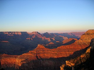
The Rocky Mountains, also known as the Rockies, are a major mountain range and the largest mountain system in North America. The Rocky Mountains stretch 3,000 miles in straight-line distance from the northernmost part of western Canada, to New Mexico in the southwestern United States. Depending on differing definitions between Canada and the U.S., its northern terminus is located either in northern British Columbia's Terminal Range south of the Liard River and east of the Trench, or in the northeastern foothills of the Brooks Range/British Mountains that face the Beaufort Sea coasts between the Canning River and the Firth River across the Alaska-Yukon border. Its southernmost point is near the Albuquerque area adjacent to the Rio Grande rift and north of the Sandia–Manzano Mountain Range. Being the easternmost portion of the North American Cordillera, the Rockies are distinct from the tectonically younger Cascade Range and Sierra Nevada, which both lie farther to its west.
The Western United States is the region comprising the westernmost U.S. states. As American settlement in the U.S. expanded westward, the meaning of the term the West changed. Before around 1800, the crest of the Appalachian Mountains was seen as the western frontier. The frontier moved westward and eventually the lands west of the Mississippi River were considered the West.

Glacier National Park is an American national park located in northwestern Montana, on the Canada–United States border, adjacent to the Canadian provinces of Alberta and British Columbia. The park encompasses more than 1 million acres (4,000 km2) and includes parts of two mountain ranges, more than 130 named lakes, more than 1,000 different species of plants, and hundreds of species of animals. This vast pristine ecosystem is the centerpiece of what has been referred to as the "Crown of the Continent Ecosystem," a region of protected land encompassing 16,000 square miles (41,000 km2).

Marmots are large ground squirrels in the genus Marmota, with 15 species living in Asia, Europe, and North America. These herbivores are active during the summer, when they can often be found in groups, but are not seen during the winter, when they hibernate underground. They are the heaviest members of the squirrel family.
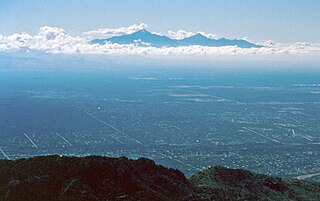
Sky islands are isolated mountains surrounded by radically different lowland environments. The term originally referred to those found on the Mexican Plateau, and has extended to similarly isolated high-elevation forests. The isolation has significant implications for these natural habitats. The American Southwest region began warming up between c. 20,000 and 10,000 years BP and atmospheric temperatures increased substantially, resulting in the formation of vast deserts that isolated the sky islands. Endemism, altitudinal migration, and relict populations are some of the natural phenomena to be found on sky islands.

Gannett Peak is the highest mountain peak in the U.S. state of Wyoming at 13,810 feet (4,210 m). It lies in the Wind River Range within the Bridger Wilderness of the Bridger-Teton National Forest. Straddling the Continental Divide along the boundary between Fremont and Sublette counties, it has the second greatest topographic prominence in the state (7076') after Cloud Peak (7077'), and is the highest ground for 290.36 miles in any direction.

The Bears Paw Mountains are an insular-montane island range in the Central Montana Alkalic Province in north-central Montana, United States, located approximately 10 miles south of Havre, Montana. Baldy Mountain, which rises 6,916 feet (2,108 m) above sea level, is the highest peak in the range. The Bears Paw Mountains extend in a 45-mile arc between the Missouri River and Rocky Boy Indian Reservation south of Havre.

Nothofagus menziesii, commonly known as silver beech, is a tree of the southern beech family endemic to New Zealand. Its common name probably comes from the fact that its bark is whitish in colour, particularly in younger specimens. It is found from Thames southwards in the North Island, and throughout the South Island. Silver beech is a forest tree up to 30 m tall. The trunk, which is often buttressed, may be up to 2 m in diameter. The leaves are small, thick and almost round in shape, 6 to 15 mm long and 5 to 15 mm wide with rounded teeth which usually occur in pairs, 1 or 2 hair fringed domatia are found on the underside of each leaf. Its Māori name is tawhai. It grows from low altitudes to the mountains. Nothofagus menziesii was proposed to be renamed Lophozonia menziesii in 2013.

Montana is one of the eight Mountain States, located in the north of the region known as the Western United States. It borders North Dakota and South Dakota to the east. Wyoming is to the south, Idaho is to the west and southwest, and the Canadian provinces of British Columbia, Alberta, and Saskatchewan are to the north, making it the only state to border three Canadian provinces.

Greece is a country of the Balkans, in Southeastern Europe, bordered to the north by Albania, North Macedonia and Bulgaria; to the east by Turkey, and is surrounded to the east by the Aegean Sea, to the south by the Cretan and the Libyan seas, and to the west by the Ionian Sea which separates Greece from Italy.

A bornhardt is a dome-shaped, steep-sided, bald rock outcropping at least 30 metres (100 ft) in height and several hundred metres in width. They are named after Wilhelm Bornhardt (1864–1946), a German geologist and explorer of German East Africa, who first described the feature.

The Big Snowy Mountains are a small mountain range south of Lewistown in Fergus County, Montana. Considerably east of and isolated from the main crest of the Northern Rockies, they are one of the few points of significant elevation in the immediate area and are considered one of Montana's island ranges. The range's highest elevation is 8,681 feet (2,646 m). The smaller Little Snowy Mountains are a contiguous range immediately to the east.

The Sweet Grass Hills are a small group of low mountains rising more than 3,000 feet (910 m) above the surrounding plains southwest of Whitlash, Montana, in Liberty and Toole County, Montana. The tallest point in the hills is West Butte at 6,983 feet (2,128 m). Quite prominent in the local area, they are clearly visible from US Highway 2 to the south, I-15, and can sometimes be seen as far North as the Crowsnest Highway (Highway 3) near Medicine Hat in Alberta as well as from the West, near Glacier National Park and Browning, Montana. Other named peaks in the small group are Gold Butte (6,512 ft [1,985 m]), East Butte, and Mount Lebanon (5,807 ft [1,770 m]). The Sweet Grass Hills are an example of the island ranges that dot the central third portion of the state of Montana. These island ranges, completely surrounded by the 'sea' of plains and not geographically part of the Rocky Mountains to the west, are "biological hotspots", containing more species than the prairie below.

Moccasin is an unincorporated community in Judith Basin County, Montana, United States. The community was named for the nearby Moccasin mountain range. Moccasin has a post office with the ZIP code 59462.

The ecology of the Rocky Mountains is diverse due to the effects of a variety of environmental factors. The Rocky Mountains are the major mountain range in western North America, running from the far north of British Columbia in Canada to New Mexico in the southwestern United States, climbing from the Great Plains at or below 1,800 feet (550 m) to peaks of over 14,000 feet (4,300 m). Temperature and rainfall varies greatly also and thus the Rockies are home to a mixture of habitats including the alpine, subalpine and boreal habitats of the Northern Rocky Mountains in British Columbia and Alberta, the coniferous forests of Montana and Idaho, the wetlands and prairie where the Rockies meet the plains, a different mix of conifers on the Yellowstone Plateau in Wyoming and in the high Rockies of Colorado and New Mexico, and finally the alpine tundra of the highest elevations.

The Mountain states form one of the nine geographic divisions of the United States that are officially recognized by the United States Census Bureau. It is a subregion of the Western United States.
References
- ↑ ""Island Range". Montana Wilderness Association. Web site. Accessed April 13, 2010". Archived from the original on October 8, 2010. Retrieved April 14, 2010.
| | This article about geography terminology is a stub. You can help Wikipedia by expanding it. |