
Issaquah is a city in King County, Washington, United States. The population was 40,051 at the 2020 census. Located in a valley and bisected by Interstate 90, the city is bordered by the Sammamish Plateau to the north and the "Issaquah Alps" to the south. It is home to the headquarters of the multinational retail company Costco Wholesale Corporation. Issaquah is included in the Seattle metropolitan area.

Lake Sammamish is a freshwater lake 8 miles (13 km) east of Seattle in King County, Washington, United States. The lake is 7 miles (11 km) long and 1.5 miles (2 km) wide, with a maximum depth of 105 feet (32 m) and a surface area of 8 sq mi (21 km2). It lies east of Lake Washington and west of the Sammamish Plateau, and stretches from Issaquah in the south to Redmond in the north. At Issaquah it is fed by Issaquah Creek, and at Redmond it drains to Lake Washington via the Sammamish River, named after the native people who once lived along its entire length.

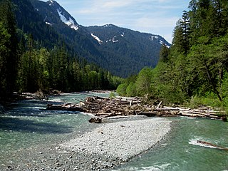
The Cowlitz River is a river in the state of Washington in the United States, a tributary of the Columbia River. Its tributaries drain a large region including the slopes of Mount Rainier, Mount Adams, and Mount St. Helens.

The Hiram M. Chittenden Locks, or Ballard Locks, is a complex of locks at the west end of Salmon Bay in Seattle, Washington's Lake Washington Ship Canal, between the neighborhoods of Ballard to the north and Magnolia to the south.

The Sammamish River flows through north King County, Washington for about 14 miles (23 km), draining Lake Sammamish into Lake Washington. Along its course, the Sammamish River flows through Redmond, Woodinville, Bothell, and Kenmore.

The White River is a white, glacial river in the U.S. state of Washington. It flows about 75 miles (121 km) from its source, the Emmons Glacier on Mount Rainier, to join the Puyallup River at Sumner. It defines part of the boundary between King and Pierce counties.

Coal Creek is a creek in Bellevue, Washington, United States, on Seattle's Eastside. It is named for the coal mining industry prominent in the area in the 19th century. There is a popular trail which parallels the creek, allowing views of defunct coal mining equipment and even some bits of coal sitting on the ground in spots.

Lake Oroville is a reservoir formed by the Oroville Dam impounding the Feather River, located in Butte County, northern California. The lake is situated 5 miles (8 km) northeast of the city of Oroville, within the Lake Oroville State Recreation Area, in the western foothills of the Sierra Nevada. Known as the second-largest reservoir in California, Lake Oroville is treated as a keystone facility within the California State Water Project by storing water, providing flood control, recreation, freshwater releases to assist in controlling the salinity intrusion into the Sacramento-San Joaquin Delta and protecting fish and wildlife.

Oncorhynchus is a genus of ray-finned fish in the subfamily Salmoninae of the family Salmonidae, native to coldwater tributaries of the North Pacific basin. The genus contains twelve extant species, namely six species of Pacific salmon and six species of Pacific trout, all of which are migratory mid-level predatory fish that display natal homing and semelparity.
Puget Sound salmon recovery is a collective effort of federal, state and local authorities and non-profit coalitions of universities, scientists, business and industry aimed at restoring Pacific salmon and anadromous forms of Pacific trout (Oncorhynchus) within the Puget Sound region. The Puget Sound lies within the native range of the Pacific Salmon (Oncorhynchus) and two sea-run forms of Pacific trout, the coastal rainbow trout or steelhead and coastal cutthroat trout. Populations of Oncorhynchus have seen significant declines since the middle of the 19th century due to over fishing, habitat loss, pollution and disease. Salmon species residing in or migrating through the Puget Sound to spawning streams include Chum, Coho, Chinook, Sockeye, and Pink salmon. Pacific salmon require freshwater rivers for spawning and most major tributaries of the Puget Sound have salmon, steelhead and cutthroat trout spawning runs.
Cougar Mountain Regional Wildland Park is a regional park in King County, Washington, near the towns of Bellevue and Issaquah. The park was established in June 1983 to protect the central core of Cougar Mountain, the park covers 3,115 acres (12.61 km2) with 38 miles (61 km) of hiking trails and 12 miles (19 km) of equestrian trails.

Squak Mountain is the second most westerly mountain of the Issaquah Alps mountain chain in Washington state. It is situated between Cougar Mountain to the west and Tiger Mountain to the east. Interstate 90 parallels the base of the north side of the mountain. Much of the Squak Mountain watershed drains into Lake Sammamish. Most of the mountain is protected by Squak Mountain State Park and the Cougar/Squak and Squak/Tiger Corridors of King County.
The Baker River is an approximately 30-mile (48 km), southward-flowing tributary of the Skagit River in northwestern Washington in the United States. It drains an area of the high North Cascades in the watershed of Puget Sound north of Seattle, and east of Mount Baker. With a watershed of approximately 270 square miles (700 km2) in a complex of deep valleys partially inside North Cascades National Park, it is the last major tributary of the Skagit before the larger river reaches its mouth on Skagit Bay. The river flows through Concrete, Washington, near its mouth and has two hydroelectric dams owned by Puget Sound Energy.

The Samish River is approximately 25 miles (40 km) long, in northwestern Washington in the United States. The river drains an area of 139 square miles (360 km2) between the Skagit River basin on the south and the Nooksack River basin on the north. The Samish River originates on a low divide in Whatcom County, and its tributary, Friday Creek, originates in the hills south of Bellingham. The river continues its southwesterly flow through Skagit County and outlets into Samish Bay in Puget Sound.

The Sol Duc River is a river in the U.S. state of Washington. About 78 miles (126 km) long, it flows west through the northwest part of the Olympic Peninsula, from the Olympic Mountains of Olympic National Park and Olympic National Forest, then through the broad Sol Duc Valley. Near the Pacific Ocean the Sol Duc River joins the Bogachiel River, forming the Quillayute River, which flows about 4 miles (6.4 km) to the Pacific Ocean at La Push. Although the Quillayute River is short, its large tributary rivers—the Sol Duc, Bogachiel, Calawah, and Dickey Rivers—drain the largest watershed of the northern Olympic Peninsula, 629 square miles (1,630 km2). The Sol Duc's watershed is the largest of the Quillayute's tributaries, at 219 square miles (570 km2).
The Sanpoil River is a tributary of the Columbia River, in the U.S. state of Washington. The river is named for the Sanpoil, the Interior Salish people who live along the river course. The name is from the Okanagan term [snpʕʷílx], meaning "people of the gray country", or "gray as far as one can see".
The Mashel River is a river in Pierce County, in the U.S. state of Washington. It is a tributary of the Nisqually River, which it enters about 3.6 miles (5.8 km) southwest of Eatonville, at Nisqually river mile 39.6.
The Tye River is a river in the U.S. state of Washington. It rises near Stevens Pass in the Cascade Mountains and flows west, joining the Foss River to form the South Fork Skykomish River. Its waters eventually empty into Puget Sound near Everett via the Skykomish River and Snohomish River. U.S. Route 2 follows the river's entire length. A BNSF Railway line follows most of the river except near the pass where the tracks use the Cascade Tunnel. Powerlines run by the Bonneville Power Administration (BPA) follow the Tye River west of Tunnel Creek.

The Beckler River is a tributary of the South Fork Skykomish River in the U.S. state of Washington in the United States.

Lake Bellevue, also called Lake Sturtevant, is a small lake inside the city limits of Bellevue, Washington. Along with Phantom Lake and Larsen Lake, it is one of three small lakes inside the city, which also borders Lake Washington and Lake Sammamish. Sturtevant Creek, a tributary of Kelsey Creek, has its origin at Lake Bellevue and contains Chinook, Sockeye and Coho salmon. In the 773-acre (313 ha) creek basin, 71% of the land has an impervious surface.


