Choithar (Rithar) is a village located east of Ukhrul in Ukhrul district, Manipur state, India. The village is 12 kilometers from Ukhrul. National Highway 150 Imphal-Kohima via Jessami partially connects the village. The village is about 6 kilometers from the National highway connected earlier by an old British road. There was a proposal to construct a new road under PMGSY for which there were reports of discrepancies on the part of the executing agencies. Choithar is flanked by Ukhrul in the west, Choithar in the north, Nungshong in the south and Khangkhui in the east.
Nungshong Khullen is located south of Ukhrul in Ukhrul district, Manipur state, India. The village is about 30 kilometers from Ukhrul via the state highway that connects Ukhrul-Kamjong via Shangshak. The shorter un-metalled road from Ukhrul to Nungshong khullen is about 15 kilometers. Construction of a new road under PMGSY to connect the neighboring villages with Ukhrul is underway for which there were reports of irregularities on the part of the executing agencies. Nungshong is flanked by Hungpung in the west, Shangching in the south, Choithar and Khangkhui in the north. Locally, the residents speak Nungshong dialect which belongs to the Tibeto-Burman language family.

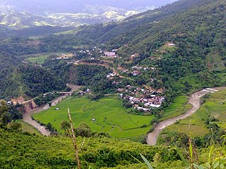
Shangshak is a generic reference to two villages viz. Shangshak Khullen and Shangshak Khunou located south of Ukhrul in Ukhrul district, Manipur state, India. The village is about 15 kilometers from Ukhrul via National Highway 150 and the state highway that connects Ukhrul-Kamjong via Shangshak. Shangshak is flanked by Hungpung in the north, Koso in the south, Ramva in the west and Gamnom and Yengtem in the east. The Battle of Shangshak fought for two weeks from 21 to 26 March 1944 is considered one of the bloodiest battles of the Second World War. Locally, the residents speak Shangshak dialect which belongs to the Tibeto-Burman language family.
Tashar, also known as Tushar or Tushen, is a generic reference to two villages viz. Tashar and Tashar Chanhong located south-west of Ukhrul in Ukhrul district, Manipur state, India. The village is about 18 kilometers from Ukhrul via National Highway that connects Imphal and Kohima via Ukhrul and Jessami. Tashar is flanked by Pharung in the north, Ramva in the south, Shangshak in the east and Sirarakhong in the West. The village is divided into two major parts, Tashar main and Tashar Chanhong. Locally, the inhabitants speak Tashar tui which belongs to the Tibeto-Burman language family.
Hatha is a small Village located south-west of Ukhrul in Ukhrul district, Manipur state, India. The village is about 20 kilometers from Ukhrul via National Highway 150 that connects Imphal and Kohima via Ukhrul and Jessami. Hatha is flanked by Hungpung in the north, Ramva in the south, Shangshak in the east and Tashar in the West. Locally, the inhabitants speak Hatha tui which belongs to the Tibeto-Burman language family.
Lungpha is a village located south of Ukhrul in Ukhrul district, Manipur state, India. The village is about 15 kilometers from Ukhrul via National Highway 150 that connects Imphal and Kohima via Ukhrul and Jessami. Lungpha is flanked by Ramva in the north, Tungou in the west, Litan in the south and Shangshak in the east. Locally, the inhabitants speak Lungpha tui which belongs to the Tibeto-Burman language family.
Shingkap is a village located south of Ukhrul in Ukhrul district, Manipur state, India. The village is about 35 kilometers from Ukhrul via National Highway 150 that connects Imphal and Kohima via Ukhrul and Jessami. Shingkap is flanked by Lungpha in the north, Riha in the west, Tangkhul Hundung in the south and Alang in the east. Locally, the inhabitants speak Shingkap tui which belongs to the Tibeto-Burman language family.
Tungou also misnomerly referred to as Ringui is a village located south of Ukhrul in Ukhrul district, Manipur state, India. The village is about 35 kilometers from Ukhrul via National Highway 150 that connects Imphal and Kohima via Ukhrul and Jessami. Tungou is flanked by Ramva in the east, Tashar in the north, Sinakeithei in the west and Lungpha in the south. Locally, the inhabitants speak Tungou tui which belongs to the Tibeto-Burman language family.
Ringui Ramhon is a small village located west of Ukhrul in Ukhrul district, Manipur state, India. The village is about 35 kilometers from Ukhrul partially connected by National Highway 150 that connects Imphal and Kohima via Ukhrul and Jessami. Ringui Ramhon is flanked by Ramva in the east, Tashar in the north, Sinakeithei in the west and Lungpha in the south. Locally, the inhabitants speak Ringui tui which belongs to the Tibeto-Burman language family.
Sarkaphung, also called Shikiphung or Sikiphung, is a village south of Ukhrul in Ukhrul district, Manipur state, India. The village is about 45 kilometers (28 mi) from Ukhrul and about 35 kilometers (22 mi) from Imphal. The village is partially connected by National Highway 150, which connects Imphal and Kohima via Ukhrul and Jessami. The village is flanked by Litan in the north, Thoyee in the south, Sinakeithei in the west, and Marao Shingkap in the east. The inhabitants speak Sarkaphung Tui, which belongs to the Tibeto-Burman language family.
Tangkhul Hundung is a village south of Ukhrul in Ukhrul district, Manipur, India. The village is about 65 kilometres (40 mi) from Ukhrul and about 45 kilometres (28 mi) from Imphal and is partially connected by National Highway 150 that connects Imphal and Kohima via Ukhrul and Jessami. Tangkhul Hundung is divided into two major parts, Tangkhul Hundung Khullen and Tangkhul Hundung Khunou. The village is flanked by Thoyee in the west, Shingkap in the north, Itham in the south and Alang in the east. Locally, the inhabitants speak Tangkhul Hundung tui, which belongs to the Tibeto-Burman language family.
Hungpung also called as Hundung is a village located south in Ukhrul district, Manipur state, India. The village falls under Ukhrul sub division. HAO (Animism) religion was strictly practiced in the kingdom of "KHAYAIWUNG" i,e Kingdom of Hungpung Haokok.
Pharung also called as Shimtang is a village located west of Ukhrul in Ukhrul district, Manipur state, India. The village falls under Ukhrul sub division. Pharung borders with Hunphun (Ukhrul) village and Hungpung. The village is connected by the old National highway road route. Pharung is flanked by Ukhrul in the east, Seikhor in the west, Tashar in the south and Ngainga in the north. Locally the inhabitants speak Pharung tou which belongs to the Tibeto-Burman language family.
Seikhor is a village located west of Ukhrul in Ukhrul district, Manipur state, India. The village falls under Ukhrul sub division. Seikhor is partially connected by the old Imphal-Ukhrul road and is about 18 kilometers from Ukhrul. Seikhor is flanked by Pharung in the east, Teinem in the west, Tashar in the south and Ngainga in the north. Locally, the inhabitants speak Seikhor dialect that belongs to the Tibeto-Burman language family.
Lamlang also popularly referred as Lamlang Gate is a village located west of Ukhrul in Ukhrul district, Manipur state, India. The village falls under Ukhrul sub division. The old Imphal-Ukhrul road passes through the village and is about 19 kilometers from Ukhrul. Lamlang is flanked by Seikhor in the north, Pharung in the east, Tashar in the south and Sirarakhong in the west. Locally, the inhabitants speak Lamlang dialect that belongs to the Tibeto-Burman language family.
Ashang Khullen is a Tangkhul village in Ukhrul district, Manipur state, India. The village falls under the Ukhrul-South sub division. The village is connected by National Highway 102 that connects Shangshak and Yairipok. Ashang Khullen is flanked by Chongdan Village in the west, Nambashi in the south, Punge and Sorde in the east and Kangoi in the north. Locally, the inhabitants speak Ashang Khullen dialect that belongs to the Tibeto-Burman language family.
Chongdan is a Tangkhul village in Kamjong District, Manipur state, India. The villages fall under Kasom sub division. The village is connected by National Highway 102 that connects Shangshak-Yairipok. Chongdan is flanked by Bongbal Khullen in the west, Leihaoram in the south, Ashang Khullen in the east and Itham in the north. Locally, the inhabitants speak Chongdan dialect that belongs to the Tibeto-Burman language family.
Nongdam is a village in Imphal East district, Manipur state, India. The village falls under Sowombung sub division. The village is partially connected by National Highway 202 that connects Jessami and Imphal. Nongdam is flanked by Leishiphung in the west, Itham in the south, Chadong in the east and Riha in the north. (Provide info in detailed manner) (Stop biased proclaims)
Riha is a Tangkhul village in Kamjong district, Manipur state, India. The village falls under Phungyar sub division. The village is partially connected by National Highway 150 that connects Jessami and Imphal. Riha is flanked by Thoyee in the North, Nongdam in the South, Yaingangpokpi in the west and Shingkap in the east. Locally, the inhabitants speak tangkhul dialect that belongs to the Tibeto-Burman language family.
Chadong refers to a Tangkhul village in Kamjong district, Manipur state, India. The village falls under Phungyar sub division. The village is partially connected by National Highway 150 that connects Jessami and Imphal. Chadong is flanked by Riha in the North, Nongdam in the South, Yaingangpokpi in the west and Shingkap in the east. Locally, the inhabitants speak Chadong dialect that belongs to the Tibeto-Burman language family.

