
Ivory Coast is a sub-Saharan nation in southern West Africa located at 8° N, 5° W. The country is approximately square in shape.

Guinea is a country on the coast of West Africa and is bordered by Guinea-Bissau, Senegal, Mali, Ivory Coast, Liberia, and Sierra Leone.
Liberia is a sub-Saharan nation in West Africa located at 6 °N, 9 °W.

Ivory Coast, also known as Côte d'Ivoire and officially the Republic of Côte d'Ivoire, is a country on the southern coast of West Africa. Its capital city of Yamoussoukro is located in the centre of the country, while its largest city and economic centre is the port city of Abidjan. It borders Guinea to the northwest, Liberia to the west, Mali to the northwest, Burkina Faso to the northeast, Ghana to the east, and the Atlantic Ocean's Gulf of Guinea to the south. With 30.9 million inhabitants in 2023, Ivory Coast is the third-most populous country in West Africa. Its official language is French, and indigenous languages are also widely used, including Bété, Baoulé, Dyula, Dan, Anyin, and Cebaara Senufo. In total, there are around 78 different languages spoken in Ivory Coast. The country has a religiously diverse population, including numerous followers of Islam, Christianity, and traditional faiths often entailing animism.

Maryland County is a county in the southeastern portion of Liberia. One of 15 counties that comprise the first-level of administrative division in the nation, it has two districts. Harper serves as the capital with the area of the county measuring 887 square miles (2,300 km2). As of the 2022 Census, it had a population of 172,202, making it the ninth most populous county in Liberia.

The Nzérékoré Region is a region in the southern part of Guinea. Its capital and largest city is Nzérékoré. It is one of the eight regions of Guinea. It is bordered by the countries of Sierra Leone, Liberia, and Ivory Coast, and the Guinean regions of Kankan and Faranah.
The following outline is provided as an overview of and topical guide to Ivory Coast:

The Benin–Togo border is 651 km in length and runs from the tripoint with Burkina Faso in the north down to the Bight of Benin in the south.
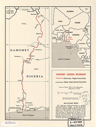
The Benin–Nigeria border is 809 km in length and runs from the tripoint with Niger in the north down to the Bight of Benin in the south.

The Guinea-Bissau–Senegal border is 341 km in length and runs from the Atlantic Ocean in the west to the tripoint with Guinea in the east.

The Guinea–Guinea-Bissau border is 421 km in length and runs from the Atlantic Ocean in the south-west to the tripoint with Senegal in the north-east.

The Guinea–Sierra Leone border is 794 km in length and runs from the Atlantic Ocean in the west to the tripoint with Liberia in the east.

The Liberia–Sierra Leone border is 299 km in length and runs from the tripoint with Guinea in the north-east to the Atlantic Ocean in the south-west.

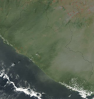
The Guinea–Liberia border is 590 km in length and runs from the tripoint with Sierra Leone in the west to the tripoint with the Ivory Coast in the east.
The Guinea–Mali border is 1,062 km in length and runs from the tripoint with Senegal in the north to the tripoint with Ivory Coast in the south.
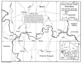
The Ivory Coast–Mali border is 599 km in length and runs from the tripoint with Guinea in the west to the tripoint with Burkina Faso in the east.
The Guinea–Ivory Coast border is 816 kilometres (507 mi) in length and runs from the tripoint with Mali in the north to the tripoint with Liberia in the south.

The Burkina Faso–Ivory Coast border is 545 km in length and runs from the tripoint with Mali in the west to the tripoint with Ghana in the east.

The Ghana–Ivory Coast border is 720 km in length and runs from the tripoint with Burkina Faso in the north to the Atlantic Ocean in the south.

The Ghana–Togo border is 1,098 km in length and runs from the tripoint with Burkina Faso in the north to the Atlantic Ocean in the south.

