
West Hills is an affluent residential community in the western San Fernando Valley region of the City of Los Angeles, California. The percentage of residents aged 35 and older is among the highest in Los Angeles County.

The Conejo Valley is a region spanning both southeastern Ventura County and northwestern Los Angeles County in Southern California, United States. It is located in the northwestern part of the Greater Los Angeles Area.

Sunkist Growers, Incorporated is an American citrus growers' non-stock membership cooperative composed of 6,000 members from California and Arizona headquartered in Valencia, California. Through 31 offices in the United States and Canada and four offices outside North America, its sales in 1991 totaled $956 million. It is the largest fresh produce shipper in the United States, the most diversified citrus processing and marketing operation in the world, and one of California's largest landowners.
La Conchita is a small unincorporated community in western Ventura County, California, on U.S. Route 101 just southeast of the Santa Barbara county line. The ZIP Code is 93001, and the community is inside area code 805.
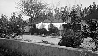
Rancho Camulos, now known as Rancho Camulos Museum, is a ranch located in the Santa Clara River Valley 2.2 miles (3.5 km) east of Piru, California and just north of the Santa Clara River, in Ventura County, California. It was the home of Ygnacio del Valle, a Californio alcalde of the Pueblo de Los Angeles in the 19th century and later elected member of the California State Assembly. The ranch was known as the Home of Ramona because it was widely believed to have been the setting of the popular 1884 novel Ramona by Helen Hunt Jackson. The novel helped to raise awareness about the Californio lifestyle and romanticized "the mission and rancho era of California history."

Somis is an unincorporated community in Ventura County, California. It was established in 1892 by Thomas Bard and D.T. Perkins on a portion of the Rancho Las Posas Mexican land grant. Somis is in the Las Posas Valley on the south bank of Fox Barranca, just west of Arroyo Las Posas. For statistical purposes, the United States Census Bureau has defined Somis as a census-designated place (CDP).

Saticoy is an unincorporated community in Ventura County, California, United States. The site of one of the largest settlements of the Chumash region, a settlement was laid out in 1887 along the railroad line that was being built from Los Angeles through the Santa Clara River Valley to the town of San Buenaventura. Although the town was 10 miles (16 km) distant at that time, the City of Ventura grew to a point where only a small residential and commercial community is left outside the city limits. For statistical purposes, the United States Census Bureau has defined that community as a census-designated place (CDP).
Bardsdale is a rural unincorporated community and populated place in Ventura County, California. It is located in the orange blossom and agricultural belt of the Santa Clara River Valley, south of the Santa Clara River and on the north slope of South Mountain. The closest town is Fillmore, which is on the north side of the Santa Clara about 3 miles (5 km) from Bardsdale. Santa Paula is about 7 miles (11 km) west, the most direct route being South Mountain Road. Moorpark is about 6 miles (10 km) south over the serpentine mountain road known as Grimes Canyon.

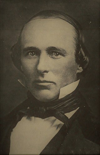
Don Adolfo Camarillo was a prominent Californio philanthropist, ranchero, and horse breeder, known for founding the city of Camarillo, California, along with his brother Juan Camarillo Jr. Camarillo also donated the land for Adolfo Camarillo High School. The horse breed Camarillo White Horse was named for Camarillo. He began breeding them in 1921 and the line continues today. Because of his philanthropy in 1950, Pope Pius XII named him a Knight of St. Gregory the Great.

Camarillo Ranch House, also known as Rancho Calleguas and Adolfo Camarillo House, is a Queen Anne-style Victorian house in Camarillo, California. Built in 1892, the 6,000-square-foot (560 m2) house was designed by architects Herman Anlauf and Franklin Ward. Adolfo Camarillo operated the ranch for 78 years, changing the operations from mostly cattle to crops. He was a leading innovator, growing lima beans, barley, corn, alfalfa, walnuts, and citrus and eucalyptus trees. The house was added to the National Register of Historic Places in 2003.

Rancho Rodeo de las Aguas was a 4,539-acre (18.37 km2) land grant in present day Beverly Hills, Los Angeles County, California given to María Rita Quinteros Valdez de Villa in 1838.
The history of the San Fernando Valley from its exploration by the 1769 Portola expedition to the annexation of much of it by the City of Los Angeles in 1915 is a story of booms and busts, as cattle ranching, sheep ranching, large-scale wheat farming, and fruit orchards flourished and faded. Throughout its history, settlement in the San Fernando Valley was shaped by availability of reliable water supplies and by proximity to the major transportation routes through the surrounding mountains.
Riverside, California, was founded in 1870, and named for its location beside the Santa Ana River. It became the county seat when Riverside County, California, was established in 1893.
Rancho Cañada de San Miguelito was a 8,877-acre (35.92 km2) Mexican land grant in present-day Ventura County, California, given in 1846 by Governor Pío Pico to Ramón Rodríguez. The name means valley of San Miguelito. The grant extended between the Pacific coast and the west bank of the Ventura River. On the east bank of the Ventura River was Rancho Cañada Larga o Verde and to the south was Rancho San Miguel, Rancho Ex-Mission San Buenaventura, and present day Ventura.
Rancho Ex-Mission San Buenaventura was a 48,823-acre (197.58 km2) Mexican land grant in present-day Ventura County, California given in 1846 by Governor Pío Pico to José de Arnaz. The grant derives its name from the secularized Mission San Buenaventura, and was called ex-Mission because of a division made of the lands held in the name of the Mission — the church retaining the grounds immediately around, and all of the lands outside of this are called ex-Mission lands. The grant extended east from present day Ventura, excluding the Rancho San Miguel (Olivas) lands, inland up the Santa Clara River to Santa Paula, between the north bank of the River and Sulphur Mountain.
Rancho Santa Clara del Norte was a 13,989-acre (56.61 km2) Mexican land grant on the Oxnard Plain in present-day Ventura County, California. It was granted in 1837 by Governor Juan B. Alvarado to Juan María Sánchez.

The California Digital Newspaper Collection (CDNC) is a freely-available, archive of digitized California newspapers; it is accessible through the project's website. The collection contains over six million pages from over forty-two million articles. The project is part of the Center for Bibliographical Studies and Research (CBSR) at the University of California Riverside.
Dos Vientos is a neighborhood of Thousand Oaks, California in westernmost portion of Newbury Park. Bordering Dos Vientos Open Space and the Santa Monica Mountains, it was a 2,350-unit housing development which was approved by the Thousand Oaks City Council in April 1988. It is an upscale and master-planned community. Major development found place after infrastructure was built to support the homes in 1998. It was the largest residential project ever within Newbury Park. It has a maximum elevation of 2,500 feet.
The Bixby land companies were a group of California-based land companies founded by various members of the Bixby and Flint families from Maine. In the late 19th and early 20th centuries, the firms of Flint, Bixby & Company, J. Bixby & Company, J. W. Bixby & Company, the Alamitos Land Company, and the Bixby Land Company controlled large swathes of California real estate, much of it derived from Mexican land grants. At various times their holdings included Rancho Los Cerritos, Rancho Los Alamitos, half of Rancho San Justo, and part of Rancho Palos Verdes together with other property in San Benito, Santa Barbara, and Los Angeles counties. Parts of the towns of Long Beach, Bellflower, Paramount, Signal Hill, Lakewood, and Los Alamitos emerged from former Bixby-held lands.
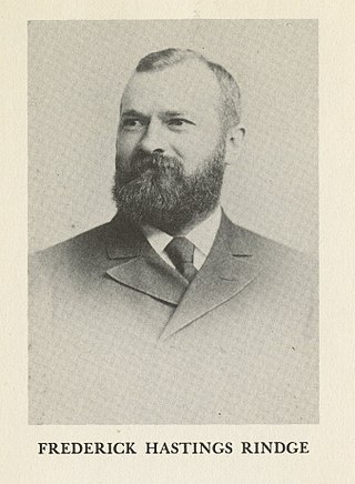
The Hueneme, Malibu & Port Los Angeles Railway was a standard-gauge, 15-mile railroad (24 km) in Malibu, California. It was founded by Frederick Hastings Rindge (1857–1905) and operated on his 13,000-acre ranch (5,300 ha) along the coast, which encompassed most of what is today Malibu. He struggled for years to keep trespassers off of his land, and feared that the Southern Pacific Company would use the power of eminent domain to build a railroad through his property. This threat animated Rindge to plan his own railroad to thwart the efforts of the Southern Pacific. This was part of his overall effort to keep outsiders off of his ranch and spoil what he considered to be paradise.