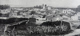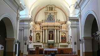
Canillas de Aceituno is a municipality in the province of Málaga in the autonomous community of Andalusia in southern Spain. It is located in the east of the province and is one of the municipalities comprising the comarca of Axarquia and the judicial district of Vélez-Málaga. It is a small village, located at the foot of the "La Maroma" mountains in Spain.

Alicante is one of the 52 constituencies represented in the Congress of Deputies, the lower chamber of the Spanish parliament, the Cortes Generales. The constituency currently elects 12 deputies. Its boundaries correspond to those of the Spanish province of Alicante. The electoral system uses the D'Hondt method and a closed-list proportional representation, with a minimum threshold of three percent.

Formentera del Segura is a municipality and village in the province of Alicante and autonomous community of Valencia, Spain. The municipality covers an area of 4.3 square kilometres (1.7 sq mi) and as of 2015 had a population of 4206 people.

Granja de Rocamora is a village in the province of Alicante and autonomous community of Valencia, Spain. The municipality covers an area of 7.2 square kilometres (2.8 sq mi) and as of 2011 had a population of 2463 people.

Hondón de los Frailes is a municipality and village in the province of Alicante and autonomous community of Valencia, Spain. The municipality covers an area of 12.6 square kilometres (4.9 sq mi) and as of 2011 had a population of 1217 people.

Monforte del Cid is a village in the province of Alicante and autonomous community of Valencia, Spain. The municipality covers an area of 79.5 square kilometres (30.7 sq mi) and as of 2011 had a population of 7,771 people.

Murla is a village in the province of Alicante and autonomous community of Valencia, Spain. The municipality covers an area of 5.81 square kilometres (2.24 sq mi) and as of 2011 had a population of 609 people.

Ondara is a village in the province of Alicante and autonomous community of Valencia, Spain. The municipality covers an area of 10.4 square kilometres (4.0 sq mi) and as of 2011 had a population of 6644 people.

Rafal is a municipality in the Valencian Community (Spain) situated in the south of the province of Alicante, in the comarca of Vega Baja del Segura. The municipality covers an area of 1.6 square kilometres (0.62 sq mi) and as of 2011 had a population of 4162 people.

Rojales is a village in the province of Alicante and autonomous community of Valencia, Spain. The municipality covers an area of 27.6 square kilometres (10.7 sq mi) and as of 2011 had a population of 21583 people.

Sagra is a village in the province of Alicante and autonomous community of Valencia, Spain. The municipality covers an area of 5.6 square kilometres (2.2 sq mi) and as of 2011 had a population of 454 people.

San Fulgencio is a village in the province of Alicante and autonomous community of Valencia, Spain. The municipality covers an area of 19.75 square kilometres (7.63 sq mi) and at the 2011 Census had a population of 9,572, of whom 77% were of foreign origin; the latest official estimate was 7,855. English was the most spoken language in the town

San Isidro is a village in the province of Alicante and autonomous community of Valencia, Spain. The municipality covers an area of 11.69 square kilometres (4.51 sq mi) and as of 2011 had a population of 1934 people.

Senija is a village in the province of Alicante and autonomous community of Valencia, Spain. The municipality covers an area of 4.8 square kilometres (1.9 sq mi) and as of 2011 had a population of 661 people.

Tormos is a municipality in the province of Alicante and autonomous community of Valencia, Spain. The municipality covers an area of 5.3 square kilometres (2.0 sq mi) and as of 2011 had a population of 383 people.

La Vall d'Ebo is a municipality in the province of Alicante and autonomous community of Valencia, Spain. The municipality covers an area of 32.4 square kilometres (12.5 sq mi) and as of 2011 had a population of 284 people.

La Vall de Laguar is a chain of three village in the province of Alicante and autonomous community of Valencia, Spain. The villages are, from the lowest and first encountered if entering the Val from the town of Orba, the most usual route, Campell,Fleix and Benimaurell. The municipality covers an area of 22.96 square kilometres (8.86 sq mi) and as of 2011 had a population of 961 people.

Aldeacentenera is a village in the province of Cáceres and autonomous community of Extremadura, Spain. The municipality covers an area of 110.56 square kilometres (42.69 sq mi) and as of 2011 had a population of 733 people.

El Gordo is a municipality in the province of Cáceres and autonomous community of Extremadura, Spain. The municipality covers an area of 78.72 square kilometres (30.39 sq mi) and as of 2011 had a population of 385 people.
Macisvenda is a village in the municipality of Abanilla, in the autonomous community of Region of Murcia, Spain. It lies close to the border of the province of Alicante in the Autonomous Community of Valencia.


