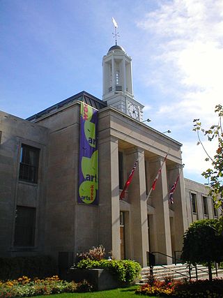
Peterborough is a city on the Otonabee River in Ontario, Canada, about 125 kilometres northeast of Toronto. According to the 2021 Census, the population of the City of Peterborough was 83,651. The population of the Peterborough Census Metropolitan Area (CMA), which includes the surrounding Townships of Selwyn, Cavan Monaghan, Otonabee-South Monaghan, and Douro-Dummer, was 128,624 in 2021. In 2021, Peterborough ranked 32nd among the country's 41 census metropolitan areas according to the CMA in Canada. The current mayor of Peterborough is Jeff Leal.
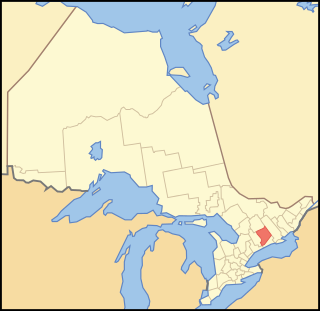
Peterborough County is located in Southern Ontario, Canada. The county seat is The City of Peterborough, which is independent of the county.

The Humber River is a river in Southern Ontario, Canada. It is in the Great Lakes Basin, is a tributary of Lake Ontario and is one of two major rivers on either side of the city of Toronto, the other being the Don River to the east. It was designated a Canadian Heritage River on September 24, 1999.
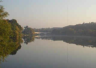
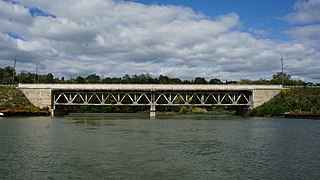
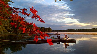
The Otonabee River is a river in Peterborough County in Central Ontario, Canada. The river flows from Katchewanooka Lake, at the north end of the community of Lakefield, through the city of Peterborough to Rice Lake. It is in the Great Lakes Basin and forms part of the Trent-Severn Waterway.
The Bayfield River is a river in Huron and Perth Counties in southwestern Ontario, Canada, that empties into Lake Huron at the community of Bayfield in the municipality of Bluewater.

The Crowe River is a river in the counties of Haliburton, Hastings, Northumberland and Peterborough in southern Ontario, Canada. It is in the Lake Ontario drainage basin and is a tributary of the Trent River.
The Black Sturgeon River is a river in Thunder Bay District, Northwestern Ontario, Canada, located west of the Nipigon River, that flows to Lake Superior.
The Brightsand River is a river in the James Bay drainage basin in Unorganized Thunder Bay District in northwestern Ontario, Canada.

The Red Deer River is a river in Alberta and a small portion of Saskatchewan, Canada. It is a major tributary of the South Saskatchewan River and is part of the larger Saskatchewan / Nelson system that empties into Hudson Bay.
Silver Lake is a small lake in the city of Kawartha Lakes in Central Ontario, Canada. Located near the community of Coboconk, it is the lowest lake on the Gull River, a drainage basin that supplies water at its mouth to Balsam Lake at the top of the Trent-Severn Waterway. Like many other lakes in the Kawarthas, Silver Lake lies in a depression formed between the Precambrian granite to the north, and the Ordovician limestone to the south.
Anstruther Lake is a lake in the municipality of North Kawartha, Peterborough County in Central Ontario, Canada, between the community of Apsley on Ontario Highway 28 8.5 kilometres (5.3 mi) to the east and the community of Catchacoma on County Road 507 8.5 kilometres (5.3 mi) to the west. Kawartha Highlands Provincial Park encompasses the lake, and the community of Anstruther Lake is on the southern shore. The lake flows out via Anstruther Creek, and the Mississaugua, Otonabee and Trent rivers into Lake Ontario.
Shadow Lake is a lake in the city of Kawartha Lakes in Central Ontario, Canada. With an area of 356.8 hectares and an elevation of 259 metres (850 ft), it is the second lake upstream of the mouth of the Gull River, and is in the Lake Ontario drainage basin.
The Indian River is a river in Peterborough County in Central Ontario, Canada. It is in the Great Lakes Basin, and is a tributary of Rice Lake.

Koshlong Lake is a lake in the municipalities of Highlands East and Dysart et al, Haliburton County in Central Ontario, Canada. It is part of the Great Lakes Basin.
Koshlong Creek is a river in geographic Glamorgan Township in the municipality of Highlands East, Haliburton County in Central Ontario, Canada. The river is in the Great Lakes Basin and is a left tributary of the Burnt River.
The Otonabee Region Conservation Authority (ORCA), sometimes shortened to Otonabee Conservation, is a conservation authority in Ontario, Canada. Established in 1959 and based in Peterborough, its member municipalities include Asphodel-Norwood, Cavan-Monaghan, Douro-Dummer, City of Kawartha Lakes, Otonabee–South Monaghan, City of Peterborough, Selwyn, and Trent Hills. Major watercourses within the watershed administered by ORCA include the Otonabee, Indian, and Ouse rivers, and Baxter, Cavan, Jackson, Miller and Squirrel creeks.
The Irondale River is a river in Haliburton County in Central Ontario, Canada. It is part of the Great Lakes Basin, and is a left tributary of the Burnt River.

Bowmanville Creek is a stream in the municipality of Clarington, Regional Municipality of Durham in south-central Ontario, Canada. It flows from the Oak Ridges Moraine to Lake Ontario at Bowmanville. The creek is under the auspices of the Central Lake Ontario Conservation Authority.

Little Lake is a small lake on the Otonabee River in the city of Peterborough, Ontario, Canada. The lake is in the downtown of the city and is used for fishing, swimming, boating, and for various special events. The lake lies on the water route from Lake Ontario to the Kawartha Lakes. The area around the lake was first settled by Europeans around the start of the 19th century. Steam- and water-powered saw mills were built on the lake and on the river upstream to prepare lumber for shipment overseas. Sawdust and other debris from the mills polluted the lake, killed the fish and clogged up the navigable channels. The smell was so noxious it drove residents near the lake to move. These problems were resolved by the end of the century, when the lake became a hub on the new Trent-Severn Waterway from Lake Ontario to Lake Huron. However, industries attracted by cheap hydroelectric power, such as General Electric used the lake for disposal of industrial chemicals for many years. The pollutants seems to be mostly contained in the sediment, and the lake is now considered safe for recreational use.
The Long Point Region Conservation Area is an agency of the province of Ontario, Canada, formed to preserve the volume of flow, and purity, of the watercourses that flow into Lake Erie, near Long Point.
