Otonabee River

Last updated
Otonabee River
Otonabeewiki.jpg
The Otonabee River in Peterborough, Ontario
Canada Southern Ontario relief location map.jpg
Red pog.svg
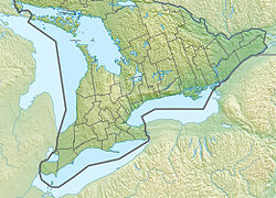
Location of the mouth of the Otonabee River in southern Ontario
EtymologyFrom the Ojibwe Odoonabii-ziibi, meaning Tullibee River
Native nameOdoonabii-ziibi'  (Ojibwe)
Location
Country Canada
Province Ontario
Region Central Ontario
County Peterborough
Cities
Physical characteristics
Source Katchewanooka Lake
  location Selwyn
  coordinates 44°25′54″N78°16′19″W / 44.43167°N 78.27194°W / 44.43167; -78.27194
  elevation233 m (764 ft)
Mouth Rice Lake
  location
Otonabee–South Monaghan
  coordinates
44°09′14″N78°13′52″W / 44.15389°N 78.23111°W / 44.15389; -78.23111 Coordinates: 44°09′14″N78°13′52″W / 44.15389°N 78.23111°W / 44.15389; -78.23111
  elevation
187 m (614 ft)
Length55 km (34 mi)
Basin size806 km2 (311 sq mi)
Basin features
River system Great Lakes Basin

The Otonabee River is a river in Peterborough County in Central Ontario, Canada. [1] The river flows from Katchewanooka Lake, at the north end of the community of Lakefield, through the city of Peterborough to Rice Lake. It is in the Great Lakes Basin and forms part of the Trent-Severn Waterway.
Contents

Etymology

The river is called Odoonabii-ziibi in the Ojibwe language. Otonabee comes from the words ode which means "heart" and odemgat that comes from "boiling water". It translates into "the river that beats like a heart in reference to the bubbling and boiling water of the rapids along the river". [2]

Course

The river begins at Katchewanooka Lake on the north side of the community of Lakefield in the municipality of Selwyn, and flows south over the Lakefield (Trent-Severn lock 6) dams and locks. After leaving the community to the Peterborough city limits, the river forms the border between Selwyn and the municipality of Douro–Dummer. The river continues south, passing through the dams associated with four more locks, enters the city of Peterborough, and passes under Faryon Bridge at Trent University. Just south of the university, the Trent-Severn departs via a south-bound canal to the Peterborough Lift Lock east of the river, while the river continues south to the west. It passes over several hydroelectricity dams and generating stations, and passes into the centre of the city of Peterborough, as close as 150 metres (490 ft) to downtown, as it reaches Little Lake. The Trent-Severn waterway rejoins the river there, exiting from Ashburnham Lock. The river leaves Little Lake at Scotts Mills lock & dam, and heads south, passes under Ontario Highway 7, passes into the municipality of Otonabee–South Monaghan, and snakes its way without any other locks or dams to reach its mouth at Rice Lake, which flows via the Trent River to Lake Ontario.

The total length of the river is 55 kilometres (34 mi), and the distance from Little Lake to Rice Lake about 30 kilometres (19 mi). The drainage basin, not including Katchewanooka Lake or other lakes further upstream, is 806 square kilometres (311 sq mi). [3]

Hydrology

Some areas of Peterborough along the Otonabee are prone to flooding following heavy rains, such as happened on July 15, 2004 when 240 mm (7.3 in) fell in some locations in under twenty-four hours.

History

Both Susanna Moodie and Catharine Parr Traill lived on farms near Katchewanooka Lake.

Economy

Trent University operates its own hydroelectric plant on the river.

Islands

Cow Island is located to the west of the mouth of the Otonabee River.

Tributaries

See also

Related Research Articles

Trent–Severn Waterway

The Trent–Severn Waterway is a 386-kilometre-long canal route connecting Lake Ontario at Trenton to Georgian Bay, Lake Huron, at Port Severn. Its major natural waterways include the Trent River, Otonabee River, Kawartha Lakes, Lake Simcoe, Lake Couchiching and Severn River. Its scenic, meandering route has been called "one of the finest interconnected systems of navigation in the world".

Peterborough County County in Ontario, Canada

Peterborough County is located in Southern Ontario, Canada. The county seat is Peterborough, which is independent of the county.

Rice Lake (Ontario)

Rice Lake is a lake located in Northumberland and Peterborough counties in south-eastern Ontario. The lake is located south of the city of Peterborough, and the Kawartha Lakes and north of Cobourg. It is part of the Trent-Severn Waterway, which flows into the lake by the Otonabee and out via the Trent. The lake is 28 kilometres (17 mi) long and 5 km wide. Its maximum depth is 10m, with a surface water level at 187 m above sea level, raised to its present height by the Hastings Dam, built in the 19th century as part of the Trent-Severn canal system. Natives called it Pemadashdakota or "lake of the burning plains".

Lake Scugog Lake in southern Ontario, Canada

Lake Scugog is an artificially flooded lake in Scugog, Regional Municipality of Durham and the unitary city of Kawartha Lakes in central Ontario, Canada. It lies between the communities of Port Perry and Lindsay. The lake has been raised and lowered several times over its history. Though not technically part of the Kawartha lakes due to its shallow depths, it is often geographically linked to them. Its sole outflow, the Scugog River, connects to Sturgeon Lake. Lake Scugog is in the Great Lakes Basin and forms part of the Trent–Severn Waterway.

Scugog River

The Scugog River is a river in the city of Kawartha Lakes in Central Ontario, Canada. It is in the Kawartha Lakes region, is part of the Great Lakes Basin, and is a branch of the Trent-Severn Waterway.

Trent Lakes Municipality in Ontario, Canada

The Municipality of Trent Lakes is a lower-tier township in the rural, mostly wooded northern section of Peterborough County, Ontario, Canada. The municipality has a primarily cottage and tourist industry based economy but has grown year round residency due to its commute distance to the Greater Toronto Area.

Crowe River

The Crowe River is a river in the counties of Haliburton, Hastings, Northumberland and Peterborough in southern Ontario, Canada. It is in the Lake Ontario drainage basin and is a tributary of the Trent River.

Young's Point is a small village in Ontario, Canada, established in 1825. It is about 25 kilometres (16 mi) north of Peterborough.

Jack Lake (Peterborough County)

Jack Lake is a lake and reservoir in the municipalities of Havelock-Belmont-Methuen and North Kawartha, Peterborough County in Central Ontario, Canada, about 100 mi (160 km) directly northeast of Toronto and at the edge of the Canadian Shield in the northeastern portion of the Kawartha lakes region. The lake is in the Great Lakes Basin, and serves as a small headwater pond for the Trent-Severn Waterway. The Dispersed rural community of Jack Lake is on the northwest shore of the lake, reached by Peterborough County Road 52 / Jack Lake Road from the community of Apsley, about 5 kilometres (3.1 mi) to the north on Ontario Highway 28.

Cobourg and Peterborough Railway

The Cobourg and Peterborough Railway (C&PRy) was one of the first railway lines to be built in Central Ontario, Canada. The line was initially considered in 1831 as a way to bring the products from the burgeoning area around Peterborough to markets on Lake Ontario through the port in the town of Cobourg. Before the railway the only means of travel was by stage coach lines between larger populated areas overland or by boat. A series of problems, including the Upper Canada Rebellion and the Panic of 1837, meant that construction did not begin until 1853, reaching Peterborough in 1854.

Gull River (Balsam Lake) river in Haliburton County, Ontario, Canada

The Gull River is a river in Algonquin Highlands and Dysart et al, Haliburton County and the single-tier municipality of Kawartha Lakes in south-central Ontario, Canada. It is in the Trent River and Lake Ontario drainage basins, and flows from southern Algonquin Provincial Park to Balsam Lake on the Trent–Severn Waterway.

Silver Lake (Kawartha Lakes) Lake in southern Ontario, Canada

Silver Lake is a small lake in the city of Kawartha Lakes in Central Ontario, Canada. Located near the community of near Coboconk, it is the lowest lake on the Gull River, a drainage basin that supplies water at its mouth to Balsam Lake at the top of the Trent-Severn Waterway. Like many other lakes in the Kawarthas, Silver Lake lies in a depression formed between the Precambrian granite to the north, and the Ordovician limestone to the south.

Katchewanooka Lake

Katchewanooka Lake is one of the Kawartha lakes in south-central Ontario, Canada. It is about 5 miles (8.0 km) long and .5 miles (0.80 km) wide. The Trent Severn Waterway flows through Lake Katchewanooka into the Otonabee River at its outlet just north of Lakefield, continuing southwest through Little Lake in Peterborough and on into Rice Lake. Lakefield College School lies on the east side of the lake.

Buckhorn Lake (Ontario)

Buckhorn Lake is a lake in the townships of Trent Lakes and Selwyn in Peterborough County, Ontario, Canada, and is one of the Kawartha lakes.

Redstone River (Haliburton County, Ontario)

The Redstone River is a river in the municipality of Dysart et al, Haliburton County in central Ontario, Canada that flows from southern Algonquin Provincial Park to the Gull River.

Indian River (Rice Lake)

The Indian River is a river in Peterborough County in Central Ontario, Canada. It is in the Great Lakes Basin, and is a tributary of Rice Lake.

Otonabee Region Conservation Authority

The Otonabee Region Conservation Authority (ORCA), sometimes shortened to Otonabee Conservation, is a conservation authority in Ontario, Canada. Established in 1959 and based in Peterborough, its member municipalities include Asphodel-Norwood, Cavan-Monaghan, Douro-Dummer, City of Kawartha Lakes, Otonabee–South Monaghan, City of Peterborough, Selwyn, and Trent Hills. Major watercourses within the watershed administered by ORCA include the Otonabee, Indian, and Ouse rivers, and Baxter, Cavan, Jackson, Miller and Squirrel creeks.

Burleigh Falls

Burleigh Falls is both a geological feature and a small community in Peterborough County, Ontario, Canada. The falls form the boundary between the municipality of North Kawartha to the north and the municipality of Selwyn to the south.

Irondale River

The Irondale River is a river in Haliburton County in Central Ontario, Canada. It is part of the Great Lakes Basin, and is a left tributary of the Burnt River.

Little Lake (Peterborough) Lake in Peterborough, Ontario

Little Lake is a small lake on the Otonabee River in the city of Peterborough, Ontario, Canada. The lake is in the downtown of the city and is used for fishing, swimming, boating, and for various special events. The lake lies on the water route from Lake Ontario to the Kawartha Lakes. The area around the lake was first settled by Europeans around the start of the 19th century. Steam- and water-powered saw mills were built on the lake and on the river upstream to prepare lumber for shipment overseas. Sawdust and other debris from the mills polluted the lake, killed the fish and clogged up the navigable channels. The smell was so noxious it drove residents near the lake to move. These problems were resolved by the end of the century, when the lake became a hub on the new Trent-Severn Waterway from Lake Ontario to Lake Huron. However, industries attracted by cheap hydroelectric power, such as General Electric used the lake for disposal of industrial chemicals for many years. The pollutants seems to be mostly contained in the sediment, and the lake is now considered safe for recreational use.

References

  1. "Otonabee River". Geographical Names Data Base . Natural Resources Canada . Retrieved 2015-02-08.
  2. Simpson, Leanne (2011). Dancing on Our Turtle's Back: Stories of Nishnaabeg Re-creation, Resurgence and a New Emergence. Winnipeg: Arbeiter Ring Publishing. p. 95. ISBN   9781894037525. OCLC   702798103.
  3. "2013 Otonabee Region Watershed Report Card Technical Report" (PDF). Otonabee Region Conservation. April 2013. Retrieved 2015-02-08.

Sources