
Ratodero (town) is the capital of Ratodero Taluka a sub-division of Larkana District in the Sindh province of Pakistan; it is some 28 km from the district capital Larkana. Since independence of Pakistan, the city has a special reputation for its sweet products. The most special is known as Mawa and handmade caps known as Sindhi topi and footwear. At present the principal trade of the town is that of paddy and rice, and there are many rice mills.
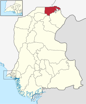
Kashmore District, , previously known as Khizmer or Khizmore, is a district of the province of Sindh, Pakistan. The capital city is Kandhkot which has a population of District Kashmore 1,206,772. Kashmoor Kandkot is part of Larkana division. Its old name was Khizmer or Khizmor. While the district headquarter is Kandkot city. Kashmoor Kandkot district was created in 2004. Before this it was part of Jacobabad district. The total population of district Kashmoor Kandkot was 1207000 persons in 2011. Total area of district is 255 square kilometers. The spoken languages are Sindhi and Balochi. Its border is connected with Punjab and Balochistan provinces. Kashmoor city is gateway to Punjab province and Balochistan province.
Ratodero Taluka is a Tehsil of Larkana District in the Sindh province of Pakistan, it is located some 28 km from the district capital Larkana. Before the independence, the city has a special reputation for its sweet products. The most special is known as Mawa and handmade caps known as Sindhi topi and footwear. At present the principal trade of the town is that of paddy and rice, and there are many rice mills. And some great leaders belong to Ratodero City As Well.
Larkana Taluka is an administrative subdivision (taluka) of Larkana District in the Sindh province of Pakistan, the city of Larkana is the capital.
Shakargarh, is a tehsil located in Narowal District, Punjab, Pakistan. Shakargarh was only tehsil of district Gurdaspur which was included in Pakistan at the time of the independence of Pakistan in 1947.

Mehar Taluka is an administrative subdivision (taluka) of Dadu District in the Sindh province of Pakistan.

Hyderabad City Taluka is an administrative subdivision (taluka) of Hyderabad District in the Sindh province of Pakistan. Hyderabad district is subdivided into 4 talukas, the Urban area around the capital Hyderabad is part of Hyderabad City Taluka.
Ganjo Takkar or the Ganjo Hills, is a small limestone range in Hyderabad District, Sindh, Pakistan that runs nearly due south parallel to the Indus for about 14 miles. The hills have an elevation just 100 feet and a type of fuller's earth, was dug from mines in the hills.
Mansehra Tehsil is a tehsil in Mansehra District, Khyber Pakhtunkhwa, Pakistan.
Wazirabad Tehsil, is an administrative subdivision (tehsil) of Gujranwala District in the Punjab province of Pakistan. The tehsil is headquartered at the city of Wazirabad and is administratively subdivided into 36 Union Councils.
Thul is the town of Jacobabad District in the Sindh Province of Pakistan. It is located at 28°14'0N 68°46'0E at an altitude of 59 metres. Thul is biggest Tehsil of Sindh; It 10 Police Stations, 3 Town Committees, 1 Civil Hospital and 5 rural Health centers, that are working. It has a degree college on Mir Pur Burriro road. Thul has the largest rice industry in the city of Sindh.
Sanghar Taluka is an administrative subdivision (taluka) of Sanghar District in the Sindh province of Pakistan, the city of Sanghar is the district headquarter of district Sanghar.
Thul is an administrative subdivision of Jacobabad District in the Sindh province of Pakistan. The subdivision is administratively subdivided into 24 Union Councils, two of which form the capital, Thul. Thul is one of the densely populated Taluka of District Jacobabad, spreading over 317,520 acres. It consists of about half of the population of whole district and its population is approximately 356,705. There are 19 union councils and 96 Dehs in this taluka. The headquarters of this taluka are about 33 km at the east side of district headquarters and connected with rail and road with other parts such as Kandhkot, Shikarpur and Baluchistan province.
Mir Bahadur Khan Khoso (1845-1930) was the son of Mir Dil Murad Khan Khoso, who during the 1857 Mutiny revolted against the British in Jacobabad. Bahadur Khan was a well known Zamindar (landlord) of Jacobabad District who was said to own a sizable portion of the agricultural lands in Jacobabad. He was an inventive genius who used to assist government officials with various agricultural problems. He had lands in all the talukas of District Jacobabad but most of the lands were in taluka Thul.

Bachro is a village and Union Council division of the Taluka of the town of Thul. It is located in the Jacobabad District of Sindh, Pakistan. It is also known as village Khan Sahib Shahal Khan Khoso, named in honor of Khan Sahib Shahal Khan, whose mausoleum is located there.
Bhurgari railway station is located in Village Ghulam Nabi Bhurgri, Taluka Shahdadkot, District Qamber Shahdadkot District, Sind, Pakistan.


