
Batu Ferringhi is a suburb of George Town in the Malaysian state of Penang. Located along the northern coast of Penang Island and about 11 km (6.8 mi) northwest of the city centre, it is the prime beach destination in Penang among locals and tourists. To cater to the influx of tourists, several major high-rise hotels have been established along the 4 km (2.5 mi) stretch of beaches.

Bayan Lepas is a suburb of George Town in the Malaysian state of Penang. Located near the southeastern tip of Penang Island, 15 km (9.3 mi) south of the city centre, it is home to the Penang International Airport, the third busiest airport in Malaysia, as well as one of the oldest free industrial zones in the country.
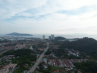
Batu Maung is a residential neighbourhood in the Malaysian state of Penang. It is located 15.7 km (9.8 mi) south of the city centre, adjacent to Bayan Lepas and the Penang International Airport. Batu Maung is home to the island terminus of the Second Penang Bridge and the southern end of the Tun Dr Lim Chong Eu Expressway. It is also surrounded by fishing villages such as Permatang Damar Laut and Teluk Tempoyak.

Batu Kawan is an island and suburb of Seberang Perai in the Malaysian state of Penang. It is geographically separated from the rest of Seberang Perai by the Jawi and Tengah rivers. As of 2020, Batu Kawan contained a population of 11,409.

Tanjong Bungah is a suburb of George Town in the Malaysian state of Penang. It is located along the northern coast of Penang Island between Batu Ferringhi and Tanjong Tokong, about 6.5 km (4.0 mi) northwest of the city centre.
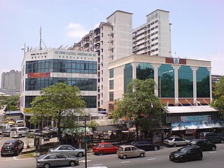
Jelutong is a suburb of George Town in the Malaysian state of Penang. Located 3.2 km (2.0 mi) south of the city centre, Jelutong has been inhabited since as early as the late 18th century, when traders from Aceh and India settled around the area.
Sungai Pinang is a residential neighbourhood within the downtown core of George Town in the Malaysian state of Penang. The neighbourhood lies along the southern bank of the Pinang River and is bounded by Jalan Sungai Pinang to the south.

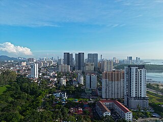
Batu Uban is a residential neighbourhood within the city of George Town in the Malaysian state of Penang, about 6.7 km (4.2 mi) south of the city centre. Founded by ethnic Minangkabaus in the early 18th century, Batu Uban is regarded as the oldest Malay settlement on Penang Island.
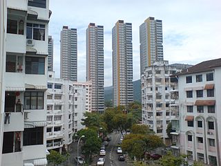
Batu Lanchang is a residential neighbourhood within the downtown core of George Town in the Malaysian state of Penang. It is sandwiched between Farlim to the west and Jelutong to the east.

SMK Batu Maung is a secondary school located in Southwest Region or Batu Maung, Penang, Malaysia. It was founded in 2001, and has the normal school day in the Southwest District of Penang.

Teluk Tempoyak is a coastal village within the city of George Town in the Malaysian state of Penang. It is located near the southeastern tip of Penang Island, about 16 km (9.9 mi) south of the city centre. The village lies just south of Batu Maung and faces the Penang Strait to the east.

The Tun Dr Lim Chong Eu Expressway, signed as Federal Route 3113, is an expressway in George Town that connects its city centre with Batu Maung at its south. This 17.8 kilometres (11.1 mi) expressway stretches along the eastern coast of Penang Island. It was named in honour of Penang's second chief minister, Lim Chong Eu who died in 2010. There are two sections of the expressway, the Jelutong Expressway and Bayan Lepas Expressway.

The Malaysian Expressway System is a network of national controlled-access expressways in Malaysia that forms the primary backbone network of Malaysian national highways. The network begins with the Tanjung Malim–Slim River tolled road which was opened to traffic on 16 March 1966, later North–South Expressway (NSE), and is being substantially developed. Malaysian toll road-expressways are built by private companies under the supervision of the government highway authority, Malaysian Highway Authority. While toll-free expressways are built by Malaysian Public Works Department or Jabatan Kerja Raya Malaysia (JKR) in Malay.

The Sultan Abdul Halim Muadzam Shah Bridge, also known as the Penang Second Bridge, is a dual carriageway toll bridge in Penang, Malaysia. It connects Bandar Cassia in Seberang Perai, Peninsular Malaysia, with Batu Maung on Penang Island. It is the second bridge to link the island to the mainland after Penang Bridge.

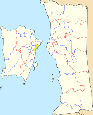
Batu Maung is a state constituency in Penang, Malaysia, that has been represented in the Penang State Legislative Assembly since 2004. It covers the southeastern corner of Penang Island, including the eponymous town of Batu Maung, the Penang International Airport and the newer parts of Bayan Lepas.

Batu Uban is a state constituency in Penang, Malaysia, that has been represented in the Penang State Legislative Assembly since 1986. It covers a portion of Penang Island's eastern seaboard, including the southernmost suburbs of George Town.

Batu Lancang is a state constituency in Penang, Malaysia, that has been represented in the Penang State Legislative Assembly since 2004. It covers two of George Town's suburbs - Batu Lanchang and parts of Jelutong.
Sungai Pinang is a state constituency in Penang, Malaysia, that has been represented in the Penang State Legislative Assembly since 1974. It covers much of Jelutong, one of the suburbs of George Town.

Permatang Damar Laut is a coastal village within the city of George Town in the Malaysian state of Penang. It is located at the southern tip of Penang Island, about 17 km (11 mi) south of the city centre, making it the southernmost human settlement on the island. The village is hemmed in between the Penang International Airport to the north and the Malacca Strait to the south.

Taman Free School is a residential neighbourhood within the downtown core of George Town in the Malaysian state of Penang. It is named after the nearby Penang Free School.
