The history of Jordan refers to the history of the Hashemite Kingdom of Jordan and the background period of the Emirate of Transjordan under British protectorate as well as the general history of the region of Transjordan.

Heshbon were at least two different ancient towns located east of the Jordan River in what is now the Kingdom of Jordan, historically within the territories of ancient Ammon.

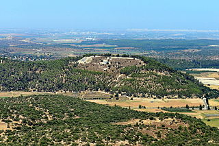
Azekah was an ancient town in the Shfela guarding the upper reaches of the Valley of Elah, about 26 km (16 mi) northwest of Hebron.

Pella was an ancient city in what is now northwest Jordan, containing ruins from the Neolithic, Chalcolithic,Bronze Age, Iron Age, Canaanite, Hellenistic and Islamic periods. It is located in a rich water source within the eastern foothills of the Jordan Valley, close to the modern village of Ṭabaqat Faḥl some 27 km (17 mi) south of the Sea of Galilee. The site is situated 130 km (81 mi) north of Amman: a drive of about an hour and a half, and an by car from Irbid, in the north of the country. Pella's ruins – predominantly temples, churches, and housing – have been partially excavated by teams of archaeologists; they attract thousands of tourists annually but especially in spring, during which time the area is awash with spring flowers.

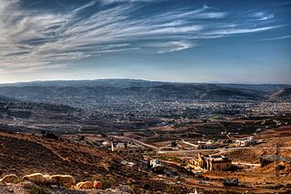
As-Salt, also known as Salt, is an ancient trading city and administrative centre in west-central Jordan. It is on the old main highway leading from Amman to Jerusalem. Situated in the Balqa highland, about 790–1,100 metres above sea level, the city is built in the crook of three hills, close to the Jordan Valley. One of the three hills, Jabal al-Qal'a, is the site of a 13th-century ruined fortress. It is the capital of Balqa Governorate of Jordan.

Dhiban, known to the Moabites as Dibon, is a Jordanian town located in Madaba Governorate, approximately 70 kilometres south of Amman and east of the Dead Sea. Previously nomadic, the modern community settled the town in the 1950s. Dhiban's current population is about 15,000, with many working in the army, government agencies, or in seasonal agricultural production. A number of young people study in nearby universities in Karak, Madaba, and Amman. Most inhabitants practice Islam.

Sahab is a municipality in Jordan located 16 kilometers (9.9 mi) southeast of the capital Amman. It is the only locality in the Sahab District of the Amman Governorate. Modern Sahab began as a Bedouin-owned plantation village in the late 19th century during Ottoman rule. The plantation was originally worked by Egyptian migrant farmers who purchased and permanently settled the lands in 1894 and developed Sahab into an agricultural estate. Sahab became its own municipality in 1962 and today is a densely populated industrial hub. It is home to the country's largest industrial city, the Abdullah II Ibn Al-Hussein Industrial Estate, and the largest cemetery in greater Amman, as well as the Caves of Raqeem site mentioned in the Qur'an. The population of Sahab in 2015 was 169,434.

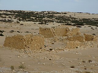
The ancient city of Halasa or Chellous, Elusa (Ελουϲα) in the Byzantine period, was a city in the Negev near present-day Kibbutz Mash'abei Sadeh that was once part of the Nabataean Incense Route. It lay on the route from Petra to Gaza. Today it is known as Haluza, and during periods of Arab habitation it was known as al-Khalūṣ and Al-Khalasa.

Farwana, was a Palestinian village, located 4.5 kilometers (2.8 mi) south of Bisan, depopulated in 1948.
Al-Yadudah is a town in the Amman Governorate in northwestern Jordan, located south of the capital Amman.
Barazin, also spelled Barazayn, is a town in the Amman Governorate of north-western Jordan.

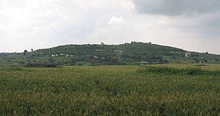
Tell es-Safi was an Arab Palestinian village, located on the southern banks of Wadi 'Ajjur, 35 kilometers (22 mi) northwest of Hebron which had its Arab population expelled during the 1948 Arab-Israeli war on orders of Shimon Avidan, commander of the Givati Brigade.

Al-Maghtas, officially known as Baptism Site "Bethany Beyond the Jordan", is an archaeological World Heritage site in Jordan, on the east bank of the Jordan River, considered to be the original location of the Baptism of Jesus by John the Baptist and venerated as such since at least the Byzantine period. The place has also been referred to as Bethabara and historically Bethany.

Tall Jawa is an archaeological and historical site in central Jordan.

Tall al-’Umayri is an archaeological dig site in western Jordan that dates from the Early Bronze Age to the Hellenistic period. It is located near the modern capital of Amman, and is significant for its well-preserved evidence of a temple, as well as archaeological evidence of a network of small farms believed to produce wine. Excavations were proceeding as of 2014.

The Balqa, known colloquially as the Balga, is a geographic region in central Jordan generally defined as the highlands east of the Jordan Valley in between the Zarqa River to the north and the Wadi Mujib gorge to the south.

Circassians in Jordan are Circassians living in Jordan. Circassian refugees arrived in Jordan in the late 19th century, after being exiled during the Circassian genocide in the 1860s and later the Russo-Turkish War (1877–1878). They settled in Jordan, then a part of Ottoman Syria, in and around Amman and Jerash. Circassians are credited with founding modern Amman as the city had been previously abandoned.
The Heshbon Expedition is the name commonly used to refer to five seasons of archaeological excavations looking for biblical Heshbon at Tall Hisban in Jordan. The excavations were carried out by a team of archaeologists from Andrews University between 1968 and 1976. The first three campaigns were led by Siegfried H. Horn of the Theological Seminary at Andrews University and Roger S. Boraas of Upsala College and last two by Lawrence T. Geraty, Horn's successor at Andrews, and Boraas.
The Madaba Plains Project, or MPP, was founded by veterans of the Heshbon Expedition to continue archaeological survey and excavations research in the hills and plains between Amman and Madaba. MPP is notable for its longevity and influence on archaeology in Jordan. An estimated 2,000 plus students, volunteers and professors have participated in MPP's projects over the past fifty years and MPP is considered Jordan's longest ongoing archaeological project.
Oystein Sakala LaBianca is a National Geographic Explorer and director of the Hisban Cultural Heritage Project at Tall Hisban in Jordan. He is notable for having introduced new interpretive tools for studying long-term processes of cultural production and change in the Eastern Mediterranean and for pioneering community archaeology in the region.


