Khagaria is a town in Indian state of Bihar and the administrative headquarters of Khagaria district. Khagaria is a part of Munger division. It is located at 25.5°N 86.48°E and has an average elevation of 36 metres (118 feet). The Khagaria Junction railway station serves the town.It is situated about 25 km north of Munger.

Munger, formerly spelt as Monghyr, is a twin city and a Municipal Corporation situated in the Indian state of Bihar. It is the administrative headquarters of Munger district and Munger Division. Munger was one of the major cities in Eastern India and undivided Bengal during Mughal period and British Raj. It is one of the major political, cultural, educational and commercial center of Bihar and Eastern India. Munger is situated about 180km from east of capital city Patna, about 480km west of Eastern India's largest city Kolkata and 1200km from country's capital New Delhi.

Saharsa is a city and municipal corporation in the Saharsa District in the eastern part of the state of Bihar, India. It is situated near the eastern banks of the Kosi River. It serves as the administrative headquarters for Saharsa District and is also the Divisional headquarters of the Kosi Division.
Samastipur is one of the thirty-eight districts of Bihar in India. The district headquarters are located at Samastipur. The district occupies an area of 2904 km² and has a population of 4,261,566.

Madhepura district is one of the thirty-eight districts of Bihar state, India, and Madhepura town is the administrative headquarters of this district. Madhepura district is a part of Kosi division.

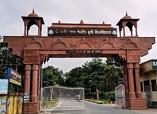
Khagaria district is an administrative district in Mithila region in the state of Bihar in India. The district headquarters are located at Khagaria. Earlier it was a part of Munger District as a sub-division that was created in 1943–44. It was upgraded to the status of a district on 10 May 1981. Khagaria district is a part of Munger Division.

Begusarai District is one of the thirty-eight districts of the Indian state of Bihar. The city of Begusarai is its administrative headquarters and is part of the Munger division.

Munger district is one of the thirty-eight districts of Bihar state in eastern India. The city of Munger is the administrative headquarters of this district. The district is a part of Munger Division. Its literacy rate of 73.3% is higher than the state literacy rate of 63.8%, but lower than national rate of 74.04%.
Gogri Jamalpur is a notified area in the Khagaria district in the Indian state of Bihar. It is located in northwestern India about 25 kilometers north of the Ganges River.
Haldibari is a city and a municipality in the Mekhliganj subdivision of the Cooch Behar district in the Indian state of West Bengal.

Jamalpur is a community development block that forms an administrative division in Bardhaman Sadar South subdivision of Purba Bardhaman district in the Indian state of West Bengal.

Bakshiganj is an upazila of Jamalpur District in the Division of Mymensingh, Bangladesh.

Jamalpur Junction railway station, station code JMP, is the railway station serving the Munger–Jamalpur twin cities in the Munger district in the Indian State of Bihar.

Shri Krishna Setu NH 333B is a rail-cum-road bridge across the Ganges, at Munger in the Indian state of Bihar and named after first Chief Minister of Bihar Shri Krishna Singh. The bridge connects the Munger-Jamalpur twin cities in Munger District to various districts of North Bihar. Srikrishna Setu Munger Ganga Bridge is the third rail-cum-road bridge over Ganga in Bihar.

Parbatta Assembly constituency is an assembly constituency in Khagaria district in the Indian state of Bihar.

Munger University is a state university and was established on 18 March 2018 through bifurcation of Tilka Manjhi Bhagalpur University, Bhagalpur. The university started operating academically from the 2018–19 academic year.

Jamalpur Karaundi is a village in Amawan block of Rae Bareli district, Uttar Pradesh, India. It is located 11 km from Raebareli, the district headquarters. As of 2011, its population is 630, in 125 households.
Borne is a village in the state of Bihar, India. It is located on the eastern part of Khagaria District, approximately 24 kilometres east of Khagaria, the seat of the district government. It had a population of 34,026 by 2011.


