
The River Liffey is a river in eastern Ireland that ultimately flows through the centre of Dublin to its mouth within Dublin Bay. Its major tributaries include the River Dodder, the River Poddle and the River Camac. The river supplies much of Dublin's water and supports a range of recreational activities.

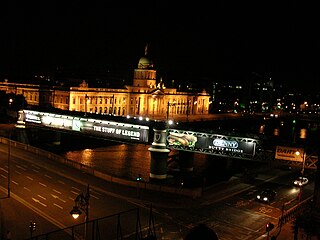
The Talbot Memorial Bridge is a road bridge spanning the River Liffey in Dublin, Ireland. Completed in 1978, it is 22 metres (72 feet) wide, and was designed by De Leuw, Chadwick and O’hEocha Consulting Engineers. The bridge marks the furthest point up to the Liffey to which tall ships may travel, as all bridges downriver of it are either swingbridges or bascule.

Grattan Bridge is a road bridge spanning the River Liffey in Dublin, Ireland, and joining Capel Street to Parliament Street and the south quays.

O'Connell Bridge is a road bridge spanning the River Liffey in Dublin, Ireland, which joins O'Connell Street to D'Olier Street, Westmoreland Street and the south quays.

Seán Heuston Bridge is a cast-iron bridge spanning the River Liffey beside Heuston Station in Dublin, Ireland. It was previously named King's Bridge and Sarsfield Bridge - and the bridge and adjacent train station are still commonly referred to by older Dubliners as "Kings Bridge" and "Kings Bridge Station" respectively. Previously used for road traffic, the bridge now carries pedestrian and Luas (tram) traffic.

The Millennium Bridge is a pedestrian bridge spanning the River Liffey in Dublin, Ireland, joining Eustace Street in Temple Bar to the north quays.

O'Donovan Rossa Bridge is a road bridge spanning the River Liffey in Dublin, Ireland, which joins Winetavern Street to Chancery Place and the north quays.
The Loopline Bridge is a railway bridge spanning the River Liffey and several streets in Dublin, Ireland. It joins rail services from south of Dublin to Connolly Station and lines north.

Seán O'Casey Bridge is a pedestrian swingbridge spanning the River Liffey in Dublin, Ireland, joining City Quay in the Grand Canal Docks area to North Wall Quay and the IFSC.

Frank Sherwin Bridge is a road bridge spanning the River Liffey in Dublin, Ireland. It joins St. John's Road and the south quays from Heuston Station to Wolfe Tone Quay and Parkgate Street on the Northside.

The Butt Bridge is a road bridge in Dublin, Ireland which spans the River Liffey and joins Georges Quay to Beresford Place and the north quays at Liberty Hall.

Father Mathew Bridge is a road bridge spanning the River Liffey in Dublin, Ireland, which joins Merchants Quay to Church Street and the north quays. It occupies the approximate site of the original, and for many years the only, Bridge of Dublin, dating back to the 11th century.

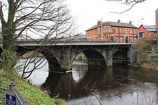
Lucan Bridge is a road bridge spanning the River Liffey in Lucan, County Dublin, Ireland. It joins Lucan's Main Street to the Lower Lucan Road, carrying traffic towards Clonsilla and the north, and the Strawberry Beds to the east. Designed by George Knowles, it was built in 1814. Constructed in collaboration with James Savage at a cost of more than £9,000, it replaced several previous bridges which had been carried away by floods.

Island Bridge, formerly Sarah or Sarah's Bridge, is a road bridge spanning the River Liffey, in Dublin, Ireland which joins the South Circular Road to Conyngham Road at the Phoenix Park.
The Anna Livia Bridge, formerly Chapelizod Bridge, is a road bridge spanning the River Liffey in Chapelizod, Dublin, Ireland which joins the Lucan Road to Chapelizod Road.

Samuel Beckett Bridge is a cable-stayed swingbridge in Dublin, Ireland that joins Sir John Rogerson's Quay on the south side of the River Liffey to Guild Street and North Wall Quay in the Docklands area.

The Dublin quays refers to the two roadways and quays that run along the north and south banks of the River Liffey in Dublin, Ireland. The stretches of the two continuous streets have several different names. However, all but two of the names share the same "quay" designation. The quays have played an important part in Dublin's history.

Rory O'More Bridge is a road bridge spanning the River Liffey in Dublin, Ireland and joining Watling Street to Ellis Street and the north quays.

The Rosie Hackett Bridge is a road and tram bridge in Dublin, Ireland, which opened on 20 May 2014. Spanning the River Liffey and joining Marlborough Street to Hawkins Street, it is used solely by public transport, taxis, cyclists and pedestrians. It is 26 metres wide and 48 metres long, and is a single span, smooth concrete structure, with the underside of the bridge designed to be as high above the water as possible so that river traffic is not impeded. It was built to carry the extended Luas Green line, and was budgeted at €15 million. It is named for trade unionist Rosie Hackett (1893–1976).


