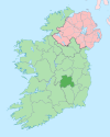
Ballyheigue, officially Ballyheige, is a coastal town and civil parish in County Kerry, Ireland. It is 18 km (11 mi) northwest of Tralee along the R551 road. It is a scenic locale which forms part of the Wild Atlantic Way and has several miles of beaches that connect to Banna Strand to the south, and Kerry Head to the north. Local events include the "Half on the Head" (Kerryhead) half marathon in June and an annual summer festival in July.

Newtownabbey is a large settlement north of Belfast city centre in County Antrim, Northern Ireland. It is separated from the rest of the city by Cavehill and Fortwilliam golf course, but it still forms part of the Belfast metropolitan area. It surrounds Carnmoney Hill, and was formed from the merging of several small villages including Whiteabbey, Glengormley and Carnmoney. At the 2021 census, Metropolitan Newtownabbey Settlement had a population of 67,599, making it the third largest settlement in Northern Ireland and seventh on the Island of Ireland. It is part of Antrim and Newtownabbey Borough Council.

Monknewtown, historically called Rathenskin, is a townland 3 km east of Slane in County Meath, Ireland. It stands on the right bank of the Mattock River, which feeds several historic watermills nearby and which forms approximately the townland's eastern boundary with Keerhan and Sheepgrange townlands in County Louth. Neighbouring townlands to the south are Balfeddock, Knowth, and Crewbane, to the west Cashel, Mooretown, and Knockmooney. The northern boundary of Monknewtown with Kellystown is formed by a tributary of the Mattock River, while the southern boundary is formed by the N51 road. Other than the latter, only minor roads traverse the townland, among them L5606 from west to east. The townland is in a civil parish of the same name.
Pádraig Ó Siochfhradha and his brother Mícheál Ó Siochfhradha were Irish language writers, teachers and storytellers, from Dingle, County Kerry, Ireland.
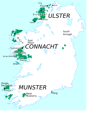
Ulster Irish is the variety of Irish spoken in the province of Ulster. It "occupies a central position in the Gaelic world made up of Ireland, Scotland and the Isle of Man". Ulster Irish thus has much in common with Scottish Gaelic and Manx. Within Ulster there have historically been two main sub-dialects: West Ulster and East Ulster. The Western dialect is spoken in parts of County Donegal and once was spoken in parts of neighbouring counties, hence the name 'Donegal Irish'. The Eastern dialect was spoken in most of the rest of Ulster and northern parts of counties Louth and Meath.

Connacht Irish is the dialect of the Irish language spoken in the province of Connacht. Gaeltacht regions in Connacht are found in Counties Mayo and Galway. Connacht Irish is also spoken in the Meath Gealtacht Ráth Chairn and Baile Ghib. The dialects of Irish in Connacht are extremely diverse, with the pronunciation, forms and lexicon being different even within each county.

Williamstown is a small village in County Galway, Ireland. It is in the northeast of the county, on the R360 road in the townland of Corralough. According to the 2016 census, the population of the village was 148.

Boyerstown is a townland in County Meath, Ireland. It is located off the N51 national secondary road 5 kilometres (3 mi) southwest of Navan. The M3 motorway runs through the townland.

Ballyjamesduff is a town in County Cavan, Ireland. A former market town, it was the winner of the 1966 and 1967 Irish Tidy Towns Competition.
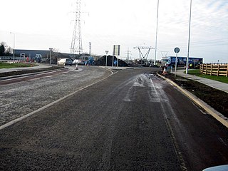
Damastown is a townland in the civil parish of Mulhuddart in Fingal, Ireland, on the outskirts of Dublin. The townland is located west of the village of Mulhuddart and is north of the N3 road. A 1.8 km (1.1 mi) link road is nearing completion to link Damastown to the Cruiserath Road intersecting Church Road which links Mulhuddart to Tyrrelstown.
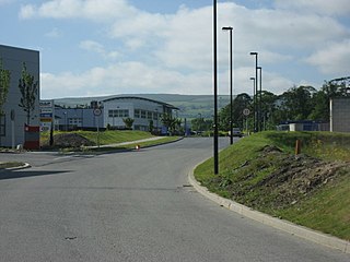
Baldonnel is a townland in west County Dublin. It is an industrial/agricultural area near Rathcoole, Clondalkin, Tallaght, Lucan, Saggart and Naas. It is around 15 km west of Dublin city centre.
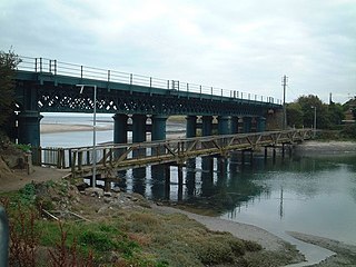
Laytown–Bettystown–Mornington–Donacarney is a built up area in County Meath, Ireland, comprising the adjoining villages of Laytown, Bettystown, Mornington and Donacarney. Prior to 2016, it was listed as Laytown–Bettystown–Mornington.
Edmondstown, also historically called 'Ballyhamon', is a townland in County Dublin and a small outer suburb of Dublin. It is on the R116 regional road, south of Ballyboden and north of Rockbrook, in the valley of the Owendoher River, and is in the local government area of South Dublin. Edmondstown National School is a Catholic primary school which serves the local area and has an attendance of 103 students. It won an Active Flag and the STEM plaque of excellence in science, technology, engineering and maths.

Staplestown is a village and townland in north County Kildare, Ireland, located 40 kilometres west of Dublin. The village has a church, a school and is home to St Kevin's GAA. The local national (primary) school is Scoil Naomh Mhuire National School.
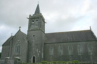
Ballymacward is a village in County Galway, Ireland, on the R359 regional road between the main road and rail networks which traverse east-west, 24 kilometres from Ballinasloe and approximately 48 kilometres from Galway City. It was once part of the kingdom of the Soghain of Connacht.
There are three Irish-speaking areas in County Mayo; Erris, Achill island and Toormakeady. Erris is located in North-West Mayo, Achill island is directly south of Erris and Tourmakeady is along the border with County Galway. There are nearly 2,500 daily Irish speakers in these areas.

The Jamestown Canal bypasses a non-navigable section of the River Shannon between Jamestown and Drumsna in Ireland. The canal is 2.6 km in length and is located in County Roscommon. The Shannon Commissioners constructed the canal in 1848 to replace an earlier, smaller canal as part of a widescale upgrade of the Shannon Navigation.
Collinstown is a townland in Fingal, County Dublin, roughly 7 km north of Dublin in Ireland. This area is in the civil parish of Santry, within the barony of Coolock.


