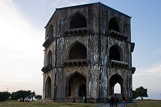
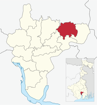
Kopargaon is a town and municipality located in the Ahmednagar district of the Indian state of Maharashtra.

Guna is a city and a municipality in Guna district in the Indian state of Madhya Pradesh. It is the administrative headquarters of Guna District and is located on the banks of Parbati river.

Khetri Nagar is a town in the Neem Ka Thana district of Rajasthan in India. It is a part of the Shekhawati region. Khetri consists of two towns, "Khetri Town," founded by Raja Khet Singhji Nirwan, and "Khetri Nagar," which is about 10 km away from Khetri. Khetri Nagar, well known for its Copper Project, was built by and is under the control of Hindustan Copper Limited, a public sector undertaking under the Government of India. Khetri Nagar is also known as "Copper." There are many attached villages near Khetri Nagar, such as Manota Khurd; the people of this village were employed in mines.
Shrigonda is a municipal council in Ahmednagar district in the Indian state of Maharashtra. Shrigonda is located at 18.616°N 74.698°E. It has an average elevation of 561 metres (1840 feet). As of the 2001 Indian census, Shrigonda had a population of 26,331. Males constitute 52% of the population and females 48%. Shrigonda has an average literacy rate of 71%, higher than the national average of 59.5%: male literacy is 77%, and female literacy is 64%. In Shrigonda, 12% of the population is under 6 years of age.

Ahmednagar district is the largest district of Maharashtra state in western India. The historical Ahmednagar city is the headquarters of the district. Ahmednagar and Sangamner are the largest cities in the district. It was the seat of the Ahmednagar Sultanate of late medieval period. This district is known for the towns of Shirdi associated with Sai Baba, Meherabad associated with Meher Baba, Shani Shinganapur with Shanidev, and Devgad with Lord Dattatreya. Ahmednagar district is part of Nashik Division. The district is bordered by Aurangabad district to the northeast, Nashik district to the northwest, Thane and Pune districts to the southwest, Solapur district to the south and Beed district to the southeast.

Kanakapura is a city in the Ramanagara district of Karnataka on the banks of the Arkavathi river and the administrative center of the taluk of the same name. Kanakapura is largest cocoon silk producer in India. River Cauvery flows around 21 km in Kanakapura Taluk.Previously belonged to Bangalore Rural District. It was formerly the largest constituency in the country. (1,553 km2 [600 sq mi]). It is located among the lush green forests of the state of Karnataka. The town is a tourism hotspot and an often visited tourist favorite in the entire state of Karnataka, as it has something for everyone ranging from avid trekkers to history buffs and wildlife enthusiasts. The forest area in this taluk is very wide and about half of the Bannerghatta National Park is located in our Kanakapura area. Kodihalli wildlife range and harohalli wildlife range its division. The Kaveri Wildlife Sanctuary consists of two main zones namely the Sangam Wildlife range, the Muggur Wildlife range
Dainhat is a town and a Municipality under Katwa police station of Katwa subdivision, in Purba Bardhaman district in the state of West Bengal, India.
Daund is a city, municipal council, and headquarters of the Daund tehsil in the Pune district in the state of Maharashtra, India. The city of Daund is located on the Bhima River.
Kachhwa is a town and a nagar panchayat in Mirzapur district in the Indian state of Uttar Pradesh.
Patuli is a village under Purbasthali police station of Kalna subdivision in Purba Bardhaman district in the Indian state of West Bengal.

Rahuri is a town and a municipal council in Ahmednagar district in the Indian state of Maharashtra.

Mollahat is an upazila of Bagerhat District in the Division of Khulna, Bangladesh.

Jamkhed taluka, is a taluka in Karjat subdivision of Ahmednagar district in Maharashtra State of India.

Karjat taluka is a taluka in Karjat subdivision of Ahmednagar district in Maharashtra state of western India.

Daund taluka is a taluka or subdivision of Pune district of the state of Maharashtra in India. The town of Daund is the only major urban area in this predominantly rural area. Daund railway station is a major railway junction. All southern railways are connected to this route, and also divided the Nagar railway to north Indian railway, like Delhi, Solapur division, Daund junction and then joined to the Pune district junction. To reach the Siddhi Vinayak Siddhatek Ganpati temple, one has to travel 14 km to Daund by road.

Domjur is a community development block that forms an administrative division in Howrah Sadar subdivision of Howrah district in the Indian state of West Bengal.

Panchla is a community development block that forms an administrative division in Howrah Sadar subdivision of Howrah district in the Indian state of West Bengal.

Shyampur II is a community development block that forms an administrative division in Uluberia subdivision of Howrah district in the Indian state of West Bengal.

Rajnikant Shankarrao Arole was born in Supa in the Ahmednagar district of Maharashtra, India on 10 July 1934, the second child of Shankar and Leelawati Salve Arole. His parents were both schoolteachers and his father became Inspector of Schools. The Aroles raised their three sons and four daughters in the faith of the Church of England, inculcating in them Christian ethical and spiritual values that have guided Rajnikant through a lifetime of public service.
Dadegaon is a village in Ashti tahsil of Beed District in Marathwada region of Maharashtra state, India.


