
Rourkela is a planned city located in the northern district Sundargarh of Odisha, India. It is the third-largest Urban Agglomeration in Odisha after Bhubaneswar and Cuttack. It is situated about 328 kilometres (204 mi) west of the state capital Bhubaneswar and is surrounded by a range of hills and encircled by the rivers Koel, Sankha, & Brahmani. The city is also popularly known as Ispat Nagar and Steel City of Odisha as well. One of the largest integrated steel plants set up with German collaboration Known as Rourkela Steel Plant, of Steel Authority of India Limited (SAIL). It also has one of the premier national level technical institute known as National Institutes of Technology (NIT Rourkela). Every year, on 3 March Rourkela Day has been celebrated.
Kalinganagar is a planned industrial town in Jajpur district of coastal Odisha, India. Kalinganagar is emerging to be major global hub in steel, power and ancillary products. A large number of steel plants including projects by Jindal Steel, VISA Steel and Tata Steel are in various stages of implementation.

The Brahmani is a major seasonal river in the Odisha state of eastern India. The Brahmani is formed by the confluence of the Sankh and South Koel rivers, and flows through the districts of Sundargarh, Deogarh, Angul, Dhenkanal, Cuttack, Jajapur and Kendrapara. Also the South Koel can be considered as the upper reaches of the Brahmani. Together with the river Baitarani, Brahmani forms a large delta before emptying into the Bay of Bengal at Dhamra. It is the second widest river in Odisha after Mahanadi.

Cuttack district is one of the 30 districts of Odisha state in India. It is located in the coastal part of the state and its administrative headquarters are located in the city of Cuttack. As of 2011 Census, after Ganjam, it is the second most populous district of Odisha, with a population of 2,624,470. The name is an anglicized form of Kataka or Katak meaning Fort – referring to the Barabati Fort. The district is bisected by the river Mahanadi and its numerous distributaries and occupies a large portion of the river's delta. It is bounded by the Angul, Dhenkanal, Nayagarh and Khurda districts to the west while its southern and eastern boundaries touch Puri, Jagatsinghpur, Kendrapara and Jajpur districts.

Jajpur is a district of Odisha state in eastern India. The Odisha Government carried out a re-organisation of districts of Odisha in 1993. The erstwhile Cuttack district was split into multiple districts with Jajpur being one of them. The district came into being on 1 April 1993.

The Baitarani is one of six major rivers of Odisha, India. Venerated in popular epics and legends, the Baitarani River is a source of water for agricultural irrigation. The coastal plain of Odisha has the name of "Hexadeltaic region" or the "Gift of Six Rivers". These deltas divide the coastal plain into three regions from north to south. The Baitarani, the Mahanadi and the Brahmani rivers form the Middle Coastal Plain, with evidence of past "back bays" and present lakes.
Kendrapara is a Town and a municipality in the Kendrapara district of the Indian state of Odisha. It is the headquarters of Kendrapara district.
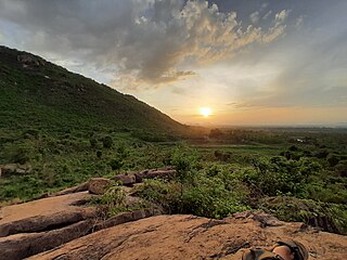
Anandapur is a town and municipality of Kendujhar district in the state of Odisha, India.
Belaguntha or Bellaguntha is a town and a Notified Area Council (N.A.C.) in Odisha, India. It's famously known as The Brass Fish Town.

Chopda or Chopra is a city and municipal council in the Jalgaon district in the state of Maharashtra, India.

Jajpur is a town and a municipality in Jajpur district in the Indian state of Odisha. It was the capital of the Kesari dynasty, later supplanted by Cuttack. Now, it is the headquarter of Jajpur district.
Pattamundai is a town and a municipality in Kendrapara district in the Indian state of Odisha, located on the centre of SH-9A from Cuttack to Chandbali along the south end of Brahmani River. It is also the headquarter of Pattamundai Block.
Umerkote, also known as Umarkot and Amarkot, is a town of Nabarangpur district, Odisha, in eastern India. Umerkote is an urban area and the name of a Municipality declared on 3 March 2014 and a Subdivision declared by State Cabinet on 3 November 2015. The town is a prominent business place of the Nabarangpur District.

Pushpagiri was an ancient Indian mahavihara or monastic complex located atop Langudi Hill in Jajpur district of Odisha, India. Pushpagiri was mentioned in the writings of the Chinese traveller Xuanzang and some other ancient sources. Until the 1990s, it was hypothesised to be one or all of the Lalitgiri-Ratnagiri-Udayagiri group of monastic sites, also located in Jajpur district. These sites contain ruins of many buildings, stupas of various sizes, sculptures, and other artifacts.
Kansbahal is a modern industrial town situated in the state of Odisha India. It lies on the State Highway #10 about 25 km from Rourkela main city; and on the main railway route between Howrah (Kolkata) and CST/Kurla (Mumbai). Kansbahal comes under the jurisdiction of Rourkela Municipal Corporation.
Chandikhol is a town and a Notified Area Council in Jajpur district, Odisha, India. The place has been named after Goddess "Chandi" worshipped by late monk Baba Bhairabananda Bramhachari who established the deity of Maa Chandi in one of the adjoining hills of Barunei full of dense forest and ferocious animals in 1932. Chandikhol has been selected for the establishment of one of Strategic Petroleum Reserve (India) location.
Sukinda is a town in Jajpur district, Odisha, India. Odisha accounts for about 98% of the total proved chromite reserves of the country, of which about 97% occur in the Sukinda Valley. In September 2007, the Blacksmith Institute listed Sukinda as one of the 10 most polluted places in the world. Multiple local political figures and scientists disputed the listing, claiming that the Blacksmith Institute used outdated research.
Saptamaruka Temple is Hindu temple in Jajpur in the Indian state of Odisha. Temple is dedicated to Hindu Tantric and Puranic goddesses Saptamatrikas.
Brahmani temple is a Hindu and Buddhist temple located in Avana, Baleswar, Odisha, India built in the 10th–11th centuries A.D. It is a living temple and the presiding deity is an eight-armed three-faced Chamunda image. It is a protected monument of Odisha State Archaeology.
Pingua is a village in Dhenkanal district, Odisha, India.


