Valsad, historically known as Bulsar, is a city and a municipality in Valsad district of the Indian state of Gujarat. It is the district headquarters of Valsad district. Valsad is located south of Navsari and shares border with Maharashtra and the union territories of Dadra and Nagar Haveli and Daman and Diu in the south.

Amreli is a city and a municipality in Amreli district in Indian state of Gujarat.

Rajkot district is one of the 33 districts of the Indian state of Gujarat. Located in Saurashtra peninsula, Rajkot city is the administrative headquarters of the district. It is the third-most advanced district in Gujarat and the fourth most populus.

Gondal is a city of about 115,000 residents and a municipality of about 175,000 in the Rajkot district of the Indian state of Gujarat. Gondal Village was one of the eight first-class princely states of Kathiawar Agency, Bombay Presidency in British India. Ruled by a Hindu Rajput dynasty of the Jadeja.
Dhrangadhra is a town, taluka headquarters and a municipality in Surendranagar district in the state of Gujarat, India. During the period of the British Raj, the city was the capital of Dhrangadhra State, one of the eight first-class princely states of the Kathiawar Agency in the Bombay Presidency.

Veraval is a city and the headquarters of Gir Somnath district in the Indian state of Gujarat. Somnath temple, a place of pilgrimage due to its importance as Jyotirlinga site dedicated to Hindu deity Shiva, is located here. It is also known for the hub of fishing industries in India.
Bagasara is a municipality in Bagasara Taluka of Amreli district, Gujarat, India. The town is situated on the northern bank of the Satalli river. nearest airport div airport.
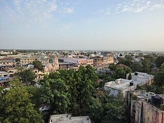
Botad is a city and district headquarters of Botad district, Gujarat, India. It is about 92 km from Bhavnagar and 133 km From Ahmedabad by road distance.

Dhoraji is a town situated on the banks of the River Safura, a tributary of the River Bhadar. It is a municipality in the Rajkot district in the state of Gujarat, India.
Gadhada is a town and a municipality in Botad District in the state of Gujarat, India. Gadhada is situated at bank of River Ghela. Swaminarayan lived here for more than 25 years.
Halvad is a town and a municipality in Morbi district in the Gujarat state of India.
Kodinar is a town and municipality in Gir Somnath district, in the Indian state of Gujarat, 37 kilometres (23 mi) west of Una. Kodinar is close to the Gir Forest National Park. The main transport connections for Kodinar are Diu Airport, Veraval Junction railway station, and Veraval Port.
Mahuva is a town and taluka of Bhavnagar District, in the state of Gujarat, India. Located on the coast of the Arabian Sea, Mahuva is known for its mild weather and green, lush surroundings, including many coconut tree plantations. The town is a part of the Saurashtra region and is known as the Kashmir of Saurashtra. Mahuva is also known for wooden toys, raw onions, groundnuts, and a local variety of mango called the Jamadar. The region is home to a thriving agribusiness industry, particularly enterprises that dehydrate vegetables such as garlic and onions for use in processed foods.
Rajula is a city and municipality in Amreli district in the Indian state of Gujarat. City was known as Rajgadh at the time of local ruler daha dhakhda. He founded the official gadh

Dhari is a town in Amreli District in Indian state of Gujarat, India. It is an administrative headquarter of the Dhari tehsil(almost 87 villages and ness).Dhari is the most populous town in Amreli District as per census 2011 with 30352 population. Dhari is located on the bank of Shetrunji River, 42 km(26.2 mi) from district headquarter Amreli & 318 km(199.8 mi) from state capital Gandhinagar. Dhari is famous for kesar mango and Asiatic lion. Dhari is capital of East Gir Forest.
The River Ghela is a river that runs through the town of Gadhada in the Indian state of Gujarat. The Ghela river originates from the Jasdan hills, near Fulzar village in the Jasdan district and flows into the Arabian sea. Its length is 118 km and its catchment area is 622 km2. The Ghelo Somnath Dam and the Ghelo Itaria Dam are situated on this river having 60 km2 and 104 km2 catchment area respectively.
Gir Gadhada is a town in Gir Somnath district in the state of Gujarat, India. Before 2013, it was a town of Una Taluka in Junagadh District, Now it has become the administrative headquarters for 42 villages when that taluka was created as part of the new Gir Somnath District in August of that year. Newly built BAPS Shree Swaminarayana Mandir is a popular place of worship and spiritual activities here. There is another older Swaminarayan mandir nearby. Other temples in the town are Shree Khodiyar Mandir, Shree ramji Mandir, Hanuman Ji mandir, Shiv mandir and Ganpati temple

Botad Districtwas formed on August 15, 2013 from the southwestern section of Ahmedabad District and the northwestern part of Bhavnagar District. Erstwhile, it was part of Bhavnagar District. Botad District is surrounded by Surendranagar District to the northeast, Rajkot District to the west, Bhavnagar District and Amreli District to the south and Ahmedabad District to the East.

Jasdan State was a princely state in Saurashtra during the British Raj. Its last ruler signed the accession to the Indian Union on 15 February 1948. The capital of the state was in Jasdan town.
Lavkumar Jiva Khachar or K.S. Lavkumar was an ornithologist, nature and wildlife conservationist from India.

