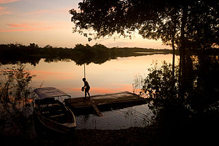
The Juruena River is a 1,240 km (770 mi) long river in west-central Brazil, in the state of Mato Grosso.

Novo Airão is a municipality located in the state of Amazonas in northern Brazil on the Rio Negro River about 180 km upstream of Manaus. Its population was 19,928 (2020) and its area is 37,771 km2. The town is accessible by both river and road.

The Gregório River is a river of Amazonas and Acre states in western Brazil. It is a tributary of Juruá River.
Alalaú River is a river forming part of the border between the Amazonas and Roraima states in north-western Brazil, a tributary of the Jauaperi River.

Aripuanã River is a river in the Mato Grosso and Amazonas states in north-western Brazil. It is a tributary of the Madeira River in the Amazon Basin. The town of Novo Aripuanã is located on its banks where it merges into the Madeira River. The town of Aripuanã is also on its banks, but on the upper (southern) section of the river.
The Biá River is a river of Amazonas state in north-western Brazil. It is a tributary of the Jutaí River.
Camanaú River is a river of Amazonas state in north-western Brazil, a tributary of the Curiuaú River.

Içana River is a tributary of the Rio Negro in South America. Its source is in the Guainía Department of Colombia, where it is known as the Isana River. From its source, it flows mostly east until it reaches the border between Colombia and Brazil, where the river forms a small part of the boundary between the two countries. From the border, it flows mostly southeast through Amazonas state until it joins the Rio Negro at Missão Boa Vista.

The Ipixuna River or Paranápixuna River is a river of Amazonas state in north-western Brazil. It is a tributary of the Purus River. The confluence of these two rivers is at Tapauá.

Jaú River is a river of Amazonas state in north-western Brazil. It is a tributary of the Rio Negro, which itself is a tributary of the Amazon River.

The Jutaí River is a river in Amazonas state in north-western Brazil.
Manicoré River is a river of Amazonas state in north-western Brazil. It is a tributary of the Madeira River and merges into this river about 3 km (1.9 mi) upstream from the town of Manicoré.
The Mutum River is a river of Amazonas state in north-western Brazil. It is a tributary of the Jutaí River.
The Pitinga River is a river of Amazonas state in north-western Brazil. It empties into the Balbina Dam on the Uatumã River.

The Tefé River is a tributary of the Amazon River in Amazonas state in north-western Brazil.

Vaupés River is a tributary of the Rio Negro in South America. It rises in the Guaviare Department of Colombia, flowing east through Guaviare and Vaupés Departments. It forms part of the international border between the Vaupés department of Colombia and the Amazonas state of Brazil. On the border it merges with the Papurí River and becomes known as the Uaupés. In 1847 an explorer saw a rapid which hurled its waves 12 or 15 metres in the air, "as if great subaqueous explosions were taking place." The river continues eastwards through the Alto Rio Negro Indigenous Territory until it flows into the Rio Negro at São Joaquim, Amazonas. Vaupés is a blackwater river.

Urubu River is a river in Amazonas state in north-western Brazil. It is a tributary of the Amazon River, and it branches to the north near the town of Itacoatiara. It is a blackwater river.

The Waimiri Atroari Indigenous Territory is an indigenous territory in the states of Amazonas and Roraima, Brazil. There has been a long history of violent conflict between the indigenous Waimiri-Atroari people and newcomers from other parts of Brazil. Since the 1960s there have been many efforts to "civilise" the Waimiri-Atroari to avoid problems with the BR-174 highway, which cuts across the territory, and with tin mines and the huge Balbina Dam. The territory is now considerably smaller, but there have been improvements in living standards.

The Pitinga mine is an open pit tin mine in Brazil. It is thought to have the largest undeveloped tin deposit in the world. A complete community of 5,000 people was established in the remote location in the Amazon rainforest to support the mining operations, which began in 1982. There have been accidents, but efforts have been made to minimise environmental damage and to restore areas that have been mined. As of 2014 the more accessible alluvial deposits had been exhausted, but mining of primary rock was continuing.

The Caverna do Maroaga Environmental Protection Area is an environmental protection area in the state of Amazonas, Brazil. It contains caves and waterfalls that have tourist potential if the infrastructure were provided.


