Gmina Markowa is a rural gmina in Łańcut County, Subcarpathian Voivodeship, in south-eastern Poland. Its seat is the village of Markowa, which lies approximately 8 kilometres (5 mi) south-east of Łańcut and 22 km (14 mi) east of the regional capital Rzeszów.
Gmina Dubiecko is a rural gmina in Przemyśl County, Subcarpathian Voivodeship, in south-eastern Poland. Its seat is the village of Dubiecko, which lies approximately 28 kilometres (17 mi) west of Przemyśl and 36 km (22 mi) south-east of the regional capital Rzeszów.
Gmina Jawornik Polski is a rural gmina in Przeworsk County, Subcarpathian Voivodeship, in south-eastern Poland. Its seat is the village of Jawornik Polski, which lies approximately 26 kilometres (16 mi) south-west of Przeworsk and 25 km (16 mi) south-east of the regional capital Rzeszów.
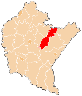
Gmina Kańczuga is an urban-rural gmina in Przeworsk County, Subcarpathian Voivodeship, in south-eastern Poland. Its seat is the town of Kańczuga, which lies approximately 11 kilometres (7 mi) south-west of Przeworsk and 29 km (18 mi) east of the regional capital Rzeszów.

Hadle Kańczuckie is a village in the administrative district of Gmina Jawornik Polski, within Przeworsk County, Subcarpathian Voivodeship, in south-eastern Poland.
Hadle Szklarskie is a village in the administrative district of Gmina Jawornik Polski, within Przeworsk County, Subcarpathian Voivodeship, in south-eastern Poland. It lies approximately 22 kilometres (14 mi) south-west of Przeworsk and 25 km (16 mi) south-east of the regional capital Rzeszów.
Hucisko Jawornickie is a village in the administrative district of Gmina Jawornik Polski, within Przeworsk County, Subcarpathian Voivodeship, in south-eastern Poland. It lies approximately 22 kilometres (14 mi) south-west of Przeworsk and 29 km (18 mi) south-east of the regional capital Rzeszów.
Jawornik-Przedmieście is a village in the administrative district of Gmina Jawornik Polski, within Przeworsk County, Podkarpackie Voivodeship, in south-eastern Poland.
Manasterz is a village in the administrative district of Gmina Jawornik Polski, within Przeworsk County, Subcarpathian Voivodeship, in south-eastern Poland. It lies approximately 10 kilometres (6 mi) north-east of Jawornik Polski, 17 km (11 mi) south-west of Przeworsk, and 28 km (17 mi) east of the regional capital Rzeszów.
Widaczów is a village in the administrative district of Gmina Jawornik Polski, within Przeworsk County, Subcarpathian Voivodeship, in south-eastern Poland. It lies approximately 22 kilometres (14 mi) south-west of Przeworsk and 26 km (16 mi) south-east of the regional capital Rzeszów.
Zagórze is a village in the administrative district of Gmina Jawornik Polski, within Przeworsk County, Subcarpathian Voivodeship, in south-eastern Poland. It lies approximately 10 kilometres (6 mi) north-east of Jawornik Polski, 17 km (11 mi) south-west of Przeworsk, and 28 km (17 mi) east of the regional capital Rzeszów.
Parcelacja Rożniatowska is a village in the administrative district of Gmina Zarzecze, within Przeworsk County, Subcarpathian Voivodeship, in south-eastern Poland. It lies approximately 2 kilometres (1 mi) south-west of Zarzecze, 11 km (7 mi) south of Przeworsk, and 38 km (24 mi) east of the regional capital Rzeszów.
Zarzecze is a village in Przeworsk County, Subcarpathian Voivodeship, in south-eastern Poland. It is the seat of the gmina called Gmina Zarzecze. It lies approximately 10 kilometres (6 mi) south of Przeworsk and 39 km (24 mi) east of the regional capital Rzeszów.
Chodakówka is a village in the administrative district of Gmina Kańczuga, within Przeworsk County, Subcarpathian Voivodeship, in south-eastern Poland. It lies approximately 8 kilometres (5 mi) south-west of Kańczuga, 18 km (11 mi) south-west of Przeworsk, and 24 km (15 mi) east of the regional capital Rzeszów.
Lipnik is a village in the administrative district of Gmina Kańczuga, within Przeworsk County, Subcarpathian Voivodeship, in south-eastern Poland. It lies approximately 8 kilometres (5 mi) west of Kańczuga, 18 km (11 mi) south-west of Przeworsk, and 22 km (14 mi) east of the regional capital Rzeszów.
Łopuszka Wielka is a village in the administrative district of Gmina Kańczuga, within Przeworsk County, Subcarpathian Voivodeship, in south-eastern Poland. It lies approximately 8 kilometres (5 mi) south of Kańczuga, 17 km (11 mi) south-west of Przeworsk, and 31 km (19 mi) east of the regional capital Rzeszów.
Medynia Kańczucka is a village in the administrative district of Gmina Kańczuga, within Przeworsk County, Subcarpathian Voivodeship, in south-eastern Poland. It lies approximately 8 kilometres (5 mi) south of Kańczuga, 18 km (11 mi) south-west of Przeworsk, and 29 km (18 mi) south-east of the regional capital Rzeszów.
Siedleczka is a village in the administrative district of Gmina Kańczuga, within Przeworsk County, Subcarpathian Voivodeship, in south-eastern Poland. It lies approximately 5 kilometres (3 mi) south-west of Kańczuga, 15 km (9 mi) south-west of Przeworsk, and 27 km (17 mi) east of the regional capital Rzeszów.
Sietesz is a village in the administrative district of Gmina Kańczuga, within Przeworsk County, Subcarpathian Voivodeship, in south-eastern Poland. It lies approximately 6 kilometres (4 mi) west of Kańczuga, 16 km (10 mi) south-west of Przeworsk, and 25 km (16 mi) east of the regional capital Rzeszów.
Jawornik is a village in the administrative district of Gmina Komańcza, within Sanok County, Subcarpathian Voivodeship, in south-eastern Poland, close to the border with Slovakia. It lies approximately 3 kilometres (2 mi) north-east of Komańcza, 23 km (14 mi) south of Sanok, and 76 km (47 mi) south of the regional capital Rzeszów.