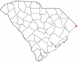
Little River is a census-designated place (CDP) in Horry County, South Carolina, United States. The population was 11,711 at the 2020 census.

Agkistrodon piscivorus is a species of venomous snake, a pit viper in the subfamily Crotalinae of the family Viperidae. It is one of the world's few semiaquatic vipers, and is native to the Southeastern United States. As an adult, it is large and capable of delivering a painful and potentially fatal bite. When threatened, it may respond by coiling its body and displaying its fangs. Individuals may bite when feeling threatened or being handled in any way. It tends to be found in or near water, particularly in slow-moving and shallow lakes, streams, and marshes. It is a capable swimmer, and like several species of snakes, is known to occasionally enter bays and estuaries and swim between barrier islands and the mainland.

Lynches River, named for Thomas Lynch, Jr., signer of the Declaration of Independence, rises in North Carolina near Waxhaw, North Carolina, at about 700 feet (210 m) elevation, flowing only a short distance to the South Carolina border, and thence to join the Great Pee Dee River near Johnsonville. It is about 140 mi (230 km) long and the drainage area is 1,030 square miles (2,700 km2).

The Black River is a tributary of the Cape Fear River, approximately 50 mi (80 km) long, in southeastern North Carolina in the United States.

Goose Creek State Park is a North Carolina state park near Washington, Beaufort County, North Carolina in the United States. It covers 1,672 acres (6.77 km2) just off of Pamlico Sound, in North Carolina's Coastal Plain. Goose Creek State Park is home to a wide variety of wildlife that make their homes in the extensive salt water marshes, inlets and creeks on the northern side of the sound. Goose Creek State Park is open for year-round recreation, east of Washington, two miles (3 km) south of U.S. Route 264 on Camp Leach Road.

Congaree National Park is a 26,692.6-acre American national park in central South Carolina, 18 miles southeast of the state capital, Columbia. The park preserves the largest tract of old growth bottomland hardwood forest left in the United States. The lush trees growing in its floodplain forest are some of the tallest in the eastern United States, forming one of the highest temperate deciduous forest canopies remaining in the world. The Congaree River flows through the park. About 15,000 acres are designated as a wilderness area.

The Etowah River is a 164-mile-long (264 km) waterway that rises northwest of Dahlonega, Georgia, north of Atlanta. On Matthew Carey's 1795 map the river was labeled "High Town River". On later maps, such as the 1839 Cass County map, it was referred to as "Hightower River", a name that was used in most early Cherokee records.

Lake Waccamaw is a fresh water lake located in Columbus County in North Carolina. It is the largest of the natural Carolina Bay lakes. Although bay trees are present within many Carolina Bays, the term "bay" does not refer to the trees but comes instead from an early science publication by Glenn (1895), who used the word "bay" to refer to these features near the town of Darlington, South Carolina. Lake Waccamaw is fed by four creeks: First, Second, Third, and Big creeks. The outlet forms the Waccamaw River which flows south-southwest to empty into the Atlantic Ocean near Georgetown, South Carolina

The Little Pee Dee River is a 116-mile-long (187 km) tributary of the Pee Dee River. The Little Pee Dee technically arises near Laurinburg, North Carolina as Gum Swamp, which flows southward, receiving several small tributaries, across the South Carolina border into Red Bluff Lake, near McColl, South Carolina. The lake is at an elevation of 135 feet (41 m) above sea level, and from the outlet of the lake, the flow is called the Little Pee Dee River. The Little Pee Dee River is named after the Pee Dee Indian Tribe. Today, the tribe still occupies some of the land, although the tribe only consists of just over 200 enrolled members.

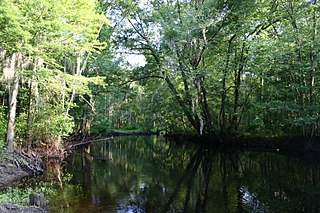
A blackwater river is a type of river with a slow-moving channel flowing through forested swamps or wetlands. Most major blackwater rivers are in the Amazon Basin and the Southern United States. The term is used in fluvial studies, geology, geography, ecology, and biology. Not all dark rivers are blackwater in that technical sense. Some rivers in temperate regions, which drain or flow through areas of dark black loam, are simply black due to the color of the soil; these rivers are black mud rivers. There are also black mud estuaries.

The Lumber River, sometimes referred to as the Lumbee River, is a 133-mile-long (214 km) river in south-central North Carolina in the flat Coastal Plain. European settlers first called the river Drowning Creek, which is still used as the name of its headwater. The waterway known as the Lumber River extends downstream from the Scotland County-Hoke County border to the North Carolina-South Carolina border. Soon after crossing into South Carolina, the Lumber River flows into the Little Pee Dee River, which flows into the Pee Dee River, or Great Pee Dee River. Finally, the combined waters flow into Winyah Bay and the Atlantic Ocean.
Dorchester was a town in the Province of South Carolina. Situated on the Ashley River about 18 miles (29 km) from Charleston, it was founded in February 1696 by followers of Reverend Joseph Lord from Dorchester, Massachusetts.

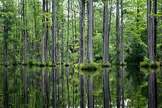
Cypress Gardens is a 170-acre (69 ha) preserve and gardens located at 3030 Cypress Gardens Road, Moncks Corner, South Carolina, United States. The centerpiece of the garden is the 80 acres (32 ha) blackwater bald cypress/tupelo swamp, surrounded with both boat and foot trails.
The Salkehatchie River originates near the City of Barnwell, South Carolina and accepts drainage from Turkey Creek and Whippy Swamp before merging with the Little Salkehatchie River to form the Combahee River Basin, which empties into Saint Helena Sound and the Atlantic Ocean. Prior to the confluence, the Little Salkehatchie River accepts drainage from Lemon Creek, Buckhead Creek, and Willow Swamp.

Cape Fear is a coastal plain and Tidewater region of North Carolina centered about the city of Wilmington. The region takes its name from the adjacent Cape Fear headland, as does the Cape Fear River which flows through the region and empties into the Atlantic Ocean near the cape. Much of the region's populated areas are found along the Atlantic beaches and the Atlantic Intracoastal Waterway, while the rural areas are dominated by farms and swampland like that of the Green Swamp. The general area can be also identified by the titles "Lower Cape Fear", "Wilmington, NC Metropolitan Statistical Area", "Southeastern North Carolina", and "Azalea Coast". The latter name is derived from the North Carolina Azalea Festival held annually in Wilmington. Municipalities in the area belong to the Cape Fear Council of Governments.

Highland Creek is a river in the Scarborough district of Toronto, Ontario, emptying into Lake Ontario at the eastern end of the Scarborough Bluffs. It is home to several species of fish including trout, carp, bass and salmon. It is a meandering river which, like most rivers in Toronto, travels through a glacial ravine formed after the last Ice Age. The Highland Creek watershed, including tributaries, is almost entirely contained within Scarborough.

The Grose River, a perennial river that is part of the Hawkesbury-Nepean catchment, is located in the Blue Mountains region of New South Wales, Australia.

The brown water snake is a large species of nonvenomous natricine snake endemic to the southeastern United States. This snake is often one of the most abundant species of snakes found in rivers and streams of the southeastern United States, yet many aspects of its natural history is poorly known. Due to abundance and distribution throughout its biological range, this species could be used to investigate anthropogenic impacts on aquatic ecosystems by studying their movements.

The Ashepoo Combahee Edisto Basin National Estuarine Research Reserve is a 140,000-acre (570 km2) reserve area located in the ACE Basin, one of the largest undeveloped estuaries on the Atlantic coast of the United States. It is named for the Ashepoo, Combahee and Edisto Rivers, which flow past cypress swamps, historic plantation houses, old rice fields and tidal marshes to meet at South Carolina's biologically rich St. Helena Sound.


