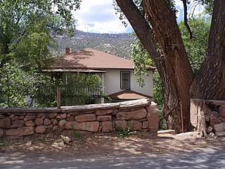
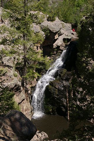
Jemez Springs is a village in Sandoval County, New Mexico, United States. The population was 250 at the 2010 census. Named for the nearby Pueblo of Jemez, the village is the site of Jemez State Monument and the headquarters of the Jemez Ranger District. The village and nearby locations in the Jemez Valley are the site of hot springs and several religious retreats.

The Valles Caldera is a 13.7-mile (22.0 km) wide volcanic caldera in the Jemez Mountains of northern New Mexico. Hot springs, streams, fumaroles, natural gas seeps, and volcanic domes dot the caldera landscape. The highest point in the caldera is Redondo Peak, an 11,254-foot (3,430 m) resurgent lava dome located entirely within the caldera and surrounded by moat-like flows of rhyolitic solidified lavas.Located within the caldera are several grass valleys, or valles, the largest of which is Valle Grande, the only one accessible by a paved road. In 1975, Valles Caldera was designated as a National Natural Landmark by the National Park Service with much of the caldera being within the Valles Caldera National Preserve, a unit of the National Park System. The area has a varied history involving cultural significance, economic resources, scientific studies, and complex geological setting.
The Jemez Mountains are a group of mountains in Rio Arriba, Sandoval, and Los Alamos counties, New Mexico, United States.
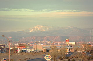
Chicoma Mountain is the highest point in the Jemez Mountains, a prominent mountain range in the U.S. State of New Mexico. The tree line in this area is exceptionally high, and the mountain is forested almost all the way to its summit which is conspicuous from the towns of Los Alamos, Santa Fe, and Española and other areas in the valley of the Rio Grande in northern New Mexico. Like the rest of the Jemez, it is of volcanic origin; it lies on the northeast rim of the Valles Caldera, one of the best examples of a caldera in the United States.
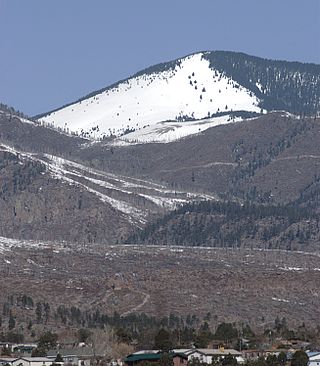
Redondo Peak is a conspicuous summit in the Jemez Mountains of New Mexico, in the southwestern United States. It is located entirely within the Valles Caldera National Preserve. It is the second highest summit in the Jemez after Chicoma Mountain. It is the most visually prominent peak in the range when viewed from the south, for example, from Albuquerque. From many other directions it is less prominent or not visible, due to its location in the center of the Valles Caldera, well away from the caldera's rim.
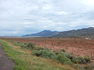
The Sierra Nacimiento, or Nacimiento Mountains, are a mountain range in the northwestern part of the U.S. state of New Mexico. They are just west of the more prominent Jemez Mountains near the town of Cuba, and are separated from them by the Río Guadalupe and the Río de Las Vacas. This article will consider them as a unit together with the San Pedro Mountains, which are a smaller range contiguous with the Sierra Nacimiento on the north, and which are also part of the Nacimiento Uplift and lie at the edge of the greater San Juan Basin, which sits atop the Colorado Plateau. The combined range runs almost due north-south with a length of about 40 mi (65 km). The highest point in the combined range is the high point of the San Pedro Peaks, known unofficially as San Pedro Peak, 10,605 ft.
Jemez or Jémez may refer to
The Santa Fe National Forest is a protected national forest in northern New Mexico in the Southwestern United States. It was established in 1915 and covers 1,558,452 acres (6,306.83 km2). Elevations range from 5,300 feet (1600 m) to 13,103 feet (4000 m) at the summit of Truchas Peak, located within the Pecos Wilderness. The Jemez, Coyote, and Cuba districts are located in the Jemez Mountains; the Pecos/Las Vegas district is located in the Sangre de Cristo Mountains; and the Española district is located in both mountain ranges. In descending order of land area the forest lies in parts of Rio Arriba, San Miguel, Sandoval, Santa Fe, Mora, and Los Alamos counties. Forest headquarters are located in the city of Santa Fe.
The Jemez Mountains salamander is a species of salamander in the family Plethodontidae endemic to New Mexico in the United States. Its natural habitat is temperate forests. It is threatened by habitat loss, is in rapid decline, and was placed on the IUCN Red List in 2013.
New Mexico State Road 4 (NM 4) is a 67.946-mile-long (109.348 km) state highway in Sandoval, Los Alamos, and Santa Fe counties in New Mexico, United States. It is significant as the main access route connecting the remote town of Los Alamos, Los Alamos National Laboratory, and Bandelier National Monument to other, more major highways in New Mexico.

New Mexico State Road 126 (NM 126) is a 39.654-mile-long (63.817 km) state highway in New Mexico, United States. NM 126's western terminus is in the small town of Cuba, at U.S. Route 550 (US 550). The route passes through the Nacimiento Mountains and Jemez Mountains, along the southern boundary of the San Pedro Parks Wilderness, then descends past Fenton Lake to the small, unincorporated community of La Cueva, where it ends at NM 4.

The Jemez Lineament is a chain of late Cenozoic volcanic fields, 800 kilometers (500 mi) long, reaching from the Springerville and White Mountains volcanic fields in East-Central Arizona to the Raton-Clayton volcanic field in Northeastern New Mexico.
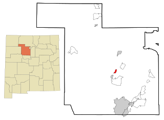
Jemez Pueblo is a census-designated place (CDP) in Sandoval County, New Mexico, United States. The population was 1,963 at the 2020 census. It is part of the Albuquerque Metropolitan Statistical Area.

The Jemez River is a tributary of the Rio Grande in eastern Sandoval County, New Mexico, United States.

The Las Conchas Fire was a large wildfire in the state of New Mexico, in the United States, in 2011. The fire started in Santa Fe National Forest and burned more than 150,000 acres, threatening Los Alamos National Laboratory and the town of Los Alamos. After five days of burning, it became the largest wildfire in New Mexico state history at the time. It was surpassed in 2012 by the much larger Whitewater-Baldy Complex Fire and in 2022 by the Calf Canyon/Hermits Peak Fire and the Black Fire making the Las Conchas Fire the fourth-largest fire in New Mexico's recorded history.

Jemez Canyon Dam is a dam in Sandoval County, New Mexico, in the United States, a few miles north of Albuquerque.

The Madera Group is a group of geologic formations in northern New Mexico. Its fossil assemblage dates the formation to the middle to late Pennsylvanian period.

The Tewa Group is a group of geologic formations exposed in and around the Jemez Mountains of northern New Mexico. Radiometric dating gives it an age of 1.85 million to 72 thousand years, corresponding to the Pleistocene epoch.