The Akashi Kaikyo Bridge is a suspension bridge which links the city of Kobe on the Japanese island of Honshu to Iwaya on Awaji Island. It is part of the Kobe-Awaji-Naruto Expressway, and crosses the busy and turbulent Akashi Strait. It was completed in 1998, and at the time, was the longest central span of any suspension bridge in the world, at 1,991 metres (6,532 ft). Currently, it is the second-longest, behind the 1915 Çanakkale Bridge that was opened in March 2022.

The Goethals Bridge is the name of a pair of cable-stayed bridge spans connecting Elizabeth, New Jersey, to Staten Island, New York, in the United States. The spans cross a strait known as Arthur Kill, and replaced a cantilever bridge span built in 1928. The bridge is operated by the Port Authority of New York and New Jersey.

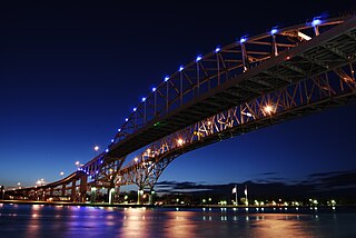
The Blue Water Bridge is a twin-span international bridge across the St. Clair River that links Port Huron, Michigan, United States, and Point Edward, Ontario, Canada. The Blue Water Bridge connects Highway 402 in Ontario with both Interstate 69 (I-69) and Interstate 94 (I-94) in Michigan.

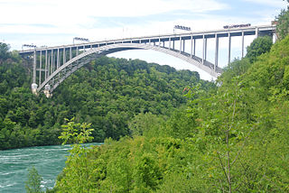
The Lewiston–Queenston Bridge, also known as the Queenston–Lewiston Bridge, is an arch bridge that crosses the Niagara River gorge just south of the Niagara Escarpment. The bridge was officially opened on November 1, 1962. It is an international bridge between the United States and Canada. It connects Interstate 190 in the town of Lewiston, New York to Highway 405 in the community of Queenston, Ontario. The Lewiston–Queenston Bridge is a twin of the Rainbow Bridge at Niagara Falls and designed by Richard Lee.

The Royal Alexandra Interprovincial Bridge, also known as the Alexandra Bridge or Interprovincial Bridge, is a steel truss cantilever bridge spanning the Ottawa River between Ottawa, Ontario and Gatineau, Quebec. In addition to carrying vehicle traffic, a shared use pathway on the bridge for pedestrians and cyclists is maintained by the National Capital Commission.

The Vasco da Gama Bridge is a cable-stayed bridge flanked by viaducts that spans the Tagus River in Parque das Nações in Lisbon, the capital of Portugal.
Route 2 is a major provincial highway in the Canadian province of New Brunswick, carrying the main route of the Trans-Canada Highway in the province. The highway connects with Autoroute 85 at the border with Quebec and Highway 104 at the border with Nova Scotia, as well as with traffic from Interstate 95 in the U.S. state of Maine via the short Route 95 connector. A core route in the National Highway System, Route 2 is a four-lane freeway in its entirety, and directly serves the cities of Edmundston, Fredericton, and Moncton.

The Seven Mile Bridge is a bridge in the Florida Keys, in Monroe County, Florida, United States. It connects Knight's Key in the Middle Keys to Little Duck Key in the Lower Keys. Among the longest bridges in existence when it was built, it is part of the Overseas Highway in the Keys, which is part of the 2,369-mile (3,813 km) U.S. Route 1.

The George P. Coleman Memorial Bridge is a double swing bridge that spans the York River between Yorktown and Gloucester Point, in the United States state of Virginia. It connects the Peninsula and Middle Peninsula regions of Tidewater, Virginia. The bridge is the only public crossing of the York River, though State Route 33 crosses both of its tributaries just upriver of their confluence at West Point.

The Carquinez Bridge is a pair of parallel bridges spanning the Carquinez Strait at the northeastern end of San Francisco Bay. They form the part of Interstate 80 between Crockett and Vallejo, California, United States.

The Granville Street Bridge or Granville Bridge is an eight-lane fixed cantilever/truss bridge in Vancouver, British Columbia, Canada, carrying Granville Street between Downtown Vancouver southwest and the Fairview neighborhood. It spans False Creek and is 27.4 m (90 ft) above Granville Island. The bridge is part of Highway 99.
The Saint John River High Level Crossing is a steel girder bridge crossing the Saint John River at Coytown, New Brunswick, Canada.

An extradosed bridge employs a structure that combines the main elements of both a prestressed box girder bridge and a cable-stayed bridge. The name comes from the word extrados, the exterior or upper curve of an arch, and refers to how the "stay cables" on an extradosed bridge are not considered as such in the design, but are instead treated as external prestressing tendons deviating upward from the deck. In this concept, they remain part of the main bridge superstructure.

The Sea Cliff Bridge, together with the adjoining Lawrence Hargrave Drive Bridge, are two road bridges that carry the scenic Lawrence Hargrave Drive across the rockface on the Illawarra escarpment, located in the northern Illawarra region of New South Wales, Australia. The balanced cantilever and incremental launching girder bridges link the coastal villages of Coalcliff and Clifton and carry two lanes of traffic, and a pedestrian walkway.

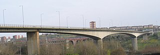
The Redheugh Bridge is a road bridge spanning the River Tyne west of Newcastle upon Tyne city centre on the north bank and Gateshead town centre on the south bank, in North East England. It currently carries the A189 road.

The Third Avenue Bridge carries southbound road traffic on Third Avenue over the Harlem River, connecting the boroughs of Manhattan and the Bronx in New York City. It once carried southbound New York State Route 1A. The Third Avenue Bridge carries traffic south from the intersections of either Third Avenue and East 135th Street, or Bruckner Boulevard and Lincoln Avenue, in the Bronx. On the Manhattan side, the bridge funnels traffic into three locations: East 128th Street; the intersection of East 129th Street and Lexington Avenue; or the southbound Harlem River Drive in Manhattan.
Route 105 is a collector highway in New Brunswick running from Route 10 in Youngs Cove to Route 108 in Grand Falls, mostly along the east and north banks of the Saint John River, over a distance of 307.0 kilometres (190.8 mi). Route 105 consists largely of former alignments of Route 2 and runs parallel to Route 2 over its entire length.

The Mount Henry Bridge carries the Kwinana Freeway and Mandurah railway line over the Canning River in Perth, approximately 10 kilometres (6.2 mi) south of the Perth central business district. At 688 metres (2,257 ft) in length including abutments, it is the longest road bridge in Western Australia. It spans the river between the Mount Henry Peninsula and the suburb of Mount Pleasant.

The Parkersburg–Belpre Bridge is a four-lane cantilever bridge that connects Parkersburg, West Virginia, to Belpre, Ohio, across the Ohio River. The bridge was completed in 1980. The bridge had been signed U.S. Route 50 (US 50) until June 13, 2008, when that highway was re-routed to the Blennerhassett Island Bridge a few miles to the west, as part of the completion of the Corridor D project around Parkersburg. The American Discovery Trail uses the bridge to cross the Ohio River.


