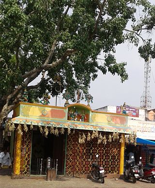
Chikmagalur, officially Chikkamagaluru is an administrative district in the Malnad subregion of Karnataka, India. Coffee was first cultivated in India in Chikmagalur. The hills of Chikmagalur are parts of the Western Ghats and the source of Tunga and Bhadra rivers. Mullayanagiri, the highest peak in Karnataka is located in the district. The area is well known for the Sringeri Mutt that houses the Dakshina Peeta established by Adi Shankaracharya.

Bagalkot district, is an administrative district in the Indian state of Karnataka. The district headquarters is located in the town of Bagalkot. The district is located in northern Karnataka and borders Belgaum, Gadag, Koppal, Raichur and Bijapur. The new Bagalkot district was carved out of Vijayapura in 1997 via Government of Karnataka directive Notification RD 42 LRD 87 Part III. The bifurcated Bagalkot district consists of ten taluks — Badami, Bagalkot, Bilagi, Guledgudda, Rabkavi Banhatti, Hunagund, Ilkal, Jamakhandi and Mudhol, Teradal.

Kalaburagi district, formerly known as Gulbarga district, is one of the 31 districts of Karnataka state in southern India. Kalaburagi city is the administrative headquarters of the district. The district is the headquarters of Kalaburagi division.

Somwarpet is a panchayat town in Kodagu district in the Indian state of Karnataka. It is the main town of the Somwarpet taluk, in the north-east of the district. 2nd highest Administrative town in Karnataka in terms of elevation. The main crops grown in the area are coffee and spice crops such as cardamom, peppers, oranges, ginger and vegetables.
Nyamati is taluk place located in Davangere District of the Karnataka state, India. It is approximately 65 km south of Davangere and 26 km north of Shivamogga.

Hungund or Hunagunda is a taluk in the northern district of Bagalkot in Karnataka, India. Major towns in the taluk are Amingad, Hunagunda. Kudalasangama, where the social reformist Basavanna died, is located in the taluk. Hunagunda Taluk also contains Aihole and Pattadkal which were once under the rule of Chalukyas of Badami. Amingad is known for Amingad karadantu, a sweet dish.

Kanakapura is a city in the Ramanagara district of Karnataka on the banks of the Arkavathi river and the administrative center of the taluk of the same name. Its founder is Shrihan Kanaka Sigmanath, hence its name. Kanakapura is largest cocoon silk producer in India. River Cauvery flows around 21 km in Kanakapura Taluk.Previously belonged to Bangalore Rural District. It was formerly the largest constituency in the country. (1,553 km2 [600 sq mi]). It is located among the lush green forests of the state of Karnataka. The town is infamous with the traffic of Kanakpura Road in Benglaluru, one of the most narrow and traffic-prone roads of the state. The town is a tourism hotspot and an often visited tourist favorite in the entire state of Karnataka, as it has something for everyone ranging from avid trekkers to history buffs and wildlife enthusiasts. The forest area in this taluk is very wide and about half of the Bannerghatta National Park is located in our Kanakapura area. Kodihalli wildlife range and harohalli wildlife range its division. The Kaveri Wildlife Sanctuary consists of two main zones namely the Sangam Wildlife range, the Muggur Wildlife range.
Afzalpur is a panchayat town in Kalaburagi district in the Indian state of Karnataka. It is also the headquarters of the Afzalpur taluk.
Chikkanayakanahalli is a town in Tiptur sub-division of Tumakuru district, in the state of Karnataka, India. It is 30 km away from Tiptur and 132 km from Bangalore.
Chitapur or Chittapur is a town and taluk in Kalaburagi district in the state of Karnataka, India. It is also the headquarters of the Chittapur taluk. It is known for polished stones and toor dal.
Honnāli is a town and a taluk headquarter in Davanagere district in the Indian state of Karnataka. Its name is derived from honnarali, which means "Blossom of gold".
Hukkeri is a Town Municipal Council and taluka in Belgavi district in the Indian state of Karnataka.
Kushtagi is a panchayat town in Koppal district in the Indian state of Karnataka. Kushtagi is a taluk center of Koppal district. This taluk has a population of 353,142 as per the 2021 census estimate. In this taluk, pomegranate fruits are popularly grown.There is a Durga devi temple in heart of the town. To its North lies Ilkal, Gajendragad to the West, Hospet to the South and Sindhanur to the East. Red and black soil can be found in this taluk. A big lake 4kms away from the city is the main source of drinking water is situated in west side and covering the area of more than 300 acres.
Shiggaon is a municipal town in Haveri district in the Indian state of Karnataka.
Siruguppa is a town and headquarters of the Siruguppa taluk and second largest city in Ballari district after Hospete carved out of Ballari district of Indian state of Karnataka.
Tarikere is a town, a taluk and is one of the two Subdivisional headquarter in the Chikmagalur district of Karnataka state, India. It is popularly known as gateway of Malnad because the Malnad area starts from here. The town's name is derived from the number of water tanks which surround it.
Shikaripur or Shikaripura is a major town in Shimoga district in the Indian state of Karnataka. It is the headquarters of Shikaripur taluk and is known as the land of shivasharanas.
Kabbur is a town in the southern state of Karnataka, India. It is located in the Chikodi taluk of Belgaum district in Karnataka.
Achatnahalli is a village in the Kolar taluk of the southern state of Karnataka, India and within the Division of Bangalore. As of the 2011 Indian Census, the village included a total population of 520 people consisting of 266 females and 254 males. The census also noted the village held a total of 129 households.
Zalaki is a village in the southern state of Karnataka, India. It is located in the Chadachan Taluk of Vijayapur district, Karnataka.


