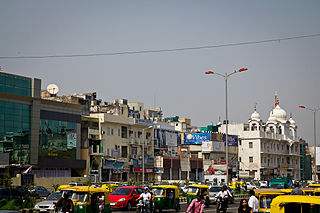
Sarai, Serai, or Saraj may refer to:

Mehrauli is a neighbourhood in South Delhi, Delhi, India. It represents a constituency in the legislative assembly of Delhi. The area is close to Gurugram and next to Vasant Kunj.
Ber Sarai is a small neighbourhood located between Jawaharlal Nehru University (JNU) and IIT Delhi in the South West district of Delhi, India.

Saharanpur district is the northernmost of the districts of Uttar Pradesh state, India. Bordering the states of Haryana, Himachal Pradesh and Uttarakhand, and close to the foothills of Shivalik range, it lies in the northern part of the Doab region.

Dadri is a town and a municipal board in Gautam Buddha Nagar District in the state of Uttar Pradesh, India. Noida, Dadri and Jewar are the 3 sub-divisions of GB Nagar district, each headed by a SDM.

South Delhi is an administrative district of the National Capital Territory of Delhi in India with its headquarters in Saket. Administratively, the district is divided into three subdivisions, Saket, Hauz Khas, and Mehrauli. It is bounded by the Yamuna River to the east, the districts of New Delhi to the north, Faridabad district of Haryana to the southeast, Gurgaon District of Haryana to the southwest, and South West Delhi to the west.

Delhi Sarai Rohilla railway station is situated about 4 kilometres from old Delhi railway junction in India. It is managed by Delhi Division of Northern Railway zone. Many trains from Delhi to Haryana, Jammu and Kashmir, Punjab, Rajasthan, Karnataka, Gujarat and Maharashtra stop at this station. More than twenty trains including Duronto and AC trains originate at this station.

Sri Aurobindo Marg or Aurobindo Marg, is an important South Delhi north-south arterial road connecting historic Safdarjung's Tomb to Qutab Minar. The road is named for Sri Aurobindo Ghosh; the Delhi campus of Sri Aurobindo Ashram is located on the road. The road was originally known as Mehrauli Road.
Karol Bagh Lok Sabha constituency was a Lok Sabha (parliamentary) constituency in the Indian National Capital Territory of Delhi. This constituency came into existence in 1961. It was abolished after the recommendations of the Delimitation Commission were approved by the presidential notification on 19 February 2008. This constituency was reserved for the candidates belonging to the scheduled castes.

The Centre for the Study of Developing Societies (CSDS) is an Indian research institute for social sciences and humanities. It was founded in 1963 by Rajni Kothari and is largely funded by the Indian Council of Social Science Research. It is located in New Delhi, close to Delhi University.
Hauz Khas is a neighborhood in South Delhi, its heart being the historic Hauz Khas Complex. Well known in medieval times, the Hauz Khas village has buildings built around the reservoir. There are remnants of Islamic architecture roughly colored by splotches of urban culture. It is centrally located and offers both rural Hauz Khas Village and urban Hauz Khas Enclave, Market environments. Hauz Khas is surrounded by Green Park, SDA to the west, Gulmohar Park towards the north, Sarvapriya Vihar towards the south and Asiad Village and Siri Fort to the east.
Kaatermu is a village in Alutaguse Parish, Ida-Viru County in northeastern Estonia.
Abhaypura is a village in Nawa tehsil of Didwana Kuchaman District of Rajasthan state in India, named after Maharaja Abhay Singh of Marwar. It was one of the 40 villages in the Princely State Abhaypura which was half of Maroth state and was founded around 1683 AD by Maharaja Bijay Singh, third son of Maharaja Raghunath Singh Mertia of Panch Mahal Maroth. Later, after a treaty in 1820 AD it became a Thikana of Marwar and is now called as Thikana Jiliya and has 14 villages, as the rest of the villages were given as appanages or jagirs to younger brothers.
Ghonda is an affluent residential area located in the North East Delhi Legislative Assembly district.

The College of Vocational Studies (CVS) is a constituent college of the University of Delhi. It is a co-educational college founded in 1972 with emphasis on vocational education as well as honours courses to bridge the gap between traditional university education, through courses in French, German and Spanish languages, Post Graduate Diploma in Tourism and Post Graduate Diploma in Book Publishing. It is well versed in the traditional course as well. Courses like Bachelor of Management Studies Honours, History Honours, English Honours, Economics Honours, Computer Science Honours, etc. are also being offered at the college.
Gambhirban is a small village in Rani Ki Sarai block, Azamgarh district, Uttar Pradesh, India. It is located about 10 kilometres (6.2 mi) from the city of Azamgarh, near a large pond called Baraila Taal. It is situated near the village of Kanaila Chakrapanipur, home of Rahul Sankrityayan, a Hindi/Sanskrit scholar.
Sarai Jagannath is a village located roughly 1 km south of Bilsuri. It is Gram Panchayat in Sikandrabad Block, Sikandrabad Tehsil in Bulandshahr District of the Indian state of Uttar Pradesh.
Katwaria Sarai is a small neighborhood in the south of New Delhi. It is one of the three villages, along with Ber Sarai and Jia Sarai, bordering the Indian Institute of Technology (IIT).

COMM-IT Career Academy is an educational institution which grants bachelor's degree in Computer Applications. It is situated in Awadh Bhawan FC-31, Institutional Area, Sheikh Sarai-II, New Delhi, India. It has a campus spread over one acre of land. The college is affiliated to Guru Gobind Singh Indraprastha University under the name of COMM-IT Career Academy.

Sarai Chhatardhari is a village in Shivgarh block of Rae Bareli district, Uttar Pradesh, India. As of 2011, its population is 1,932, in 351 households. It has one primary school and no healthcare facilities.


