
A postal code is a series of letters or digits or both, sometimes including spaces or punctuation, included in a postal address for the purpose of sorting mail.

A ZIP Code is a system of postal codes used by the United States Postal Service (USPS). The term ZIP was chosen to suggest that the mail travels more efficiently and quickly when senders use the code in the postal address.

Postal codes used in the United Kingdom, British Overseas Territories and Crown dependencies are known as postcodes. They are alphanumeric and were adopted nationally between 11 October 1959 and 1974, having been devised by the General Post Office. A full postcode is known as a "postcode unit" and designates an area with several addresses or a single major delivery point.

An IATA airport code, also known as an IATA location identifier, IATA station code, or simply a location identifier, is a three-letter geocode designating many airports and metropolitan areas around the world, defined by the International Air Transport Association (IATA). The characters prominently displayed on baggage tags attached at airport check-in desks are an example of a way these codes are used.
ISO 3166-2:US is the entry for the United States in ISO 3166-2, part of the ISO 3166 standard published by the International Organization for Standardization (ISO), which defines codes for the names of the principal subdivisions of all countries coded in ISO 3166-1.

A Canadian postal code is a six-character string that forms part of a postal address in Canada. Like British, Irish and Dutch postcodes, Canada's postal codes are alphanumeric. They are in the format A1A 1A1, where A is a letter and 1 is a digit, with a space separating the third and fourth characters. As of October 2019, there were 876,445 postal codes using Forward Sortation Areas from A0A in Newfoundland to Y1A in Yukon.

Turkey is divided into 81 provinces. Each province is divided into a number of districts. Each provincial government is seated in the central district. For non-metropolitan municipality designated provinces, the central district bears the name of the province. In the Ottoman Empire, the corresponding unit was the vilayet.
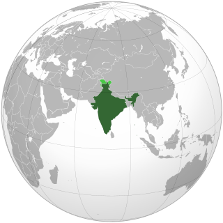
A Postal Index Number refers to a six-digit code in the Indian postal code system used by India Post. On 15 August 2022, the PIN system celebrated its 50th anniversary.
GSS codes are nine-character geocodes maintained by the United Kingdom's Office for National Statistics (ONS) to represent a wide range of geographical areas of the UK, for use in tabulating census and other statistical data. GSS refers to the Government Statistical Service of which ONS is part.

Hungary is subdivided administratively into 19 counties and the capital city (főváros) Budapest. The counties are further subdivided into 174 districts. The capital Budapest is subdivided into 23 districts.

Vehicles registered in Slovakia were generally assigned to one of the districts (okres) and from 1997 until 2022, the license plate coding generally consisted of seven characters and takes the form XX-NNNLL, where XX was a two letter code corresponding to the district, NNN was a three digit number and LL were two additional letters.
Vehicle registration plates are mandatory alphanumeric plates used to display the registration mark of a vehicle registered in Germany. They have existed in the country since 1906, with the current system in use since 1956. German registration plates are alphanumeric plates in a standardized format, issued officially by the district authorities.
The Official Municipality Key, formerly also known as the Official Municipality Characteristic Number or Municipality Code Number, is a number sequence for the identification of politically independent municipalities or unincorporated areas. Other classifications for the identification of areas include postal codes, NUTS codes or FIPS codes.

All motorised road vehicles in India are tagged with a registration or licence number. The Vehicle registration plate is issued by a Regional Transport Office (RTO) — the district-level authority on road matters in the respective state or Union Territory. The number plates are mandatory on both front and rear of the vehicle and are required to be in modern arabic numerals with latin letters. Complete specification of registration plates are specified under the HSRP: High Security Registration Plate rules.
Ubigeo is the coding system for geographical locations in Peru used by the National Statistics and Computing Institute to code the first-level administrative subdivision: regions, the second-level administrative subdivision: provinces and the third-level administrative subdivision: districts. There are 1874 different ubigeos in Peru.
Telephone numbers in India are administered under the National Numbering Plan of 2003 by the Department of Telecommunications of the Government of India. The numbering plan was last updated in 2015. The country code "91" was assigned to India by the International Telecommunication Union in the 1960s.

Postal codes in Austria were introduced in 1966. known locally as 'Postleitzahlen' are a fundamental aspect of the nation's logistical infrastructure, providing a systematic means of organizing mail delivery and geographical categorization. The term 'Postleitzahlen' translates to 'postal codes' in English.
Postal codes in Hungary are four-digit numeric postcodes administered by Magyar Posta, the postal service of Hungary. The current system was introduced on 1 January 1973.
The administrative divisions of Ohio are counties, municipalities, townships, special districts, and school districts.


