
The Westgate Hotel, Commercial Street, Newport, Wales is a hotel building dating from the 19th century. On 4 November 1839 the hotel saw the major scenes of the Newport Rising, when 3,000 Chartists, some of them armed, led by John Frost marched on Newport to attempt to secure the release of five of their number who were being held under arrest at the hotel. In the fighting between about 60 soldiers of the 45th Regiment of Foot and police on one side, and a larger number of Chartists on the other, 10-22 Chartists were killed and more than 50 wounded. The hotel is a Grade II listed building.

John Frost was a prominent leader of the British Chartist movement in the Newport Rising.

Cwmbran is a town in the county borough of Torfaen in South Wales.

Newport is a city and county borough in Wales, situated on the River Usk close to its confluence with the Severn Estuary, 12 mi (19 km) northeast of Cardiff. The population grew considerably between the 2011 and the 2021 census, rising from 145,700 to 159,587, the largest growth of any unitary authority in Wales. Newport is the third-largest principal authority with city status in Wales, and sixth most populous overall. Newport became a unitary authority in 1996 and forms part of the Cardiff-Newport metropolitan area, and the Cardiff Capital Region.

Newport City Council is the governing body for Newport, one of the principal areas of Wales. It consists of 51 councillors, who represent the city's 20 wards.
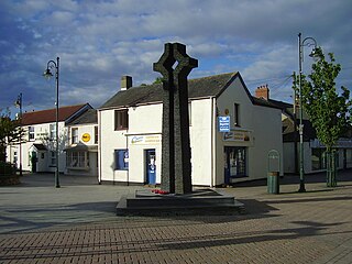
Caldicot is a market town and community in Monmouthshire, Wales. The town is located between Chepstow and the city of Newport. The site adjoins the Caldicot Levels, on the north side of the Severn Estuary. The population of the built-up area was around 11,000. It has a large school, Caldicot School, and is known for its medieval castle. The built-up area includes Portskewett. Caldicot had a population of 9,604 in 2011.
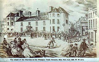
The Newport Rising was the last large-scale armed rising in Wales, by Chartists whose demands included democracy and the right to vote with a secret ballot.

Llanmartin is a village and parish in the city of Newport, Wales.

Newport Unlimited was a Welsh Urban Regeneration Company created in 2003 to help counter the impacts of decline in Newport's heavy industry and manufacturing. It was initially given a 10-year lifespan.
Maesglas or Maes-glas is a neighbourhood in the south west of the city of Newport, South Wales. In the 16th century it was recorded as Greenfield but the Welsh language name Maesglas has remained the more widely used, among English speakers.

The Kingsway Shopping Centre is an under-cover shopping centre in Newport city centre, Wales. The northern pedestrian entrance is on John Frost Square adjoining the Friars Walk shopping and leisure complex. The east pedestrian entrance is off Commercial Street. The west pedestrian entrance is on Emlyn Street. The centre is a short walk from the high street shops of Commercial Street and High Street. Newport railway station is also a short walk away.
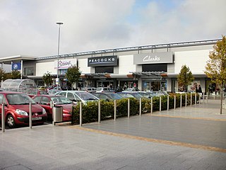
Newport Retail and Leisure Park is an out-of-town shopping centre in the city of Newport. The centre opened in January 1996, South East Wales. It is located in the Lliswerry area of the city and is accessed via the Southern Distributor Road.

Newport Museum and Art Gallery is a museum, library and art gallery in the city of Newport, South Wales. It is located in Newport city centre on John Frost Square and is adjoined to the Kingsway Shopping Centre.

Newport city centre is traditionally regarded as the area of Newport, Wales bounded by the west bank of the River Usk, the George Street Bridge, the eastern flank of Stow Hill and the South Wales Main Line. Most of the city centre is contained within two conservation areas: the central area and the area around Lower Dock Street. Most of the city centre is located in the Stow Hill district.
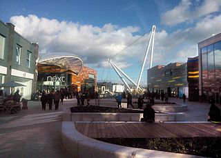
Friars Walk is a partially under-cover shopping centre and leisure complex in Newport city centre, South Wales. It has several levels and includes a range of high street shops, eateries, a cinema, a bowling alley and a soft play area.

Newport Central bus station is a bus terminus and interchange located in the city centre, Newport, South Wales. It is the largest road transport hub for public services in the county. It is situated on the Newport Market site and the adjacent Friars Walk site.

The Shire Hall, Monmouth, Wales, is a prominent building on Agincourt Square in the town centre. It was built in 1724, and was formerly the centre for the Assize Courts and Quarter Sessions for Monmouthshire. The building was also used as a market place. In 1839–40, the court was the location of the trial of the Chartist leader John Frost and others for high treason for their part in the Newport Rising.
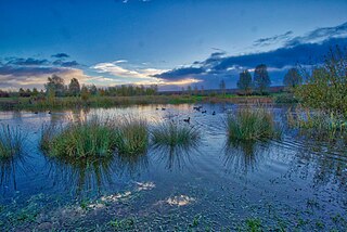
Glan Llyn is a mixed-use community development south-east of Newport, South Wales, at the western end of the former Llanwern steelworks, on the A4810 road at the edge of the Caldicot Levels.

The Chartist Mural was a mosaic mural designed by Kenneth Budd and created in 1978 in a pedestrian underpass in Newport, Wales. It commemorated the Newport Rising of 1839, in which an estimated 22 demonstrators were killed by troops. It was 115 feet (35 m) long and 13 feet (4.0 m) high. The mural was demolished in 2013 amid considerable controversy and misinformation. The original decision to remove the artwork was taken in 2005 by the Labour-controlled Council to allow Modus development company to build the Friars Walk shopping centre. Modus were removed by the Conservative/Lib Dem coalition Council after taking control in 2008 and replaced with Queensbury Development Company Friars Walk.


