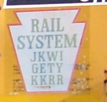
Johnsonburg, Kane, Warren and Irvine Railroad

Last updated
Johnsonburg, Kane, Warren and Irvine Railroad
JKWI Herald.jpg
Reporting mark JKWI
Locale Pennsylvania
Dates of operation19821985
Track gauge 4 ft 8 12 in (1,435 mm) standard gauge
Headquarters Kane, Pennsylvania

The Johnsonburg, Kane, Warren and Irvine Railroad( reporting mark JKWI) was a railroad company in Pennsylvania, United States, formed on May 24, 1982, by Sloan Cornell who also owned the Knox and Kane Railroad. The JKWI was the designated operator of the Irvine, Warren, Kane & Johnsonburg Railroad, [1] that was a partnership of Brock Railroad (a wholly owned subsidiary of Warren Car Company), Irvine Railroad (a wholly owned subsidiary of National Forge Company) and Struthers Wells Inter-American Corporation (a subsidiary of Struthers Wells), all three being Pennsylvania corporations, and had acquired from Conrail the following railroad line segments: MP 58.52 to MP 66.7 (Irvine to Warren) and MP 92.5 to MP 111.0 (Kane to Johnsonburg). [2]

Reporting mark alphabetic code ID used on the North American railroad network

A reporting mark is an alphabetic code of two to four letters used to identify owners or lessees of rolling stock and other equipment used on certain railroad networks.

Knox and Kane Railroad

The Knox and Kane Railroad (K&K) was a short-line railroad in Pennsylvania that operated between Knox, in Clarion County, to Kane and then on to Mount Jewett, in McKean County.

The Brock Railroad was a wholly owned subsidiary of the Warren Car Company of Warren, PA. The business entity Brock Railroad Company was created with the Pennsylvania Department of State on February 17, 1982.

Contents

Operation of the Irvine to Johnsonburg trackage began on July 16, 1982, while registration of the business entity IWK&J RAILROAD COMPANY with the Pennsylvania Department of State followed on October 18, 1982, [3]

The Pennsylvania Department of State is a cabinet-level agency in the Commonwealth of Pennsylvania. The department is headed by the Secretary of the Commonwealth of Pennsylvania.

The property was sold to Hammermill Paper, which began operations under the Allegheny Railroad name on September 3, 1985. [4] The Johnsonburg, Kane, Warren & Irvine Railroad Company filed a Certificate of Election to Dissolve on September 10, 1985, and filed Articles of Dissolution on October 3, 1986. [4]

The Allegheny Railroad was an American railroad company operating in northwestern Pennsylvania.

Locomotive Roster

#ModelPowerBuilderYearNotes
29 U33B 3,300  hp (2,500 kW) GE 1968ex Conrail
6414 GP9M 1,700 hp (1,300 kW) EMD 1957ex Chessie

Related Research Articles

The Pennsylvania Turnpike is a toll highway operated by the Pennsylvania Turnpike Commission (PTC) in the U.S. state of Pennsylvania. A controlled-access highway, it runs for 360 miles (580 km) across the state. The turnpike begins at the Ohio state line in Lawrence County, where the road continues west into Ohio as the Ohio Turnpike. It ends at the New Jersey border at the Delaware River–Turnpike Toll Bridge over the Delaware River in Bucks County, where the road continues east as the Pearl Harbor Memorial Extension of the New Jersey Turnpike.

Elk County, Pennsylvania U.S. county in Pennsylvania

Elk County is a county in the U.S. state of Pennsylvania. As of the 2010 United States Census, the population was 31,946. Its county seat is Ridgway. The county was created on April 18, 1843, from parts of Jefferson, Clearfield and McKean Counties, and is named for the Eastern elk that historically inhabited the region.

Warren, Pennsylvania City in Pennsylvania, United States

Warren is a city in Warren County, Pennsylvania, United States, located along the Allegheny River. The population was 9,710 at the 2010 census. It is the county seat of Warren County. It is home to the headquarters of the Allegheny National Forest and the Cornplanter State Forest. It is also the headquarters for the Chief Cornplanter Council, the oldest continuously chartered Boy Scouts of America Council, and the catalog company Blair. Warren is the principal city of the Warren, PA Micropolitan Statistical Area.

Allegheny Portage Railroad United States historic place

The Allegheny Portage Railroad was the first railroad constructed through the Allegheny Mountains in central Pennsylvania, United States; it operated from 1834 to 1854 as the first transportation infrastructure through the gaps of the Allegheny that connected the midwest to the eastern seaboard across the barrier range of the Allegheny Front. Approximately 36 miles (58 km) long overall, both ends connected to the Pennsylvania Canal, and the system was primarily used as a portage railway, haulting river boats and barges over the divide between the Ohio and the Susquehanna Rivers.

Interstate 376 (I-376) is a major auxiliary route of the Interstate Highway System in the U.S. state of Pennsylvania, located within the Allegheny Plateau. It runs from I-80 near Sharon south and east to a junction with the Pennsylvania Turnpike in Monroeville, after having crossed the Turnpike at an interchange earlier in its route. The route serves Pittsburgh, Pennsylvania and its surrounding areas, and is the main access road to Pittsburgh International Airport (PIT). Portions of the route are known as the Beaver Valley Expressway, Southern Expressway, and Airport Parkway. Within Allegheny County, the route runs along the majority of the Penn-Lincoln Parkway, known locally as Parkway West and Parkway East. It is currently the fifth-longest auxiliary Interstate route in the system, and second only to I-476 within Pennsylvania.

Union Station (Pittsburgh) railway station in Pittsburgh, Pennsylvania, United States

Union Station is a historic train station at Grant Street and Liberty Avenue, south of the Allegheny River, in Pittsburgh, Pennsylvania, United States. It was one of several passenger rail stations that served Pittsburgh during the 20th century, and it is the only surviving station in active use.

U.S. Route 422 (US 422) is a 271-mile (436 km) long spur route of US 22 split into two segments in the U.S. states of Ohio and Pennsylvania. The western spur of US 422 begins in downtown Cleveland and ends at Ebensburg, Pennsylvania. The eastern spur, located entirely within Pennsylvania, begins in Hershey and ends at King of Prussia, PA, near Philadelphia. U.S. Route 422 Business is the offshoot road into each of 4 towns along the way.

Lackawanna Cut-Off

The Lackawanna Cut-Off was built by the Delaware, Lackawanna & Western Railroad (DL&W) between 1908 and 1911 and it ran from Port Morris Junction in Port Morris, New Jersey, to Slateford Junction in Slateford, Pennsylvania.

Allegheny Mountain Tunnel tunnel in Pennsylvania

The Allegheny Mountain Tunnel is a vehicular tunnel carrying the Pennsylvania Turnpike through the Allegheny Mountains. At this point, the Turnpike carries Interstates 70 and 76. When the tunnel was built, it was considered an "engineering marvel."

Wiregrass Central Railroad

The Wiregrass Central Railroad is a shortline railroad operating 19.5 miles (31.4 km) of track from a CSX Transportation connection at Waterford, near Newton, to Enterprise, Alabama via the south side of Fort Rucker. The company was initially a subsidiary of Gulf and Ohio Railways and began operations in 1987 following the purchase of the Enterprise Subdivision branch line of CSX Transportation.

U.S. Route 6 (US 6) travels east–west near the north edge of the U.S. state of Pennsylvania from the Ohio state line near Pymatuning Reservoir east to the Mid-Delaware Bridge over the Delaware River into Port Jervis, New York. It is the longest highway segment in the Commonwealth. Most of it is a two-lane rural highway, with some freeway bypasses around larger towns. Except east of Dunmore, where it is paralleled by Interstate 84 (I-84), it is the main route in its corridor. What is now I-80—the Keystone Shortway—was once planned along the US 6 corridor as a western extension of I-84. The corridor was originally the Roosevelt Highway from Erie, Pennsylvania to Port Jervis, New York, designated Pennsylvania Route 7 in 1924. The PA 7 designation soon disappeared, but as US 6 was extended and relocated, the Roosevelt Highway followed it. The Pennsylvania section of US 6 was renamed the Grand Army of the Republic Highway in 1946; this name was applied to its full transcontinental length by 1953.

Pennsylvania Route 3 state highway in Chester, Delaware, and Philadelphia counties in Pennsylvania, United States

Pennsylvania Route 3 is a 24.3-mile (39.1 km) state highway located in the southeastern portion of Pennsylvania. The route connects U.S. Route 322 Business in West Chester with PA 611 in Philadelphia. The route begins in downtown West Chester and heads east out of town as a one-way pair of streets. Between West Chester and Upper Darby Township, PA 3 follows a four-lane divided highway known as West Chester Pike through suburban areas. Along this stretch, the route passes through Edgmont, Newtown Square, Broomall, and Havertown. The route has an interchange with Interstate 476 (I-476) between Broomall and Havertown. Upon reaching Upper Darby, PA 3 heads into Philadelphia along Market Street. In Philadelphia, the route follows multiple one-way pairs, running along Chestnut Street and Walnut Street in West Philadelphia before heading into Center City Philadelphia along Market Street and John F. Kennedy Boulevard and ending at Philadelphia City Hall.

Pennsylvania Route 68 highway in Pennsylvania

Pennsylvania Route 68 is a 90.036-mile-long (144.899 km) east–west state highway located in western Pennsylvania in the United States. The western terminus of the route is at the Ohio state line west of Glasgow, where PA 68 continues into Ohio as State Route 39. The eastern terminus is at U.S. Route 322 in Clarion. The route runs southwest-northeast across Beaver, Butler, Armstrong, and Clarion counties. PA 68 follows the Ohio River between the Ohio border and Beaver, where it crosses the Beaver River into Rochester and heads northeast away from the Ohio River. The route runs through rural areas to Butler County, where it intersects Interstate 79 (I-79) in Zelienople before serving Evans City and Butler. PA 68 passes through a section of Armstrong County before crossing the Allegheny River into Clarion County. Here, the route passes through Rimersburg and Sligo before it has an interchange with I-80 and continues to its terminus in Clarion.

U.S. Route 422 Business (Reading, Pennsylvania) highway in Pennsylvania

U.S. Route 422 Business is a 7.29-mile-long (11.73 km) business route of US 422 located in the Reading, Pennsylvania area. The route is one of four auxiliary routes of US 422 in Pennsylvania. Its western terminus is at an interchange with US 222 and US 422 in Wyomissing. Its eastern terminus is at an interchange with US 422 in Reiffton. US 422 Bus. heads east from US 222/US 422 along Penn Avenue, passing through Wyomissing and West Reading. The route has an interchange with the US 422 freeway before it crosses the Schuylkill River into Reading. US 422 Bus. passes through downtown Reading on the one-way pair of Franklin Street eastbound and Washington Street westbound, intersecting the southern terminus of Pennsylvania Route 183 and crossing US 222 Bus. The business route heads into the eastern part of the city southeast on Perkiomen Avenue before following the one-way pair of Perkiomen Avenue eastbound and Mineral Spring Road westbound into Mount Penn. US 422 Bus. continues along Perkiomen Avenue to St. Lawrence, where it intersects the western terminus of PA 562 and turns southeast. The route passes through Reiffton before it merges into eastbound US 422.

Pennsylvania Route 462 state highway in York and Lancaser counites in Pennsylvania, United States

Pennsylvania Route 462 is a 32-mile-long (51 km) east–west running local state route in York and Lancaster counties in central Pennsylvania. The western terminus is west of York, and the eastern terminus is east of Lancaster. At both ends, PA 462 terminates at U.S. Route 30, which follows a freeway alignment parallel to the north between York and Lancaster. The route heads east into York, where it follows the one-way pair of Market Street eastbound and Philadelphia Street westbound. In York, PA 462 runs concurrent with PA 74 and crosses Interstate 83 Business. East of York, the route becomes a multilane road and has an interchange with I-83 and crosses PA 24. PA 462 continues east to through Hallam to Wrightsville and passes through that town before it crosses the Susquehanna River and runs through Columbia. East of here, the route continues through Mountville before reaching the city of Lancaster. In Lancaster, PA 462 is routed on the one-way pair of King Street eastbound and West Walnut Street, with the westbound direction concurrent with PA 23. The route crosses US 222/PA 272 and northbound PA 72 in Lancaster. East of Lancaster, PA 462 becomes a multilane road again and continues to its eastern terminus.

Guilford station

Guilford is a regional rail station on the Northeast Corridor, located slightly south of the town center of Guilford, Connecticut. Owned by the Connecticut Department of Transportation, it is served by the Shore Line East service.

Coudersport and Port Allegany Railroad

The Coudersport and Port Allegany Railroad was a shortline railroad that operated in Potter and McKean Counties in Pennsylvania in the United States between 1882 and 1964. The original line ran 17 miles (27 km) along the Allegheny River between the boroughs of Coudersport, the county seat of Potter County, and Port Allegany in McKean County. The line was originally a 3 ft narrow gauge and converted to 4 ft 8 12 instandard gauge in 1889. It was prosperous during a lumber boom in the region and expanded east to Ulysses. The lumber boom ended in the early 20th century and the line slowly declined until 1964, when it was purchased by the Wellsville, Addison and Galeton Railroad. The line was finally abandoned in 1970. Today the only surviving building from the railroad is the Coudersport and Port Allegany Railroad Station, which was listed on the National Register of Historic Places in 1976 and serves as the town hall for Coudersport today. As of 2009, much of the C&PA railroad grading can still be found. Railroad bridge abutments exist at Lillibridge Creek in Port Allegany and along the Allegheny River at Coleman Mills, east of Roulette, and east and west of Coudersport.

Conway Yard

Conway Yard is a major rail yard located in the boroughs of Conway and Freedom, Pennsylvania, 22 miles (35 km) northwest of Pittsburgh, along the Ohio River. It was the largest freight yard in the world from 1956 until 1980. It is currently owned by Norfolk Southern (NS) and one of the largest yards in the United States.

The Delmarva Central Railroad is an American short-line railroad owned by Carload Express that operates 188 miles (303 km) of track on the Delmarva Peninsula in the states of Delaware, Maryland, and Virginia. The railroad operates lines from Porter, Delaware to Hallwood, Virginia and from Harrington, Delaware to Frankford, Delaware along with several smaller branches. The DCR interchanges with the Norfolk Southern Railway and the Maryland and Delaware Railroad. The railroad was created in 2016 to take over the Norfolk Southern Railway lines on the Delmarva Peninsula. The DCR expanded by taking over part of the Bay Coast Railroad in 2018 and the Delaware Coast Line Railroad in 2019.

References

  1. Pennsylvania Department of State. (2008). Search for JOHNSONBURG, KANE, WARREN & IRVINE RAILROAD. Retrieved November 24, 2008
  2. Bradley, Richard E.(May, 1985). "Shortlining in Pennsylvania's North Country...Irvine, Warren, Kane and Johnsonburg". Railpace Newsmagazine, p. 19.
  3. Pennsylvania Department of State. (2008). Search for IWK&J RAILROAD COMPANY. Retrieved November 29, 2008
  4. 1 2 Bradley, Richard E. (November 1985). "Allegheny Railroad Begins Operations". Railpace Newsmagazine. Piscataway, NJ: Railpace: 24.
International Standard Book Number Unique numeric book identifier

The International Standard Book Number (ISBN) is a numeric commercial book identifier which is intended to be unique. Publishers purchase ISBNs from an affiliate of the International ISBN Agency.