| Judaberg | |
|---|---|
| Village | |
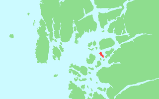
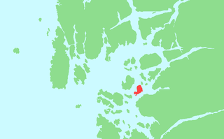
 Judaberg Location in Rogaland county  Judaberg Judaberg (Norway) | |
| Coordinates: 59°10′19″N05°52′34″E / 59.17194°N 5.87611°E Coordinates: 59°10′19″N05°52′34″E / 59.17194°N 5.87611°E | |
| Country | Norway |
| Region | Western Norway |
| County | Rogaland |
| District | Ryfylke |
| Municipality | Finnøy |
| Area [1] | |
| • Total | 0.72 km2 (0.28 sq mi) |
| Elevation [2] | 3 m (10 ft) |
| Population (2015) [1] | |
| • Total | 734 |
| • Density | 1,019/km2 (2,640/sq mi) |
| Time zone | CET (UTC+01:00) |
| • Summer (DST) | CEST (UTC+02:00) |
| Post Code | 4160 Finnøy |
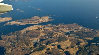
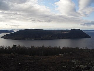
Judaberg is the administrative centre of Finnøy municipality in Rogaland county, Norway. The village is located on the eastern shore of the island of Finnøy. The island is located on the south side of the Boknafjorden, northeast of the large city of Stavanger. [3]
An administrative centre is a seat of regional administration or local government, or a county town, or the place where the central administration of a commune is located.

Finnøy is an island municipality in Rogaland county, Norway. It is located in the traditional district of Ryfylke. The administrative centre of the municipality is the village of Judaberg.

Rogaland[²ruːɡɑlɑn](
The 0.72-square-kilometre (180-acre) village has a population (2015) of 734, giving the village a population density of 1,019 inhabitants per square kilometre (2,640/sq mi). [1] Judaberg is the commercial centre of the municipality with several small industries as well as shopping. The Rygjabø upper secondary school, the only high school in Finnøy is located here. The newspaper Øyposten has been published in Judaberg since 1999. [4]

Population density is a measurement of population per unit area or unit volume; it is a quantity of type number density. It is frequently applied to living organisms, and most of the time to humans. It is a key geographical term. In simple terms population density refers to the number of people living in an area per kilometer square.
Øyposten is a local Norwegian newspaper published in the municipality of Finnøy in Rogaland county. The newspaper was established in 1970 as a municipal newsletter, and it became an independent newspaper in 1999. Its offices are located in Judaberg. The paper is published in Nynorsk and it is edited by Jon Asgaut Flesjå.
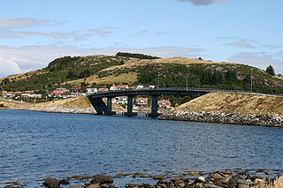
Judaberg is a transportation hub of the island municipality with several ferry routes connecting to all the surrounding islands such as Ombo, Sjernarøyane, Halsnøya, and Fogn as well as to the village of Nedstrand on the mainland. There is also high speed ferry service to the city of Stavanger. Judaberg is connected to the mainland by road by a series of bridges and undersea tunnels including the Finnøy Tunnel, Mastrafjord Tunnel, and Byfjord Tunnel. [3]
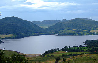
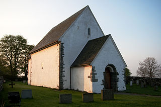
Ombo is the largest island in the Ryfylke region on the southwestern coast of Norway, and is the second largest island in Rogaland county. The 57.5-square-kilometre (22.2 sq mi) island of Ombo is divided between the municipalities Hjelmeland and Finnøy. There are several villages on the island including Jørstadvåg, Atlatveit, and Eidssund in the western part of the island which belongs to Finnøy municipality. The villages of Tuftene, Skipavik, Skår, and Vestersjø are located on the southeastern part of the island which belongs to Hjelmeland municipality. Jørstad Church is located in the village of Jørstadvåg.

Sjernarøyane is an island group in Finnøy municipality in Rogaland county, Norway. The islands are located in the Nedstrandsfjorden, west of the large island of Ombo and north of the large island of Finnøy. As of 2014, the islands were home to 365 residents. The islands were historically part of the municipality of Sjernarøy before merging into the municipality of Finnøy in 1965. The Aubøsund strait, which runs between the islands of Aubø and Bjergøy was a historically important trading post.
Fogn is an island in Finnøy municipality in Rogaland county, Norway. The 10.4-square-kilometre (4.0 sq mi) island lies southeast of the island of Finnøy and northeast of the island of Talgje. The Finnøyfjorden lies between Fogn and Finnøy and the Fognafjorden lies between Fogn and the mainland to the southeast. The highest point on the island is the 166-metre (545 ft) tall mountain Domfjellet. Fogn Church is located on the island.