Julington Creek Plantation, Florida

Last updated
Julington Creek Plantation, Florida
Country United States
State Florida
City St. Johns, Florida
Area
  Total4,120 acres (1,670 ha)
Time zone Eastern Standard Time

Julington Creek Plantation is an unincorporated community in the larger community of St. Johns, St. Johns County, Florida, United States. It consists of several large neighborhoods, and is located along Race Track Road east of State Road 13, across from Fruit Cove (which is also the name of a census-designated place that includes Julington Creek Plantation).

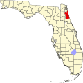
Julington Creek Plantation Community Development District encompasses approximately 4,120 acres and is located in northwest St. John’s County, approximately twenty miles south of downtown Jacksonville, seven miles south of Interstate 295, and fifteen miles west of the Atlantic Ocean. The community is halfway between the historic city of Saint Augustine and the excitement of downtown Jacksonville. [1] [2]

Julington Creek Plantation is served by the highest ranked schools in Florida which, according to the Huffington Post, are among the "Top Ten in the Country". [3]

St. Johns County schools have received a state government grade of "A" for their work with the students and FCAT grading from 2004 to 2014. [4]

The neighborhood of Julington Creek Plantation has a new $15 million country club-style clubhouse with a state-of-the-art gym, skate board park, turf football and lacrosse field, four soccer fields, volleyball and four basketball courts, and a full-service restaurant. Other amenities include 130 lakes, 1200 acres of nature trails, parks, playgrounds, and a top-rated golf course.[ citation needed ]

Related Research Articles

<span class="mw-page-title-main">Clay County, Florida</span> County in Florida, United States

Clay County is located in the northeastern part of the U.S. state of Florida along the west bank of the St. Johns River. As of 2020, the population was 218,245 and in 2022, that number increased to 226,589, making it the third largest county in the Jacksonville metropolitan area. While most of the county is unincorporated, there are 4 municipalities with Green Cove Springs being the county seat and the unincorporated Lakeside CDP being the largest place. It is named in honor of Henry Clay, a famous American statesman, member of the United States Senate from Kentucky, and United States Secretary of State in the 19th century.

<span class="mw-page-title-main">Jacksonville, Florida</span> City in Florida, United States

Jacksonville is the most populous city proper in the U.S. state of Florida, located on the Atlantic coast of northeastern Florida. It is the seat of Duval County, with which the City of Jacksonville consolidated in 1968. It is the largest city by area in the contiguous United States as of 2020.

<span class="mw-page-title-main">St. Johns County, Florida</span> County in Florida, United States

St. Johns County is a county in the northeastern part of the U.S. state of Florida. As of the 2020 United States census, its population was 273,425. The county seat and most populous incorporated city is St. Augustine, although the nearby community, St. Johns, has a higher population. St. Johns County is part of the Jacksonville metropolitan area.

<span class="mw-page-title-main">Middleburg, Florida</span> Census-designated place in Florida, United States

Middleburg is an unincorporated area and census-designated place (CDP) within Clay County in the U.S. state of Florida, located 26 miles (42 km) southwest of downtown Jacksonville and 16 miles (26 km) northwest of Green Cove Springs, the county seat of Clay County. As of the 2020 census, the population of Middleburg was 12,881.

<span class="mw-page-title-main">Yulee, Florida</span> Census County Division in Florida, United States

Yulee is a Census County Division (CCD) located within Nassau County, Florida, in the United States. Positioned in northeastern Florida, Yulee lies directly south of the Florida-Georgia state line, marked by the St. Marys River. Furthermore, it is situated 24 miles north of downtown Jacksonville, Florida. As of the latest survey conducted by the U.S. Census Bureau in 2021, the CCD's population is recorded at 36,742. Yulee is a constituent of the Jacksonville metropolitan area, which encompasses an estimated population of approximately 1.68 million individuals as of 2022. Presently, the Yulee Census County Division serves as a residential bedroom community for individuals commuting to Jacksonville, Naval Submarine Base Kings Bay, and various locations in Southeast Georgia. It is also actively engaged in efforts to broaden its tax base for economic diversification.

<span class="mw-page-title-main">Fruit Cove, Florida</span> CDP in Florida, United States

Fruit Cove is a census-designated place (CDP) in St. Johns County, Florida, United States. It is located in the community of St. Johns. The population was 32,143 at the 2020 census.

<span class="mw-page-title-main">Sawgrass, Florida</span> CDP in Florida, United States

Sawgrass is a census-designated place (CDP) in St. Johns County, Florida, United States. The area is located in Ponte Vedra Beach. Sawgrass is home to The Players Championship (TPC), established in 1974. The tournament offers the highest prize fund of any tournament in golf.

<span class="mw-page-title-main">Springfield (Jacksonville)</span> Neighborhood of Jacksonville, Florida

Springfield is a historic neighborhood of Jacksonville, Florida, United States, located to the north of downtown. Established in 1869, it experienced its greatest growth from the early 1880s through the 1920s. The Springfield Historic District is listed in the National Register of Historic Places, and contains some of the city's best examples of 19th and early 20th century architecture.

<span class="mw-page-title-main">Downtown Jacksonville</span> Neighborhood of Jacksonville, Florida

Downtown Jacksonville is the historic core and central business district (CBD) of Jacksonville, Florida. It comprises the earliest area of the city to be developed and is located in its geographic center along the narrowing point of the St. Johns River.

<span class="mw-page-title-main">Neighborhoods of Jacksonville</span>

There are more than 500 neighborhoods within the area of Jacksonville, Florida, the largest city in the contiguous United States by area. These include Downtown Jacksonville and surrounding neighborhoods. Additionally, greater Jacksonville is traditionally divided into several major sections with amorphous boundaries: Northside, Westside, Southside, and Arlington, as well as the Jacksonville Beaches.

Fleming Island is an unincorporated community and census-designated place (CDP) in Clay County, Florida, United States. It is located 21 miles (34 km) southwest of downtown Jacksonville, on the western side of the St. Johns River, off US 17. As of the 2010 census the Fleming Island CDP had a population of 27,126. Fleming Island's ZIP code became 32003 in 2004, giving it a different code from Orange Park, the incorporated town to the north.

Mandarin is a neighborhood located in the southernmost portion of Jacksonville, in Duval County, Florida, United States. It is located on the eastern banks of the St. Johns River, across from Orange Park. It's a short drive south of Jacksonville's city center, and is bordered by Beauclerc to the north, Julington Creek to the south and St. John's River to the west.

Flagler Estates is an unincorporated community in Flagler and St. Johns counties in the U.S. state of Florida. It is located 8 mi (13 km) southeast of Hastings. The Flagler County portion of Flagler Estates is part of the Deltona–Daytona Beach–Ormond Beach, FL metropolitan statistical area, while the St. Johns County portion is part of the Jacksonville Metropolitan Statistical Area. As of May 2006, there were an estimated 1,500 families residing in Flagler Estates.

<span class="mw-page-title-main">Nocatee, Florida</span> Planned community in Florida

Nocatee is an unincorporated planned community located primarily in northern St. Johns County, Florida and a census-designated place (CDP). The community blends a variety of neighborhoods with schools, parks, recreation, offices, shopping, and restaurants. As of 2020, the community consists of twenty-two neighborhoods, some of which are specialized for certain age groups. Part of the development lies within Jacksonville in Duval County. It is near Ponte Vedra Beach in Florida's First Coast region and sits on 13,323 acres (5,392 ha) of land. It was approved in 2001 as a Development of Regional Impact (DRI) under Section 380.06 of the Florida Statutes.

<span class="mw-page-title-main">Bartram Springs, Florida</span> Neighborhood of Jacksonville, Florida

Bartram Springs is a master-planned residential community located in Jacksonville, Florida. It resides on the Duval County and St. Johns County line.

<span class="mw-page-title-main">Riverside and Avondale</span> Neighborhood of Jacksonville, Florida

Riverside and Avondale are two adjacent and closely associated neighborhoods, alternatively considered one continuous neighborhood, of Jacksonville, Florida. The area is primarily residential, but includes some commercial districts, including Five Points, the King Street District, and the Shoppes of Avondale.

<span class="mw-page-title-main">Northside (Jacksonville)</span> Region of Jacksonville, Florida, US

The Northside is a large region of Jacksonville, Florida, and is generally understood as a counterpart to the city's other large regions, the Urban Core, Arlington, Southside, Westside, and the Beaches. The expansive area consists of historic communities, cultural landmarks, protected ecosystems and vital transportation and logistics facilities, all fundamental to the history and development of Jacksonville.

Oakleaf Plantation is a 6,400-acre planned community in the Jacksonville area located mostly in unincorporated Clay County and partially within the Jacksonville city limits. The Clay County portion is a census-designated place, with a 2010 population of 20,315. As of 2020, the population has risen to 28,153.

Julington Creek is a stream in Saint John County, Florida, near Jacksonville. Durbin Creek is a tributary. Julington Creek feeds into the St Johns River widening out into Old Bull Bay. Both are navigable by paddlecraft and has a marina on it.

The cape of Point La Vista is a bluff in Duval County, located on the eastern bank of the St. Johns River, three miles south of downtown Jacksonville, Florida. It is also the name of one of the subdivisions on the cape. This residential community of single-family homes was created during suburban expansion from the mid-1920's through the 1980s on one of the city's most geographically distinct riverfront locations. The historical boundaries of the cape of Point La Vista date from land grants of the Second Spanish Era (1783-1821). The modern half-loop road of San Jose Blvd. splits off of Hendricks Avenue just after River Oaks Park, the old Oriental Gardens, at Southside United Methodist Church and hugs the pedestrian-friendly contours of the cape for nearly two miles, ending at the Miramar Center, a shopping plaza. The portion of the cape within the old Jacksonville city limits of 1937 overlaps the traditional southern boundary of the San Marco neighborhood. Many places in Duval County are named for families who once owned property at the cape, such as Bowden Road, Shad Road, Sanchez Road, Hendricks Avenue, Philips Highway, and the Hart Bridge.

References

  1. Julington Creek Plantation website, jcpcdd.org. Accessed July 10, 2023.
  2. Suburban Jacksonville: Julington Creek Plantation, Metrojacksonville.com. Accessed July 10, 2023.
  3. Top school districts with affordable housing, huffingtonpost.com. Accessed July 10, 2023.
  4. St. Johns School District Facts, stjohns.k12.fl.us. Accessed July 10, 2023.

30°07′17″N81°37′31″W / 30.121381°N 81.625298°W / 30.121381; -81.625298