Alerta Airport is an airstrip serving Alerta, a village near the Bolivian border in the Ucayali Region of Peru. The village is on the Río Muymanu (sv), a stream in the Amazon basin.

Ouanda Djallé Airport is an airstrip serving Ouanda Djallé, a village in the Vakaga prefecture of the Central African Republic. The airstrip lies alongside the RN5 road that runs northwest out of the village.

Tepoe Airstrip is an airstrip serving Pelelu Tepu, Suriname. The runway extends southwest from the village.
Afobaka Airstrip is an airstrip near Afobaka, a village in the Brokopondo District of Suriname. The airstrip is primarily used for emergency evacuation and gold shipment. It is 5 kilometres (3.1 mi) from the campsite of the Gross Rosebel gold mine, which has its own airstrip.
Alalapadu Airstrip is an airstrip serving Alalapadu in Suriname.
Coeroeni Airstrip is an airstrip located near Coeroeni in Suriname. It was constructed as part of Operation Grasshopper.
Djoemoe Airstrip, (also called Djumu-Djomoe Airstrip) is an airstrip serving Djoemoe, Suriname.
Drietabbetje Airstrip serves the Tapanahony River village of Drietabbetje, Suriname. The river breaks into braided channels at Drietabbetje, and the airstrip is on one of the larger islands.
Sipaliwini Airstrip, near the village of Sipaliwini, in the most southern part of Suriname in the Sipaliwini District. It was constructed as part of Operation Grasshopper and the runway of the airstrip was publicly opened in 1962.

The Heriberto Gil Martínez Airport is an airport serving the municipality of Tulua in the Valle del Cauca Department of Colombia.
Botopasi Airstrip, is an airstrip serving Botopasi, Suriname.
Gamboula Airport is an airstrip serving Gamboula, a town in the Mambéré-Kadéï prefecture of the Central African Republic. The airstrip is 3 kilometres (2 mi) northeast of the town, alongside the RN6 road.

Camp Okavango Airstrip is a private airstrip serving Camp Okavango, a safari camp in the Okavango Delta, in the North-West District of Botswana.

Ailigandí Airport is an airstrip serving Ailigandí, an island town in the Guna Yala comarca of Panama. The airstrip is onshore, approximately 400 metres (1,312 ft) southeast of Ailigandí island and is reached by boat. There are no roads near the airstrip.
Malefiloane Airstrip is a high elevation airstrip serving the village of Malefiloane in Mokhotlong District, Lesotho. The runway is on a ridge above the Mokhotlong River valley.

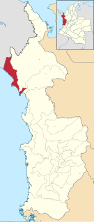
Vigía del Fuerte Airport is an airstrip serving the river town of Vigía del Fuerte, in the Antioquia Department of Colombia. The runway is on the eastern bank of the Atrato River, 2 kilometres (1.2 mi) upstream, south of the town.
Corocora Airport is one of several airstrips serving the oil and gas-producing region of Trinidad municipality in the Casanare Department of Colombia.
Santa Fe de Antioquia is a closed airstrip that formerly served the town of Santa Fe de Antioquia in the Antioquia Department of Colombia.
Alupi Airstrip is a rural airstrip serving the rice growing region southeast of Nieuw Nickerie, in the Nickerie District of Suriname. The airstrip is next to the Nickerie River.
Hacienda Nápoles Airstrip is an airstrip on Hacienda Nápoles, a large estate in the Antioquia Department of Colombia.