Jutogh | |
|---|---|
Cantonment Board | |
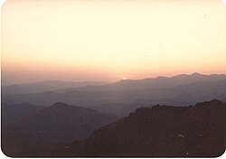 Jutogh sunset | |
 Jutogh Location in Himachal Pradesh, India  Jutogh Jutogh (India) | |
| Coordinates: 31°06′N77°07′E / 31.1°N 77.12°E | |
| Country | |
| State | Himachal Pradesh |
| District | Shimla |
| Elevation | 1,729 m (5,673 ft) |
| Population (2001) | |
• Total | 2,417 |
| Languages | |
| • Official | Hindi |
| Time zone | UTC+5:30 (IST) |
Jutogh is a cantonment board in Shimla district in the Indian state of Himachal Pradesh.
Contents
The Jutogh cantonment was established in 1843 Cantonment Board. Jutogh is a statutory body constituted under the Cantonments Act, 2006. The emergence of the Cantonment Board as a municipal body in cantonments was basically in response to the need for maintenance of proper sanitation, health and hygiene in these areas.
The scope of the Cantonment Board functions extends to the entire gamut of municipal administration. In addition to providing basic amenities, Cantonment Board, Jutogh also manages public welfare institutions and facilities to the residents of the cantonment area.
Jutogh was acquired by the British Government in 1843. It was first occupied by a regiment of Gurkhas, and was afterwards made over to the Governors of the Bishop Cotton School, but, being found unsuitable for this purpose, was for a time abandoned.
Two batteries of British Mountain Artillery and two companies of British Infantry were stationed here during the summer months.