Zuzałka is a village in the administrative district of Gmina Włocławek, within Włocławek County, Kuyavian-Pomeranian Voivodeship, in north-central Poland. It lies approximately 15 kilometres (9 mi) east of Włocławek and 64 km (40 mi) south-east of Toruń.
Kownaty-Kolonia is a village in the administrative district of Gmina Piątnica, within Łomża County, Podlaskie Voivodeship, in north-eastern Poland.
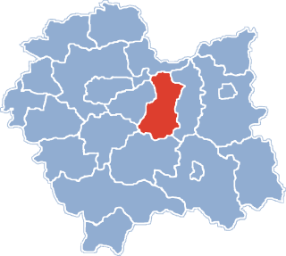
Jadwinów is a settlement in the administrative district of Gmina Gorzkowice, within Piotrków County, Łódź Voivodeship, in central Poland.
Kolonia Grabinka is a settlement in the administrative district of Gmina Zadzim, within Poddębice County, Łódź Voivodeship, in central Poland.
Józefów is a village in the administrative district of Gmina Bolimów, within Skierniewice County, Łódź Voivodeship, in central Poland. It lies approximately 8 kilometres (5 mi) north-east of Bolimów, 19 km (12 mi) north-east of Skierniewice, and 65 km (40 mi) north-east of the regional capital Łódź.
Brzozów is a village in the administrative district of Gmina Rzeczyca, within Tomaszów Mazowiecki County, Łódź Voivodeship, in central Poland. It lies approximately 5 kilometres (3 mi) north-west of Rzeczyca, 22 km (14 mi) north-east of Tomaszów Mazowiecki, and 58 km (36 mi) east of the regional capital Łódź.
Danków is a village in the administrative district of Gmina Daleszyce, within Kielce County, Świętokrzyskie Voivodeship, in south-central Poland. It lies approximately 3 kilometres (2 mi) east of Daleszyce and 18 km (11 mi) south-east of the regional capital Kielce.
Morawy-Kopcie is a village in the administrative district of Gmina Gołymin-Ośrodek, within Ciechanów County, Masovian Voivodeship, in east-central Poland.
Ożarów is a village in the administrative district of Gmina Ożarów Mazowiecki, within Warsaw West County, Masovian Voivodeship, in east-central Poland. It lies approximately 3 kilometres (2 mi) east of Ożarów Mazowiecki and 12 km (7 mi) west of Warsaw.
Strzyżew is a village in the administrative district of Gmina Kampinos, within Warsaw West County, Masovian Voivodeship, in east-central Poland.
Krzykosy is a village in the administrative district of Gmina Kłodawa, within Koło County, Greater Poland Voivodeship, in west-central Poland.
Kościerzyn Wielki is a village in the administrative district of Gmina Wyrzysk, within Piła County, Greater Poland Voivodeship, in west-central Poland. It lies approximately 7 kilometres (4 mi) north of Wyrzysk, 36 km (22 mi) east of Piła, and 93 km (58 mi) north of the regional capital Poznań.
Wiernowo is a village in the administrative district of Gmina Wyrzysk, within Piła County, Greater Poland Voivodeship, in west-central Poland. It lies approximately 2 kilometres (1 mi) south of Wyrzysk, 36 km (22 mi) east of Piła, and 86 km (53 mi) north of the regional capital Poznań.
Rusiborek is a village in the administrative district of Gmina Dominowo, within Środa Wielkopolska County, Greater Poland Voivodeship, in west-central Poland. It lies approximately 4 kilometres (2 mi) south-east of Dominowo, 8 km (5 mi) north-east of Środa Wielkopolska, and 36 km (22 mi) south-east of the regional capital Poznań.
Patoka is a settlement in the administrative district of Gmina Somonino, within Kartuzy County, Pomeranian Voivodeship, in northern Poland. It lies approximately 5 kilometres (3 mi) east of Somonino, 7 km (4 mi) south-east of Kartuzy, and 26 km (16 mi) west of the regional capital Gdańsk.
Brzostkowo is a village in the administrative district of Gmina Bartoszyce, within Bartoszyce County, Warmian-Masurian Voivodeship, in northern Poland, close to the border with the Kaliningrad Oblast of Russia. It lies approximately 6 kilometres (4 mi) south-east of Bartoszyce and 52 km (32 mi) north-east of the regional capital Olsztyn.
Falczewo is a village in the administrative district of Gmina Bartoszyce, within Bartoszyce County, Warmian-Masurian Voivodeship, in northern Poland, close to the border with the Kaliningrad Oblast of Russia.
Weskajmy is a village in the administrative district of Gmina Górowo Iławeckie, within Bartoszyce County, Warmian-Masurian Voivodeship, in northern Poland, close to the border with the Kaliningrad Oblast of Russia.
Czarny Róg is a settlement in the administrative district of Gmina Pisz, within Pisz County, Warmian-Masurian Voivodeship, in northern Poland.

Nowy Dwór is a village in the administrative district of Gmina Jedwabno, within Szczytno County, Warmian-Masurian Voivodeship, in northern Poland. It lies approximately 10 kilometres (6 mi) west of Szczytno and 34 km (21 mi) south-east of the regional capital Olsztyn.