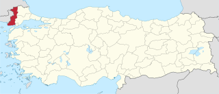
Edirne Province is a Turkish province located in East Thrace. Part of European Turkey, it is one of only three provinces located entirely within continental Europe. Edirne Province is bordered by Tekirdağ Province and Kırklareli Province to the east, and the Gallipoli peninsula of Çanakkale Province to the south-east. It shares international borders with Bulgaria to the north and Greece to the west.

Cheung Tsing Highway is a highway of Route 3 between Cheung Tsing Tunnel and North West Tsing Yi Interchange on Tsing Yi Island, Hong Kong. It was built as part of the Airport Core Programme together with the rest of Route 3 to provide a new highway link from North Western New Territories towards Hong Kong Island, and connects with Route 8 to provide access to the new Hong Kong International Airport.
Ningunsaw Provincial Park is a provincial park in British Columbia, Canada.
Prhovo is a village in Serbia. It is situated in the Pećinci municipality, in the Srem District, Vojvodina province. The village has a Serb ethnic majority and its population was 813 at the 2002 census.

Shimotaki Station is a railway station in Tamba, Hyōgo Prefecture, Japan.
Wola Dziankowska is a village in the administrative district of Gmina Lubień Kujawski, within Włocławek County, Kuyavian-Pomeranian Voivodeship, in north-central Poland.
Węgle-Żukowo is a village in the administrative district of Gmina Markusy, within Elbląg County, Warmian-Masurian Voivodeship, in northern Poland.

Lanchkhuti is a district of Georgia, in the region of Guria. Its main town is Lanchkhuti.
Dodurga Dam is a dam in Sinop Province, Turkey, built between 1990 and 2000. The development was backed by the Turkish State Hydraulic Works.
Gölköy Dam is a dam in Bolu, Turkey, built between 1965 and 1970. The development was backed by the Turkish State Hydraulic Works.
Gülüç Dam is a dam in Zonguldak Province, Turkey, built between 1964 and 1966. The development was backed by the Turkish State Hydraulic Works.
Ljeskovik (Srebrenica) is a village in the municipality of Srebrenica, Bosnia and Herzegovina.
Çalköy is a village in the District of Vezirköprü, Samsun Province, Turkey.
Paşaköy is a village in the Vezirköprü, Samsun Province, Turkey.

Ledwyche Brook is a minor river in south Shropshire, England. It is sometimes referred to as the River Ledwyche and spelled variously, including "Ledwich" or "Ledwych". The brook is a tributary of the River Teme.
Pattani railway station or Pattani railway station is a railway station located in Khok Pho Subdistrict, Khok Pho District, Pattani. It is a class 1 railway station located 1,009.209 km (627.1 mi) from Thon Buri Railway Station. The station opened in April 1917 as Khok Pho Station, as part of the Southern Line section between U Taphao Junction -Khlong Sai. The line extended further south, terminating at Su-ngai Kolok in September 1921, where it linked up with the Malaysian railway.
Halife is a village in the district of Kastamonu, Kastamonu Province, Turkey.

Sahebpur is a census town under Sonarpur police station of Sonarpur CD Block in Baruipur subdivision of South 24 Parganas district in the Indian State of West Bengal. It is a part of Kolkata Urban Agglomeration.
Bicyclic phosphate is a class of bicyclic organophosphate compound that are used as flame retardants, stabilizers and antioxidants. They are also used in spectroscopic studies.
Crenides or Krenides, or Cranides or Kranides (Κρανίδες), was a town on the Pontic coast of Bithynia, according to Arrian 60 stadia east of Sandaraca; according to Marcian only 20 stadia. It was between Heraclea and the mouth of the Billaeus.


