Tiruvallur district, also spelled as Thiruvallur district, is one of the 38 districts in the Indian state of Tamil Nadu. The fast developing city of Tiruvallur is the district headquarters. The district has a mixture of urban and rural characteristics. The eastern part of Tiruvallur district is dominated by urban characteristics while the Northern part of the district has influence of Andhra culture due to its position. In 2011, the district had a population of 3,728,104 with a sex-ratio of 987 females for every 1,000 males.
Veppampattu is one of the fastest developing suburban areas in Chennai City. It is Western part of the suburbs of the Metropolitan city Chennai in the Indian state of Tamil Nadu between Chennai and Arakkonam on the Chennai - Arakkonam railway line. It is fast-growing with a number of schools and colleges. Electric trains and NH 205 road provide transportation to Chennai. Veppampatu can be approached by both train and bus. Bus stop is a very nearby railway station. Veppampattu comes under Chennai Metropolitan Area.

Poonamallee is a town and suburb of Chennai, India under the Chennai Metropolitan Area. It was historically called Pushpagirimangalam, later renamed in Tamil as Poovirundhavalli, and now colloquially called as Poondhamalli. It is the headquarters of the Poonamallee taluk of the Tiruvallur district in the Indian state of Tamil Nadu. The nearest Railway station is at Avadi. It acts as the gateway to the city from its western side. It is a town with rich cultural heritage and also a fast-growing areas in the city. As of 2011, the town had a population of 57,224. There are plans to merge the areas under Poonamallee Municipality with Avadi Municipal Corporation.

Tiruttani is a town in the Tiruvallur district, a suburb of Chennai within the Chennai Metropolitan Area, located in the state of Tamil Nadu, India. The town is renowned for the Tiruttani Murugan Temple, which is one of the Arupadaiveedu and is dedicated to Kartikeya (Murugan). Tiruttani was added to the Chennai Metropolitan Area in October 2022.
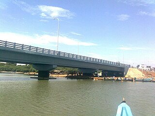
Pallipattu is a town in Tamil Nadu and a border town located between the Chittoor District of Andhra Pradesh and Tiruvallur District of Tamil Nadu. It is known for its fertile agricultural lands and the west-to-east flowing Kusasthalai river.
Ponneri is a town located in Chennai Metropolitan Area, Thiruvallur district in the Indian state of Tamil Nadu. It is located in Ponneri taluk. Ponneri is major destination for Andhra Pradesh people to buy goods. It is a part of the area Chennai Metropolitan Development Authority (CMDA) and a vital locality in Chennai Metropolitan Area.
Podaturpet is a Town under Pallipattu (Pallipet) Taluk in Thiruvallur district in the Indian state of Tamil Nadu.
Villivakkam is a neighbourhood of Chennai, Tamil Nadu, India. It is served by the Villivakkam railway station on the Chennai Central–Arakkonam suburban section. Villivakkam is the largest state assembly constituency in Tamil Nadu in terms of number of voters.

The Chennai Suburban Railway is a commuter rail system in the city of Chennai, Tamil Nadu, India, operated by the Southern Railways branch of Indian Railways. It is the second largest suburban rail network in terms of route length and the third largest in terms of commuters in India. Around 1,000 services are operated daily between 4:00 a.m. and midnight. It is the longest suburban circular route in India covering of 235.5 km (146.3 mi).

The Chennai Metropolitan Development Authority (CMDA), formerly known as the Madras Metropolitan Development Authority (MMDA), is the nodal planning agency of Chennai in the Indian state of Tamil Nadu. The CMDA administers the Chennai Metropolitan Region, spread over an area of 5,904 km2 (2,280 sq mi) and covers the districts of Chennai, Thiruvallur, Chengalpattu, Ranipet and Kancheepuram. It was set up for the purposes of planning, co-ordination, supervising, promoting and securing the planned development of the Chennai Metropolitan Area. It coordinates the development activities of the municipal corporations, municipalities and other local authorities.
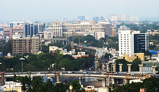
Greater Chennai Metropolitan Area, or simply the Chennai Metropolitan Area (CMA), is fourth-most populous metropolitan area in India and the 35th most populous in the world. The CMA consists of the core city of Chennai, which is coterminous with the Chennai district, and its suburbs in Kanchipuram, Chengalpattu, Thiruvallur and Ranipet districts. The Chennai Metropolitan Development Authority (CMDA) is the nodal agency that handles town planning and development within the metro area. In 1974, an area encompassing 1,189 km2 (459 sq mi) around the city was designated as the metropolitan area which was subsequently expanded to 5,904 km2 (2,280 sq mi) in 2022.
Pattabiram is a neighbourhood situated on the western part of Chennai, India. The suburb, which falls under Avadi Municipal Corporation, is about 25 km from the Chennai Central railway station.
Ayappakkam is a Western suburb of Chennai in Thiruvallur district in the Indian state of Tamil Nadu. Ayapakkam is currently a village panchayat surrounded by Thiruverkadu municipality, Avadi corporation and Greater Chennai Corporations.
Kallikuppam is a locality in Ambattur, which is a large neighbourhood in Chennai City.
Elavur is a village in the Tiruvallur district of Tamil Nadu, India. It is located in the Gummidipoondi taluk border between Tamil Nadu and Andhra pradesh. NH16 Chennai-Kolkata Highway. India's First modern Integrated Check post opened by Tamil Nadu chief minister and also located frontline medical village. ELR is and railway station code for Elavur.Farming land can be found in this place.
Senji is a village in western outskirts of Chennai located in Tiruvallur district in the Indian state of Tamil Nadu. Agriculture is the major occupation in this village. It is located 14 KM towards North from District head quarters Vellore. 7 KM from K.V.Kuppam. 151 KM from State capital Chennai
Panambakkam is a village in western outskirts of Chennai located in Tiruvallur district in the Indian state of Tamil Nadu. Agriculture is the major occupation in this village.
Pallavaram–Kundrathur–Poonamallee Road or State Highway 113A is an arterial road in Chennai City connecting Grand Southern Trunk Road in Pallavaram with Trunk Road in Kumananchavadi in Poonamallee running for a length of 13 kilometres (8.1 mi). The road is also known as Pammal Main Road. The road runs through Pammal, Anakaputhur, Kundrathur, Mangadu and Kumanan Chavadi.


