
The Taku River is a river running from British Columbia, Canada, to the northwestern coast of North America, at Juneau, Alaska. The river basin spreads across 27,500 square kilometres (10,600 sq mi). The Taku is a very productive salmon river and its drainage basin is primarily wilderness.
The Sheslay River is a tributary of the Inklin River in northwest part of the province of British Columbia, Canada. It joins the Nahlin River to form the Inklin River, one of the main tributaries of the Taku River. The lower Sheslay River marks the boundary between the Taku Plateau and the Nahlin Plateau. Its mouth at the Nahlin River marks the junction of the Taku, Nahlin, and Kawdy Plateaus. All three of these are part of the larger Stikine Plateau region.

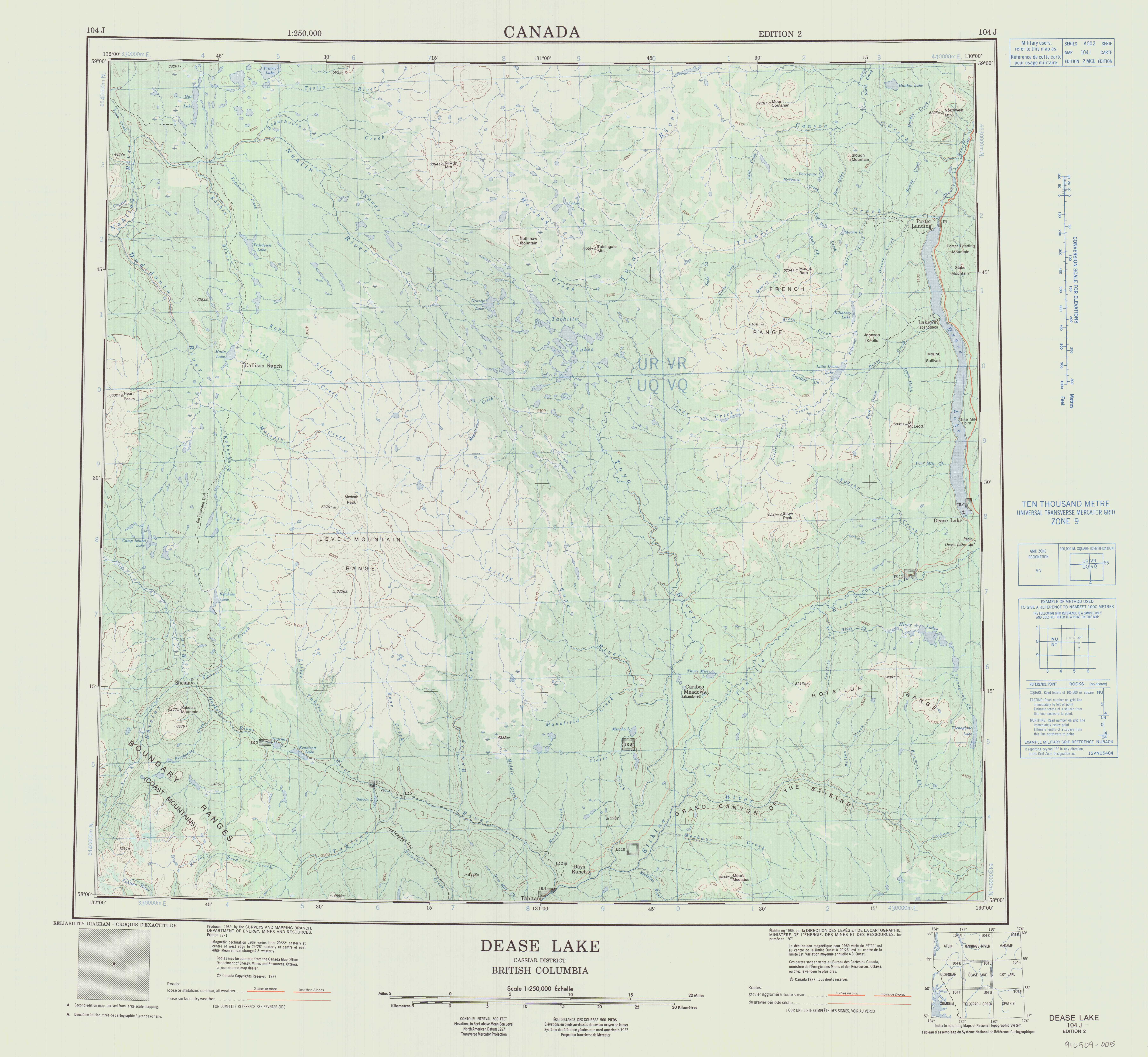
The Tahltan River is a tributary of the Stikine River in northwest part of the province of British Columbia, Canada. It flows generally east and southeast about 95 km (59 mi) to join the Stikine River at Tahltan, British Columbia. The lower Tahltan River marks the boundary between the Tahltan Highland and the Nahlin Plateau, both of which are part of the larger Stikine Plateau region.
The Hackett River is a tributary of the Sheslay River in northwest part of the province of British Columbia, Canada. It flows generally northwest about 33 km (21 mi), through two lakes, a wetland, and a gorge, to join the Sheslay River, which in turn is a tributary of the Inklin River, the main southeast fork of the Taku River.
The Tuya River is a major tributary of the Stikine River in northwest part of the province of British Columbia, Canada. From its source at High Tuya Lake in Tuya Mountains Provincial Park just south of Ash Mountain, the highest peak of the Tuya Range, the Tuya River flows south about 200 km (120 mi) to meet the Stikine River in the Grand Canyon of the Stikine. The Tuya River's main tributary is the Little Tuya River. The Tuya River divides the Tanzilla Plateau on the east from the Kawdy Plateau, to the northwest, and the Nahlin Plateau, to the southwest. All three are considered sub-plateaus of the Stikine Plateau. The Tuya River's watershed covers 3,575 km2 (1,380 sq mi), and its mean annual discharge is estimated at 36.9 m3/s (1,300 cu ft/s). The mouth of the Tuya River is located about 24 km (15 mi) northeast of Telegraph Creek, British Columbia, about 67 km (42 mi) southwest of Dease Lake, British Columbia, and about 210 km (130 mi) east of Juneau, Alaska. The Tuya River's watershed's land cover is classified as 35.7% shrubland, 31.4% conifer forest, 14.0% mixed forest, 7.2% herbaceous, and small amounts of other cover.
The Little Tuya River is a tributary of the Tuya River in northwest part of the province of British Columbia, Canada. It flows generally south and east about 71 km (44 mi) to join the Tuya River near Cariboo Meadows. The Little Tuya River's watershed covers 569 km2 (220 sq mi), and its mean annual discharge is an estimated 6.69 m3/s (236 cu ft/s).
Matsatu Creek, historically called the Matsatu River, is a tributary of Kakuchuya Creek and part of the Taku River watershed in northwest part of the province of British Columbia, Canada. It is located 40 km (25 mi) north of the abandoned settlement of Sheslay in Cassiar Land District.
The Dudidontu River is a tributary of the Nahlin River in northwest part of the province of British Columbia, Canada. It joins the Nahlin River, which forms the Inklin River, one of the main tributaries of the Taku River. The Dudidontu River's watershed covers 964 km2 (372 sq mi), and its mean annual discharge is 15.4 m3/s (540 cu ft/s). Almost half of the Dudidontu's flow comes from its main tributary, Kakuchuya Creek, and Kakuchuya Creek's main tributary, Matsatu Creek. The mouth of the Dudidontu River is located about 150 km (93 mi) northeast of Juneau, Alaska and about 110 km (68 mi) northwest of Telegraph Creek, British Columbia.
The Koshin River is a tributary of the Nahlin River in northwest part of the province of British Columbia, Canada. It flows generally north about 58 km (36 mi) to join the Nahlin River, which forms the Inklin River, one of the main tributaries of the Taku River. The Koshin River flows through the Nahlin Plateau. It joins the Nahlin River at the boundary between the Nahlin and Kawdy plateaus. Both plateaus are part of the larger Stikine Plateau region.
Beatty Creek is a tributary of the Tahltan River in northwest part of the province of British Columbia, Canada. It flows generally south about 62 km (39 mi) to join the Tahltan River a few kilometres downstream from the Little Tahltan River confluence. The Tahltan River is one of the main tributaries of the Stikine River.
Bear Creek is a tributary of the Tahltan River in northwest part of the province of British Columbia, Canada. It flows generally south through the Nahlin Plateau about 28 km (17 mi) to join the Tahltan River just downstream from the Tahltan and Little Tahltan River confluence.
Egnell Creek is a tributary of the Hackett River in northwest part of the province of British Columbia, Canada. It flows generally southwest about 24 km (15 mi) to join the Hackett River near the Hackett's confluence with the Sheslay River, which in turn is a tributary of the Inklin River, the main southeast fork of the Taku River. Mount Egnell is located near the creek's mouth, as is the historic locality known as Egnell or Sheslay, once a telegraph station on the Yukon Telegraph Line.
Classy Creek is a tributary of the Tuya River in northwest part of the province of British Columbia, Canada. It flows generally southeast and south roughly 20 km (12 mi) to join the Tuya River about 10 km (6.2 mi) north of the Tuya River's confluence with the Stikine River in the Grand Canyon of the Stikine, near Telegraph Creek Road, unofficially called Highway 51, a spur of the Stewart–Cassiar Highway.
Kaha Creek is a tributary of the Koshin River in northwest part of the province of British Columbia, Canada. It flows generally northwest for roughly 30 km (19 mi) to join the Koshin River about 3.8 km (2.4 mi) north of Hatin Lake, and about 6 km (3.7 mi) north of Callison Ranch. Kaha Creek's watershed covers 95.1 km2 (36.7 sq mi), and its mean annual discharge is estimated at 1.19 m3/s (42 cu ft/s). The mouth of Kaha Creek is located about 93 km (58 mi) north of Telegraph Creek, British Columbia, about 165 km (103 mi) east of Juneau, Alaska, and about 103 km (64 mi) west of Dease Lake, British Columbia. Kaha Creek's watershed's land cover is classified as 41.1% conifer forest, 40.2% shrubland, 12.3% barren, and small amounts of other cover.
Lost Creek is a tributary of the Koshin River in northwest part of the province of British Columbia, Canada. It flows generally northwest for roughly 26 km (16 mi) to join the Koshin River just north of Hatin Lake, and about 4 km (2.5 mi) north of Callison Ranch. Lost Creek's watershed covers 70.0 km2 (27.0 sq mi), and its mean annual discharge is estimated at 1.07 m3/s (38 cu ft/s). The mouth of Lost Creek is located about 90 km (56 mi) north of Telegraph Creek, British Columbia, about 102 km (63 mi) west of Dease Lake, British Columbia, and about 163 km (101 mi) east of Juneau, Alaska. Lost Creek's watershed's land cover is classified as 46.3% shrubland, 31.5% conifer forest, 12.2% barren, and small amounts of other cover.
Megatushon Creek is a tributary of the Nahlin River, part of the Taku River watershed in northwest part of the province of British Columbia, Canada. It flows generally northeast and east for roughly 22 km (14 mi) to join the Nahlin River not far from the Nahlin's source south of Tachilta Lakes. Megatushon Creek's watershed covers 52.7 km2 (20.3 sq mi), and its mean annual discharge is estimated at 1.03 m3/s (36 cu ft/s). The mouth of Megatushon Creek is located about 65 km (40 mi) west of Dease Lake, British Columbia, about 78 km (48 mi) north of Telegraph Creek, British Columbia, and about 120 km (75 mi) east of Juneau, Alaska. Megatushon Creek's watershed's land cover is classified as 34.8% barren, 32.3% shrubland, 24.8% conifer forest, and small amounts of other cover.
Hartz Creek is a tributary of the Tahltan River, part of the Stikine River watershed in northwest part of the province of British Columbia, Canada. It flows generally south and southwest for roughly 14 km (8.7 mi) to join the Tahltan River about 4.5 km (2.8 mi) north of Tahltan, British Columbia at the Tahltan River's confluence with the Stikine River. Hartz Creek's watershed covers 39.1 km2 (15.1 sq mi), and its mean annual discharge is estimated at 0.315 m3/s (11.1 cu ft/s). The mouth of Hartz Creek is located about 18 km (11 mi) northeast of Telegraph Creek, British Columbia, about 73 km (45 mi) southwest of Dease Lake, British Columbia, and about 200 km (120 mi) east of Juneau, Alaska. Hartz Creek's watershed's land cover is classified as 44.2% shrubland, 30.7% mixed forest, 20.8% conifer forest, and small amounts of other cover.
Middle Creek is a tributary of the Tahltan River, part of the Stikine River watershed in northwest part of the province of British Columbia, Canada. It flows generally south for roughly 15 km (9.3 mi) to join the Tahltan River about 10 km (6.2 mi) north of Tahltan, British Columbia at the Tahltan River's confluence with the Stikine River. Middle Creek's watershed covers 49.6 km2 (19.2 sq mi), and its mean annual discharge is estimated at 0.449 m3/s (15.9 cu ft/s). The mouth of Middle Creek is located about 20 km (12 mi) north of Telegraph Creek, British Columbia, about 75 km (47 mi) southwest of Dease Lake, British Columbia, and about 197 km (122 mi) east of Juneau, Alaska. Middle Creek's watershed's land cover is classified as 45.2% shrubland, 30.8% conifer forest, 21.4% mixed forest, and small amounts of other cover.
Riley Creek is a tributary of Middle Creek, which in turn is a tributary of the Tahltan River, part of the Stikine River watershed in northwest part of the province of British Columbia, Canada. It flows generally south for roughly 10 km (6.2 mi) to join Middle Creek about 1.5 km (0.93 mi) north of Middle Creek's confluence with the Tahltan River. Riley Creek's watershed covers 22.1 km2 (8.5 sq mi), and its mean annual discharge is estimated at 0.192 m3/s (6.8 cu ft/s). The mouth of Riley Creek is located about 22 km (14 mi) north of Telegraph Creek, British Columbia, about 74 km (46 mi) southwest of Dease Lake, British Columbia, and about 122 km (76 mi) east of Juneau, Alaska. Riley Creek's watershed's land cover is classified as 39.9% shrubland, 36.8% conifer forest, 20.3% mixed forest, and small amounts of other cover.
Mansfield Creek is a tributary of the Little Tuya River, which in turn is a tributary of the Tuya River, part of the Stikine River watershed in northwest part of the province of British Columbia, Canada. It flows generally south and east for roughly 35 km (22 mi) to join the Little Tuya River about 4.5 km (2.8 mi) west-northwest of the Little Tuya's confluence with the Tuya River. Mansfield Creek's watershed covers 143 km2 (55 sq mi), and its mean annual discharge is estimated at 1.46 m3/s (52 cu ft/s). The mouth of Mansfield Creek is located about 45 km (28 mi) northeast of Telegraph Creek, British Columbia, about 50 km (31 mi) west-southwest of Dease Lake, British Columbia, and about 210 km (130 mi) east of Juneau, Alaska. Mansfield Creek's watershed's land cover is classified as 40.5% shrubland, 35.3% conifer forest, 17.6% mixed forest, and small amounts of other cover.
