Almyros or Halmyros is a town and a municipality of the regional unit of Magnesia, region of Thessaly, Greece. It lies in the center of prosperous fertile plain known as 'Krokio Pedio', which is crossed by torrents. Almyros is an important agricultural and commercial center of Magnesia, and is also developing as a tourist center for the area. The main agricultural products are tomatoes, cotton, wheat, almonds, peanuts and pistachio nuts.

Melivoia is a town and a former municipality in the Larissa regional unit, Thessaly, Greece. Since the 2011 local government reform it is part of the municipality Agia, of which it is a municipal unit. Population 2,195 (2011). The municipal unit has an area of 197.633 km2. The seat of the municipality was in Kato Sotiritsa. Melivoia is located east of Larissa, the capital of the regional unit and Thessaly, and a few kilometers north of Agia. The municipal unit stretches along the Aegean Sea coast, at the foot of Mount Ossa. It was named after the ancient city Meliboea. The municipal unit borders on Magnesia to the southeast.
Afetes is a village and a former municipality in Magnesia, Thessaly, Greece. Since the 2011 local government reform it is part of the municipality South Pelion, of which it is a municipal unit. The municipal unit has an area of 80.744 km2. Population 1,746 (2011). The seat of the municipality was in Neochori. Afetes is situated in the Pelion peninsula, 2 km from the Pagasetic Gulf coast, 4 km southwest of Neochori, 6 km northwest of Argalasti and 23 km southeast of Volos.

Mouresi is a village and a former municipality in Magnesia, Thessaly, Greece. It is situated in the northeastern part of the Pelion peninsula. Since the 2011 local government reform it is part of the municipality Zagora-Mouresi, of which it is a municipal unit. The municipal unit has an area of 54.214 km2. The seat of the municipality was in Tsagkarada. In 2011 the population of the village Mouresi was 485, that of the community Mouresi was 548, and of the municipal unit 2,475.
Neochori is a village and a community situated on the peninsula of Pelion, Magnesia, eastern Thessaly, Greece. It was the seat of the former municipality Afetes. The village is hidden in the embrace of a vast pine forest 480 meters above sea level, and about 35 km southeast of the city of Volos. The community Neochori consists of the villages Neochori, Agios Dimitrios, Afyssos, Zervochia, Megali Vrysi and Plaka. The community stretches from the Aegean Sea coast of the Pelion peninsula to the Pagasetic Gulf. Agios Dimitrios and Plaka are on the Aegean coast, and the tourist centre Afyssos is on the Pagasetic coast.
Tsagkarada is a village and a community in the municipal unit of Mouresi in the eastern part of Magnesia, Greece. It was the seat of the former municipality Mouresi. It is situated at 408 m elevation, on the eastern slope of the forested Pelion mountains. Its population in 2011 was 525 for the village and 543 for the community which includes the village Mylopotamos. Tsagkarada is located 1.5 km southeast of Mouresi, 3 km north of Xorychti, 9 km southeast of Zagora and about 20 km east of the city of Volos.
Xorychti a village and a community in the municipal unit of Mouresi in the eastern part of Magnesia, Greece. It is situated at 420 m elevation, on the eastern slope of the forested Pelion mountains. Its population in 2011 was 219 for the village and 248 for the community which includes the village Kato Xorychti. Xorychti is located 2 km northwest of Lampinou, 3 km south of Tsagkarada, 5 km northeast of Milies, 12 km southeast of Zagora and 21 km east of the city of Volos.
Anilio is a village and a community in the municipal unit of Mouresi in the eastern part of Magnesia, Greece. It is situated at 296 meters elevation on the forested eastern slope of the Pelion mountains, 2 km from the Aegean Sea coast. Its population in 2011 was 355 for the village and 382 for the community which includes the village Plaka. Anilio is 1.5 km northwest of Agios Dimitrios, 1.5 km southeast of Makryrrachi, 4 km southeast of Zagora and about 18 km east of the city of Volos.
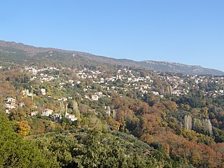
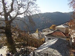
Kissos is a mountain village in the municipal unit of Mouresi, in the eastern part of Magnesia, Greece. It sits on the eastern slopes of the forested Pelion mountains, at about 500 meters elevation, 3 km from the Aegean Sea to the northeast. It is located 3 km west of Mouresi, 5 km southeast of Zagora and 17 km east of the city of Volos.
Agios Dimitrios Piliou is a village and a community in the municipality of Zagora-Mouresi, in the eastern part of Magnesia, Greece. Its population in 2011 was 243 for the village and 422 for the community, which includes the village of Agios Ioannis.
Chorto is a seaside village is the municipal unit of Argalasti in Magnesia, Greece. Its population in 2011 was 147. Chorto is located by the Pagasetic Gulf, 4 km south of Argalasti. There are several beach hotels and restaurants in the village. The ancient city of Spalathra was situated near Chorto.

Xinovrysi is a village in the Pelion area in Magnesia, Greece. It is part of the municipal unit of Argalasti. Xinovrysi is 3.5 km northeast of Argalasti, 7 km north of Promyri and 30 km southeast of Volos. Its population in 2011 was 164 for the village, and 213 for the community, which includes the village Potistika.
Ano Lechonia is a town in the Magnesia regional unit, Greece. Ano Lechonia was the seat of the former municipality of Artemida. The population of the village in 2011 was 1,068, the population of the community was 1,429. Ano Lechonia is situated in the northwestern part of the Pelion peninsula, 1.5 km from the Pagasetic Gulf coast, 3 km southwest of Agios Georgios Nileias, 4 km southeast of Agria and 11 km (7 mi) southeast of Volos.

Agios Vlasios is a village and a community in the municipal unit of Artemida, Magnesia, Greece. Agios Vlasios is situated on the slopes of mount Pelion, 1.5 km west of Agios Georgios Nileias, 2 km northeast of Ano Lechonia and 11 km east of Volos. Its population in 2011 was 515. The name comes from the church of the village.
Koropi is a village in the municipal unit of Milies, Magnesia regional unit, Greece. Koropi is situated on the Pelion peninsula, on the coast of the Pagasetic Gulf. Its population in 2011 was 246. Koropi is 2 km southeast of Kala Nera, 4 km east of Milies and 19 km southeast of Volos. The name Koropi was taken from the ancient city Korope, which dates from the 8th century BC. It was a small city that had a Temple of Apollo.

Agios Georgios Nileias is a village and a community in the municipal unit of Milies, Magnesia, Greece. It is situated on the slopes of mount Pelion, at about 700 m elevation. Its population in 2001 was 142 for the village, and 963 for the community. Agios Georgios Nileias is 1.5 km east of Agios Vlasios, 3 km northwest of Pinakates, 6 km northwest of Milies and 13 km east of Volos. Agios Georgios Nileias has a municipal museum with works of the sculptor Nikolaos Pavlopoulos.
Pinakates is a mountain village in the Magnesia regional unit, Greece. It is part of the municipal unit of Milies.

South Pelion is a municipality in the Magnesia regional unit, Thessaly, Greece. The seat of the municipality is the town Argalasti. The municipality has an area of 368.539 km2. It comprises the southern part of Mount Pelion.