
Chittoor is a city and district headquarters in Chittoor district of the Indian state of Andhra Pradesh. It is also the mandal and divisional headquarters of Chittoor mandal and Chittoor revenue division respectively. The city has a population of 189,332.

Anantapur district, officially Ananthapuramu district, is one of the eight districts in the Rayalaseema region of the Indian state of Andhra Pradesh. The district headquarters is located in Anantapur city. It is one of the driest places in South India. In the year 2022, as part of re-organisation of districts, Sri Sathya Sai district was carved out.

Ranga Reddy district is a district in the Indian state of Telangana. The district headquarters is located at Kongara Kalan Village, Ibrahimpatnam Mandal,. The district was named after the former deputy chief minister of the United Andhra Pradesh, K. V. Ranga Reddy. The district shares boundaries with Nalgonda, Yadadri Bhuvanagiri, Hyderabad, Medchal–Malkajgiri, Nagarkurnool, Mahabubnagar, Sangareddy and Vikarabad districts.
Atmakur is a town in the Nellore district of the Indian state of Andhra Pradesh. It functions as a municipality within the Atmakur mandal and serves as the administrative headquarters for both the mandal and the Atmakur Assembly Constituency. The town plays a key role in local governance and administration, acting as a central hub for surrounding villages and regions within the Nellore district.

Acharya N. G. Ranga Agricultural University (ANGRAU) is a public agricultural university with its headquarters at the village Lam, Guntur, Andhra Pradesh, India.

Punganur is a city in Chittoor district of the Indian state of Andhra Pradesh. It is the headquarters of Punganur Mandel of Palamaner Revenue Division.
Rayachoti is a Municipality and District headquarters of Annamayya district which is formed after Rajampet of the Indian state of Andhra Pradesh. Rayachoti is the headquarters of Rayachoti revenue division and is one of the oldest towns in Andhra Pradesh.

Pakala is a town in Tirupati district of the Indian state of Andhra Pradesh. It is the mandal headquarters of Pakala mandal. It comes under Tirupati revenue division.
Pulivendula is a town located in the YSR Kadapa district, Andhra Pradesh, India. It is a small town which became 3rd grade municipality in 2008 from nagar Panchayat.

Pileru is a census town in Annamayya district of Rayalaseema region of the Indian state of Andhra Pradesh. Pileru is located 197 Km North East of Bangalore, The Capital City Of Karnataka and 189 Km North West of Chennai, The Capital City Of Tamil Nadu and 464 Km South To The State Capital Amaravati .It is the mandal headquarters of Pileru mandal in Rayachoti revenue division. The name 'Pileru' means a "small river stream" or "Pilla Eru" in Telugu.

Pathapatnam is a town in Srikakulam district of the Indian state of Andhra Pradesh. It is located in Pathapatnam mandal of Tekkali revenue division. Telugu is the major spoken language in the town and in entire mandal. Pathapatnam is located on the border of Srikakulam district of Andhra Pradesh and Gajapati district of Odisha. Parlakhemundi, the headquarters of Gajapati District, can be considered as twin town of Pathapatnam because of its close proximity. It is located around 65 km from srikakulam. It was the old capital of Paralakhemundi Gajapati Maharajah of his erstwhile kingdom.
Rapur is a town, municipality, railway junction and a Mandal in SPSR Nellore district in the Indian state of Andhra Pradesh. It become a municipality in 2020.
Yellampalli is a village in Annamayya district of Andhra Pradesh in India. It is located between the towns of Kalikiri and Piler.It is a small village with population of around 100. The village is named after the earlier settlers in the village who belonged to Yellam Reddy subcaste of the Reddy caste. Later a landlord named Kasireddy Rami Reddy moved to the village and built up the basic infrastructure such as houses, canals and roads.

Nallari Kiran Kumar Reddy is an Indian politician who served as the 16th Chief Minister of Andhra Pradesh between 25 November 2010 and 1 March 2014. He was the last Chief Minister of the Andhra Pradesh before the formation of the Telangana state on 2 June 2014.
Nagiripalle is a small village near Kalikiri in Annamayya district of Andhra Pradesh, India. The family of 16th chief minister of Andhra Pradesh Nallari Kiran Kumar Reddy hails from Nagiripalli.
Vemuru mandal is one of the 25 mandals in Bapatla district of the state of Andhra Pradesh in India. It is under the administration of Tenali Revenue Division and the headquarters are located at Vemuru. The mandal is bounded by Tenali, Kollipara and Kollur, Amruthalur, Cherukupalle and Bhattiprolu mandals. The mandal is also a part of the Andhra Pradesh Capital Region under the jurisdiction of APCRDA.
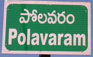
Polavaram is a village in Puthalapattu Mandal, Chittoor district of Andhra Pradesh state.

NTR district is a district in coastal Andhra Region in the Indian state of Andhra Pradesh. The district headquarters is located at Vijayawada. The district is named after former Chief Minister of Andhra Pradesh N. T. Rama Rao. The district shares boundaries with Guntur, Palnadu, Krishna, Eluru, Khammam and Suryapet districts.
Annamayya district is one of the eight districts in the Rayalaseema region of Andhra Pradesh, established in 2022. Rayachoti serves as the district's administrative headquarters, while Madanapalle is the most populous city in the district.

