Kalisizo

Last updated
Kalisizo
Uganda location map.svg
Red pog.svg
Kalisizo
Location in Uganda
Coordinates: 00°32′06″S31°37′21″E / 0.53500°S 31.62250°E / -0.53500; 31.62250
Country Flag of Uganda.svg Uganda
Region Central Uganda
District Kyotera District
Population
 (2014 Census)
  Total31,439

Kalisizo is a town in the southern part of the Central Region of Uganda. Although it is the leading commercial center in Kyotera District, the administrative headquarters of the district are in Kasaali.

Contents

Location

Kalisizo lies on the main highway between Masaka and the border town of Mutukula on Uganda's border with Tanzania. Kalisizo is located approximately 29 kilometres (18 mi), by road, southwest of Masaka, the nearest large city. [1] Kalisizo is approximately 61 kilometres (38 mi), by road, north of Mutukula, the town at the international border with Tanzania. [2] The coordinates of the town are:0°32'06.0"S, 31°37'21.0"E (Latitude:-0.5350; Longitude:31.6225). [3]

Population

In 2010, the Uganda Bureau of Statistics estimated the population of the town at 32,000, compared to 32,700 in 2011. [4] In 2014 the National Census and Household Survey enumerated the population of Kalisizo at 31,439, with the urban population being 13,464, and the rural population being 17,975. [5]

Points of interest

The following points of interest lie within the town limits or close to the edges of town:

See also

Related Research Articles

<span class="mw-page-title-main">Rakai District</span> District in Central Region of Uganda, Uganda

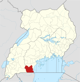
Rakai District is a district in the Central Region of Uganda. The town of Rakai is the site of the district's headquarters.

<span class="mw-page-title-main">Masaka</span> Place in Buganda Region, Uganda

Masaka is a city in the Buganda Region of Uganda, west of Lake Victoria. The city is the headquarters of Masaka District.

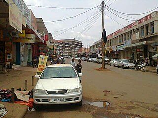
Rakai is a town in the Central Region of Uganda. It is the site of the headquarters of Rakai District. Other towns in the district include Kalisizo, Kyotera Kakuuto and Mutukula.

Sembabule is a town in Sembabule District in the Central Region of Uganda. The town is the main municipal, administrative, and commercial center of the district and the site of the district headquarters.

Kiruhura is a town in the Western Region of Uganda. It is the largest town in Kiruhura District and the site of the district headquarters.

Lyantonde is a town in the southern part of the Central Region of Uganda. It is the main municipal, administrative, and commercial center of Lyantonde District.

Kyotera is a town in the southern part of the Central Region of Uganda. It is a municipality in Kyotera District. However, the district headquarters are located at Kasaali.

Lukaya is a town in the Kalungu District of the Central Region of Uganda.

Nsangi is a town in the Central Region of Uganda. It is one of the urban centers in Wakiso District.

Kiwoko is a small town in the Central Region of Uganda. It is one of the municipalities in Nakaseke District.

Kagadi is a town in the Western Region of Uganda. It is the commercial and administrative headquarters of Kagadi District.

Kakuuto is a town in southwestern Central Uganda.

Mutukula is a town in the Central Region of Uganda, the third-largest economy in the East African Community. It sits adjacent to Mutukula, Tanzania, directly across the international border between Uganda and Tanzania.

Napak is a town in Northern Uganda. It is the commercial, administrative and municipal headquarters of Napak District. The district is named after the town.

Sango Bay is a settlement in the southern part of the Central Region of Uganda.

Masaka–Mutukula Road is a road in the Central Region of Uganda, connecting the town of Masaka, in Masaka District, to the border town of Mutukula in Rakai District.

Kalisizo General Hospital, also Kalisizo Hospital, is a hospital in the Central Region of Uganda.

Kyotera District is a district in the Central Region of Uganda. Kyotera is the largest town in the district but the district headquarters are located at Kasaali, a suburb of Kyotera.

Maya is a town in the Central Region of Uganda. It is one of the urban centers in Wakiso District.

References

  1. Globefeed.com (28 February 2018). "Distance between Masaka Post Office, Masaka, Uganda and Kalisizo, Uganda". Globefeed.com. Retrieved 28 February 2018.
  2. Globefeed.com (28 February 2018). "Distance between Kalisizo Hospital, Masaka–Kakuto Road, Kalisizo, Uganda and Kololo Weekly Market, Mutukula, Uganda". Globefeed.com. Retrieved 28 February 2018.
  3. Google (28 February 2018). "Location of Kalisizo Town, Kyotera District, Central Region, Uganda" (Map). Google Maps . Google. Retrieved 28 February 2018.
  4. UBOS (July 2010). "Estimated Population of Ugandan Towns in July 2011" (PDF). Kampala: Uganda Bureau of Statistics (UBOS). Retrieved 28 February 2018.
  5. UBOS (November 2014). "Uganda National Census & Household Survey: Appendix 3; Households and Population by Subcounty/Town Council/Urban Division and Sex, 2014" (PDF). Kampala: Uganda Bureau of Statistics. Archived from the original (PDF) on 10 January 2017. Retrieved 28 February 2018.
  6. Bindhe, Edward (11 January 2017). "One Dead, 3 Injured in Kalisizo Robbery". Kampala: Uganda Radio Network . Retrieved 28 February 2018.

Coordinates: 00°32′06″S31°37′21″E / 0.53500°S 31.62250°E / -0.53500; 31.62250