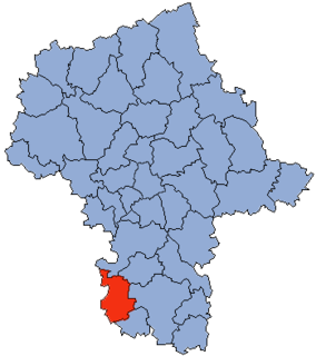
Chwaliszewo is a village in the administrative district of Gmina Kcynia, within Nakło County, Kuyavian-Pomeranian Voivodeship, in north-central Poland.

Rapy Dylańskie is a village in the administrative district of Gmina Biłgoraj, within Biłgoraj County, Lublin Voivodeship, in eastern Poland. It lies approximately 5 kilometres (3 mi) north of Biłgoraj and 74 km (46 mi) south of the regional capital Lublin.
Majdan-Obleszcze is a village in the administrative district of Gmina Szastarka, within Kraśnik County, Lublin Voivodeship, in eastern Poland.
Gabowe Grądy is a village in the administrative district of Gmina Augustów, within Augustów County, Podlaskie Voivodeship, in north-eastern Poland.

Tybory-Trzcianka is a village in the administrative district of Gmina Wysokie Mazowieckie, within Wysokie Mazowieckie County, Podlaskie Voivodeship, in north-eastern Poland. It lies approximately 11 kilometres (7 mi) north-west of Wysokie Mazowieckie and 56 km (35 mi) west of the regional capital Białystok.

Turobowice is a village in the administrative district of Gmina Koluszki, within Łódź East County, Łódź Voivodeship, in central Poland. It lies approximately 6 kilometres (4 mi) east of Koluszki and 30 km (19 mi) east of the regional capital Łódź.

Stróża is a village in the administrative district of Gmina Dobra, within Limanowa County, Lesser Poland Voivodeship, in southern Poland. It lies approximately 17 kilometres (11 mi) west of Limanowa and 40 km (25 mi) south-east of the regional capital Kraków.
Hańsk-Kolonia is a village in the administrative district of Gmina Hańsk, within Włodawa County, Lublin Voivodeship, in eastern Poland.

Marianów is a village in the administrative district of Gmina Działoszyce, within Pińczów County, Świętokrzyskie Voivodeship, in south-central Poland. It lies approximately 6 kilometres (4 mi) north-east of Działoszyce, 18 km (11 mi) south-west of Pińczów, and 56 km (35 mi) south of the regional capital Kielce.
Wiktorzyn is a settlement in the administrative district of Gmina Sobolew, within Garwolin County, Masovian Voivodeship, in east-central Poland.

Białobrzegi is a village in the administrative district of Gmina Chotcza, within Lipsko County, Masovian Voivodeship, in east-central Poland. It lies approximately 5 kilometres (3 mi) south-west of Chotcza, 9 km (6 mi) north-east of Lipsko, and 125 km (78 mi) south-east of Warsaw.

Ludomicko is a settlement in the administrative district of Gmina Ryczywół, within Oborniki County, Greater Poland Voivodeship, in west-central Poland. It lies approximately 10 kilometres (6 mi) south-west of Ryczywół, 13 km (8 mi) north-west of Oborniki, and 42 km (26 mi) north of the regional capital Poznań.

Proszów is a settlement in the administrative district of Gmina Brody, within Żary County, Lubusz Voivodeship, in western Poland, close to the German border. It lies approximately 6 kilometres (4 mi) south-east of Brody, 26 km (16 mi) north-west of Żary, and 52 km (32 mi) south-west of Zielona Góra.

Kinice is a village in the administrative district of Gmina Brusy, within Chojnice County, Pomeranian Voivodeship, in northern Poland. It lies approximately 4 kilometres (2 mi) south-east of Brusy, 23 km (14 mi) north-east of Chojnice, and 81 km (50 mi) south-west of the regional capital Gdańsk.

Kokwino is a village in the administrative district of Gmina Sierakowice, within Kartuzy County, Pomeranian Voivodeship, in northern Poland. It lies approximately 5 kilometres (3 mi) north-east of Sierakowice, 19 km (12 mi) west of Kartuzy, and 46 km (29 mi) west of the regional capital Gdańsk.

Jurandowo is a settlement in the administrative district of Gmina Kwidzyn, within Kwidzyn County, Pomeranian Voivodeship, in northern Poland. It lies approximately 12 kilometres (7 mi) east of Kwidzyn and 75 km (47 mi) south-east of the regional capital Gdańsk.

Lisiec is a settlement in the administrative district of Gmina Susz, within Iława County, Warmian-Masurian Voivodeship, in northern Poland. It lies approximately 5 kilometres (3 mi) north-east of Susz, 22 km (14 mi) north-west of Iława, and 74 km (46 mi) west of the regional capital Olsztyn.

Gola Dolna is a settlement in the administrative district of Gmina Świdwin, within Świdwin County, West Pomeranian Voivodeship, in north-western Poland. It lies approximately 5 kilometres (3 mi) south-west of Świdwin and 85 km (53 mi) north-east of its regional capital Szczecin. The settlement has a population of 40.
Mokhdan is a village in Howmeh Rural District, in the Central District of Deyr County, Bushehr Province, Iran. At the 2006 census, its population was 37, in 9 families.

Krychówpronounced [ˈkrɨxuv] is a village neighbourhood in the administrative district of Gmina Hańsk, within Włodawa County, Lublin Voivodeship, in eastern Poland. In 1975–98 the settlement belonged administratively to Chełm Voivodeship.


